 |
Claud Hider- The Bridport Photographer who recorded life in Charmouth in the 1920`s |
 |
|
| This article falls into 2 parts - the first is on the life as far as we know of Claud Hider and his work around Bridport and the second part will be his photographic depiction of the people and buildings in Charmouth nearly a century ago. |
Claud Hider was one of a number of photographers thoughout England who supplemented their livings by producing small quantities of photographic cards of their neighbourhood. During the first three decades of the 20th century there had been a golden age of postcards with many hundreds of millions bought every year and often collected in albums, some of which have survived to this day. Before the telephone, they were used as a way of sending a message, as the postal service was cheap, regular and reliable. Often on the back of a card you would read that someone was inviting a friend for tea the same day and would expect them to receive it in time for them to come. As well as the large firms, such as Tuck, Valentines and Frith, there were smaller firms who would sell real photographic cards. These had a glossy finish, the photograph having been developed directly onto a piece of card with a postcard back. Many village photographers were able to produce their own postcards. It was their local knowledge that allowed them to capture the kind of scenes that are so eagerly sought after today. |
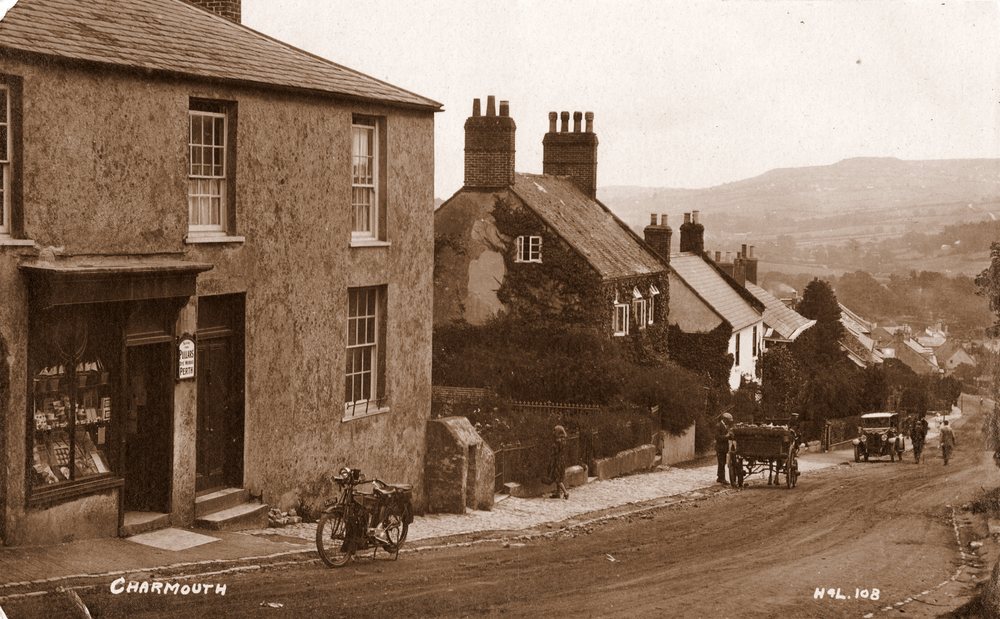 |
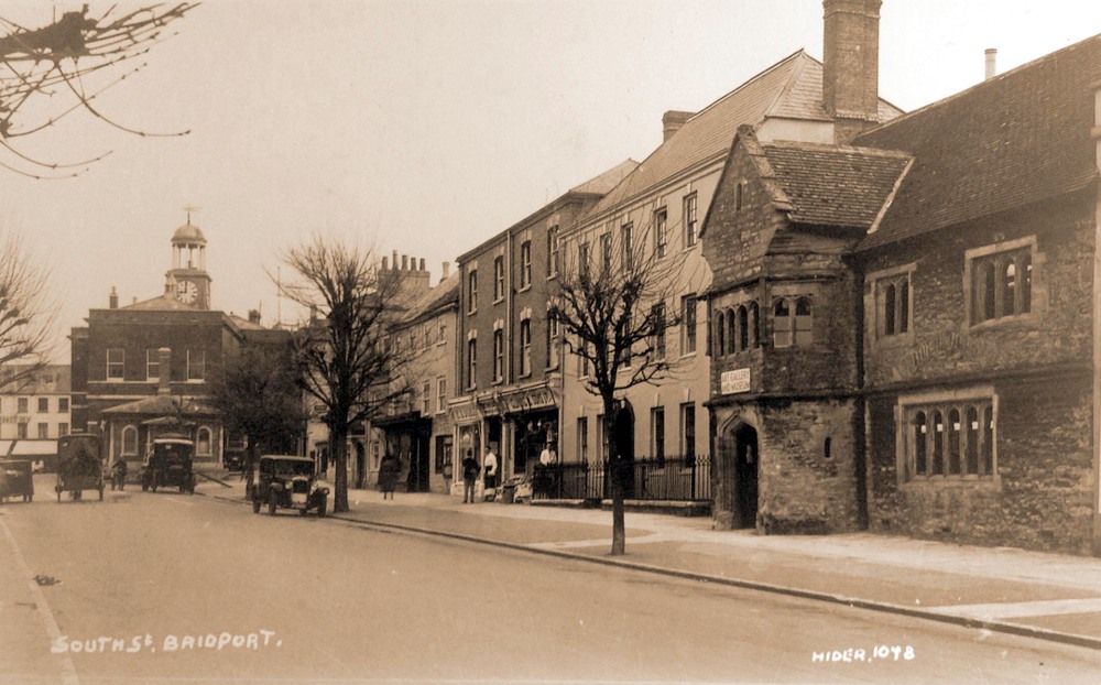
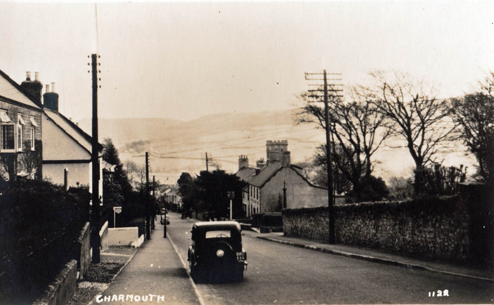
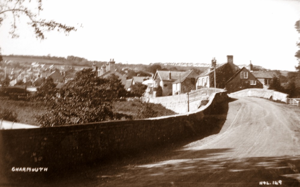
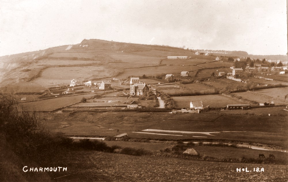
| This is a real photographic postcard of 1922, full of detail, in contrast to a published card below of the same view. |
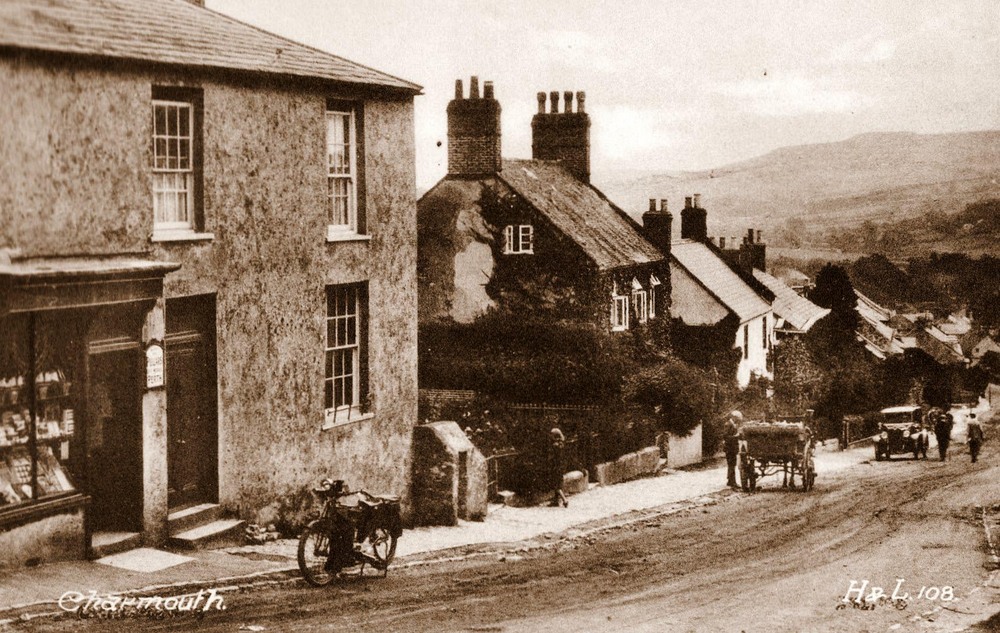 |
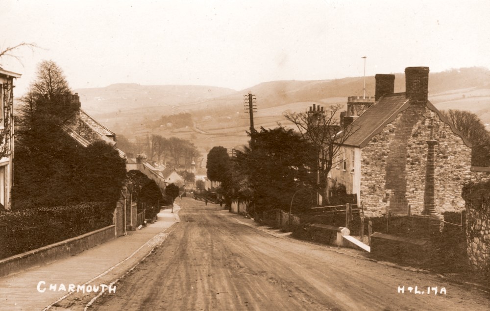
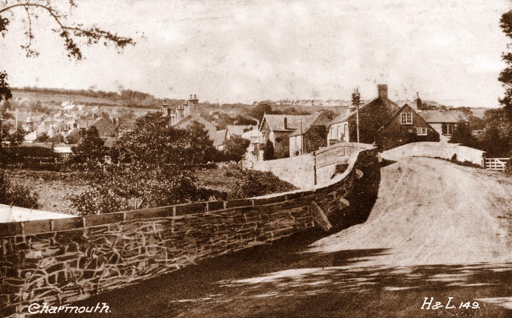
A printed postcard from H & L (Hider and Lawrence). |
.jpg) |
| A composite postcard produced in 1922 when Claud Hider was briefly in partnership with Lawrence in Bridport before moving to East Street. At the bottom on the right can be seen their names Hider & Lawrence , which was abbreviated as H&L on their early cards. A number of these early negatives were reused by Claud and H & L removed. |
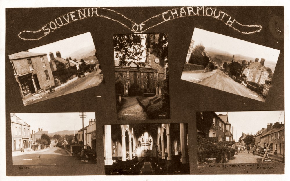 |
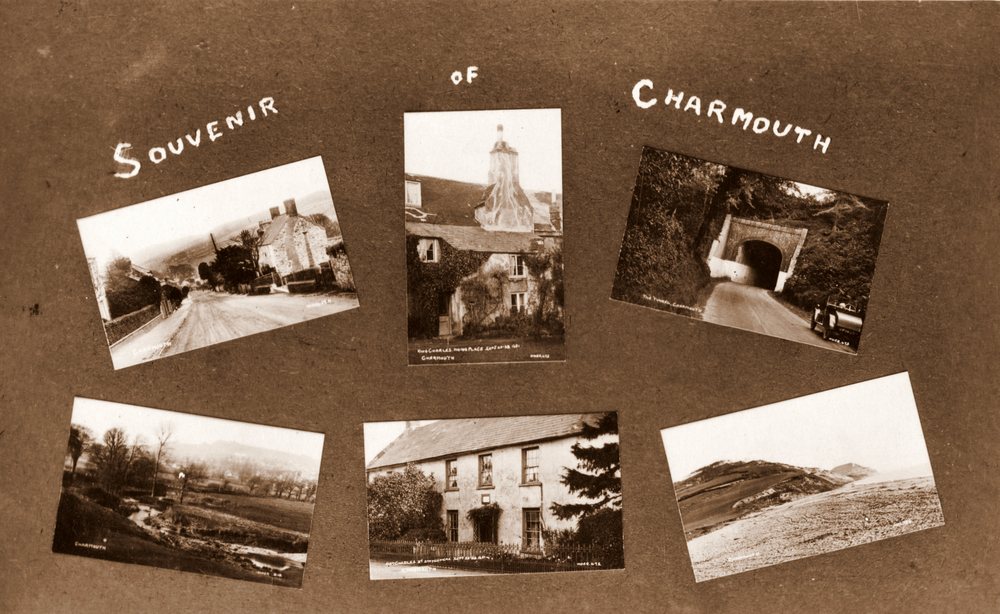
| A similar Composite Postacrd with a selection of different views of Charmouth in the year 1922 |
 |
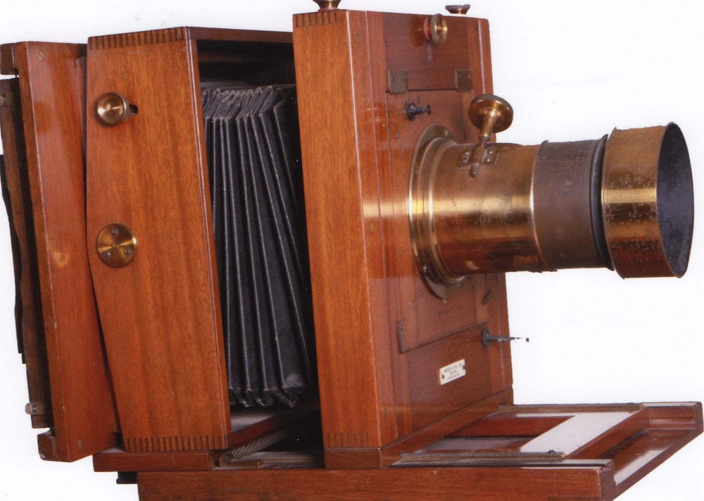
| Claud would take his photos on a large plate camera and paint on the negative its Title and number and take a section of it to fit the 4inches by 6 inches format of a postcard. This can clearly be seen in the markings on the photo above. |
|
| Roger Pinn kindly photographed Claud Hider`s original camera, which has come down to him. It was used to take his early classic images of Bridport and the surrounding area from 1922. The camera has a label on the back showing it was made by Marion & Co. who were established in 1867 and were eventually to become the famous firm - Ilford.It would appear from this label that the camera originates from the years 1901-1921. |
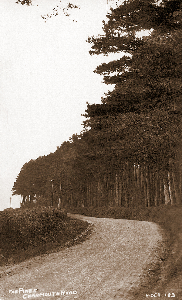
| Hider postcards rarely come up for sale and command a premium due to their popularity and quality as a unique record of a place or event nearly a century ago. He concentrated on the towns and villages around Bridport where he was based and seems to have been especailly fond of Charmouth for which he producred nearly 100 different views. The neighbouring village of Chideock, Morecombelake and Seatown were also very popular. |
 |
He was the most prolific of the photographers in the Bridport area and would produce small quantities, often no more than ten or twenty of each card that would be sold in his shop or other outlets. The location would be handwritten on the negative and thus appear in white on finished card with a reference number. Though only 4 inches by 6 inches, when scanned and enlarged their quality is so good that even at poster size they are very sharp.
He has provided a unique and comprehensive record of Charmouth and the surrounding area almost 100 years ago that we have only now been able to piece together. He had covered most of the village with his camera and there are few areas that he had missed out and even these may still turn up in time. |
Background |
| Claude Robert Hider is something of an enigma to collectors of postcards and lovers of local history as thanks to him we have such a marvellous record of Bridport and the villagers around. He is particularly relevant to Charmouth as he seems to have recorded the village from as early as 1922, sometimes returning to the same building or view after many years. He would often photograph a significant event such as the 1926 Landslip, which closed the Lyme Regis to Charmouth Road for which he produced a series of postcards. |
 |
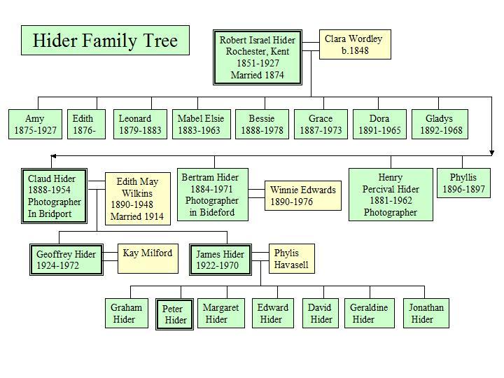
Thanks to the Ancestry website and his grandchildren we now know a little more of his life.
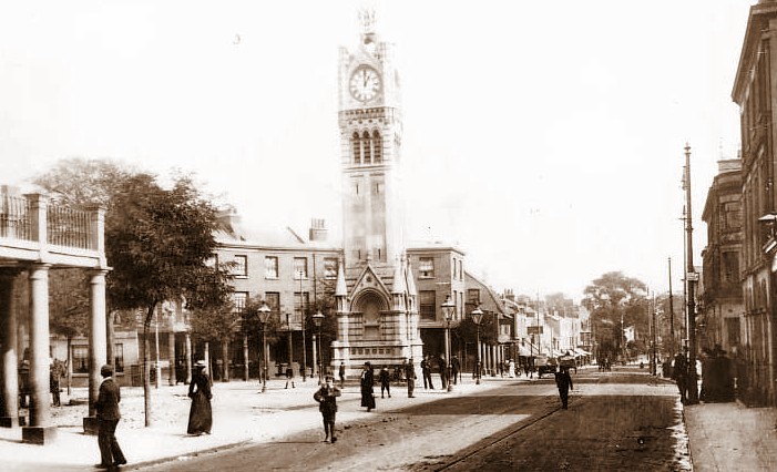
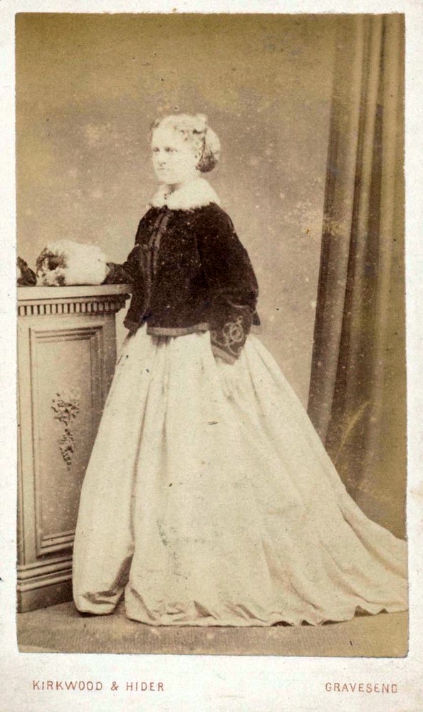
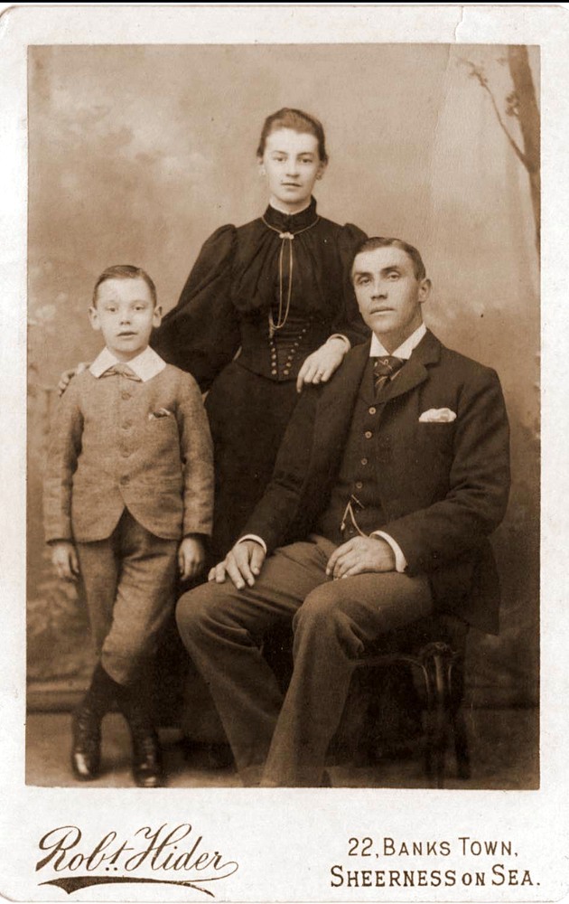
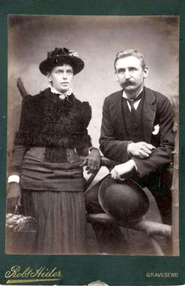
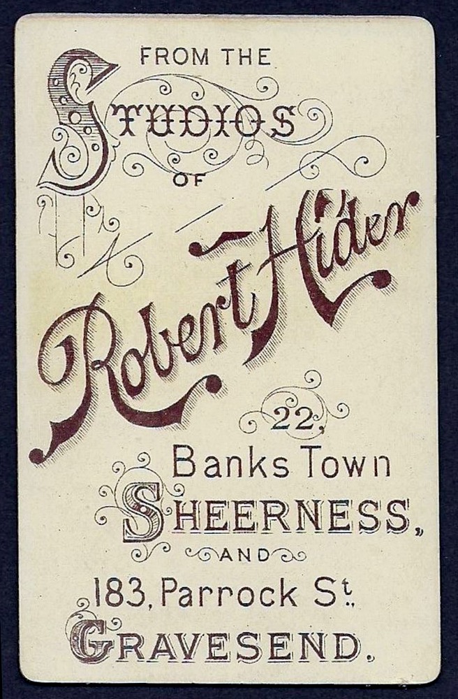
He was born in Gravesend in Kent to Robert and Clara Hider in 1888. His father appears as a professional Photographer in Directories of the time, and no doubt Claud learnt his trade from him. Robert Hider had photographic studios at 22 Banks Town in Sheerness and also 183 Parrock`s Street in Gravesend. His Cartes de Visite, which were the size of visiting cards showing Victorian sitters in his studios from these times come regularly on to the market and we have shown some here. |
|
Gravesend |
|
An early Carte de Visite with Robert Hider in partnership with James Kirkwood at Gravesend |
|
A Studio Portrait by Robert Hider |
|
| |
|
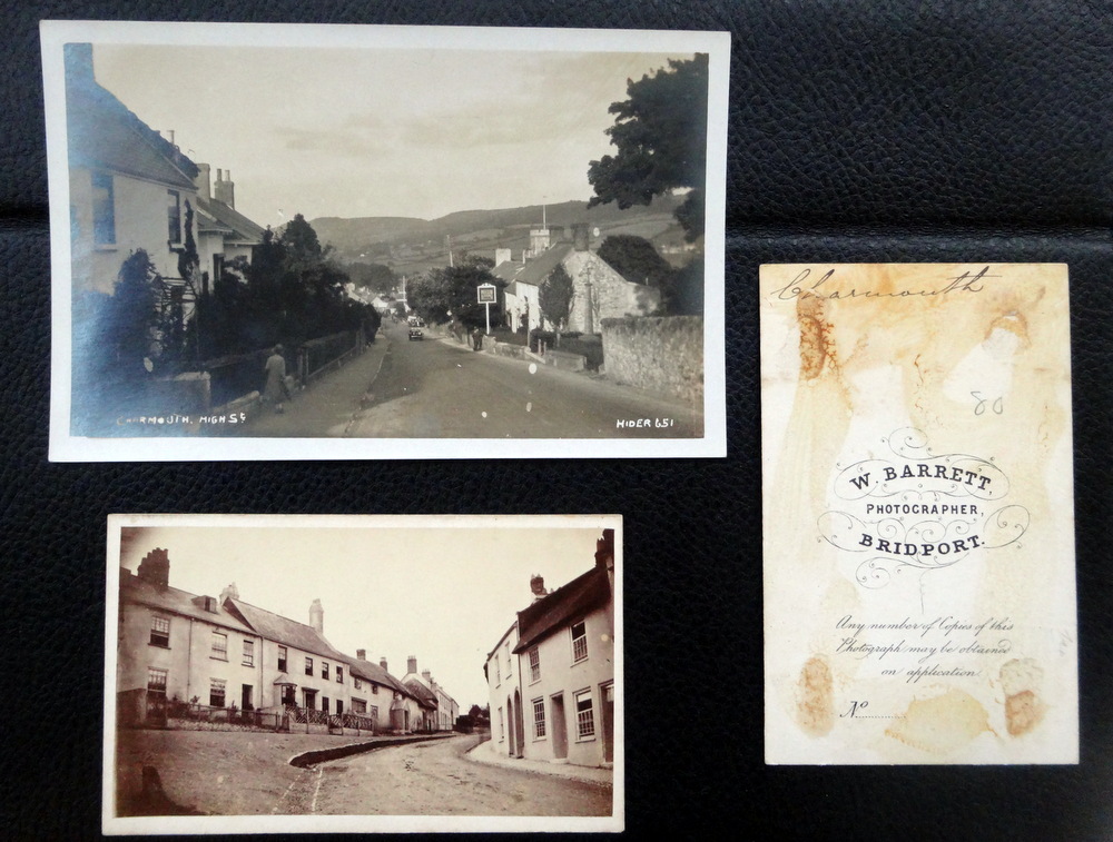
| These were very popular and by the 1860s every small town had its professional photographers and it has been estimated that up to 400 million cartes de visite were produced each year. Topographical views occasionally come to light, and I am fortunate to own some of Charmouth dating back to 1870 produced by William Barrett of Bridport. They provide some of the earliest images of towns and villages in the area. |
|
| This is an example of a Cartes de Visite of Charmouth from 1870 which measures 2 1/2 by 4 inches, compared to the postcard above, size 4 by 6 inches from 1923. |
| The 1901 Census shows that the family were living in Chatham in Kent, which would have been near the two studios. By 1911, the next Census shows Claud, aged 23 boarding with a photographer in Kettering in Northamptonshire and working as a darkroom assistant. Three years later he marries Edith Wilkin in Kettering.He then served with the Royal Fusiliers in France during the First World War and their first child is born to them in Maidstone in 1916.They then move on to Bridport in 1921, where two further children are born in 1922 and 1925. |
 |
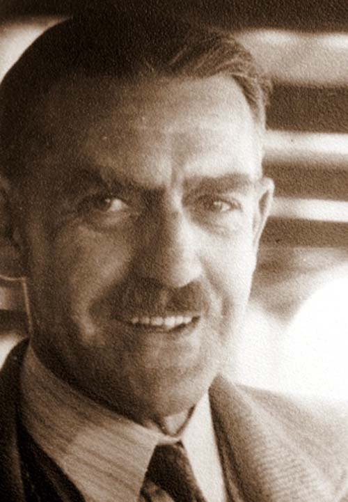 |
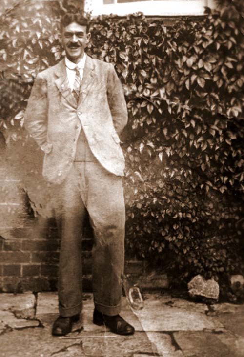
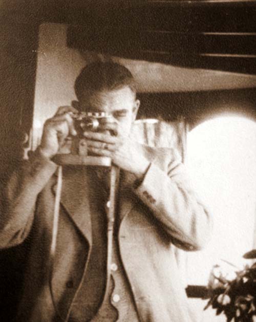
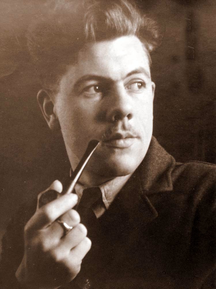
Claud Hider |
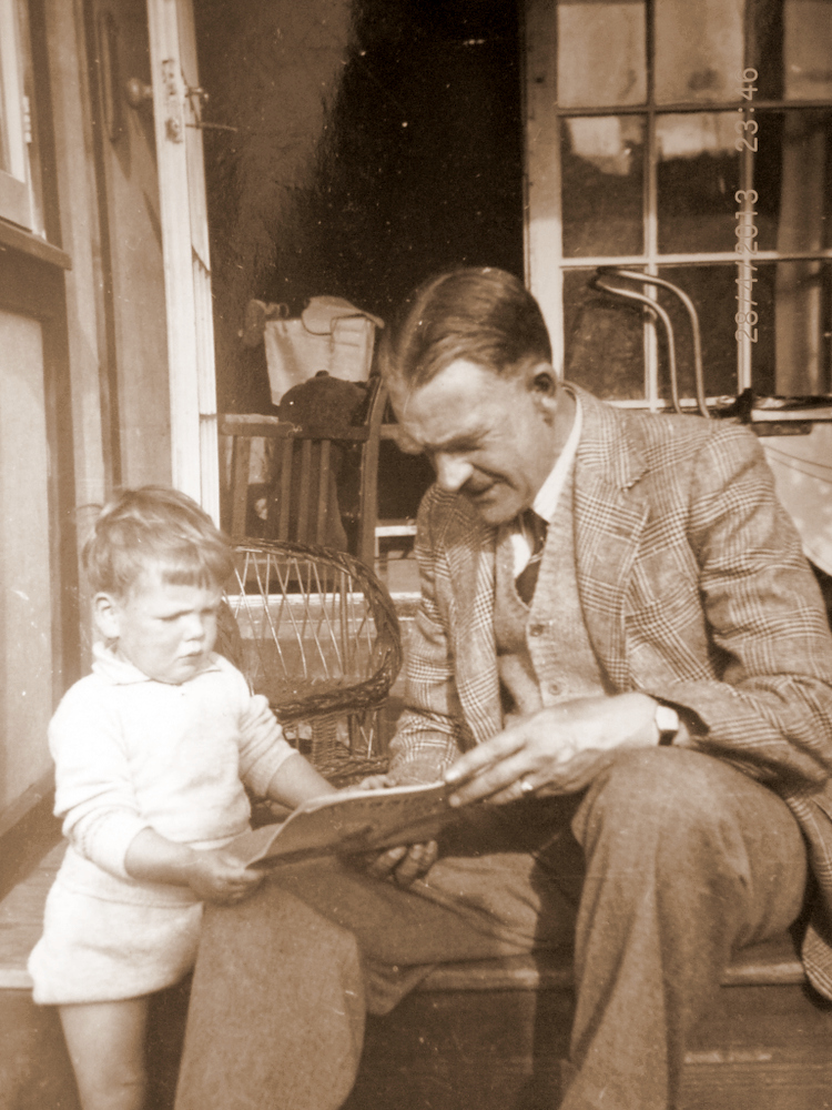
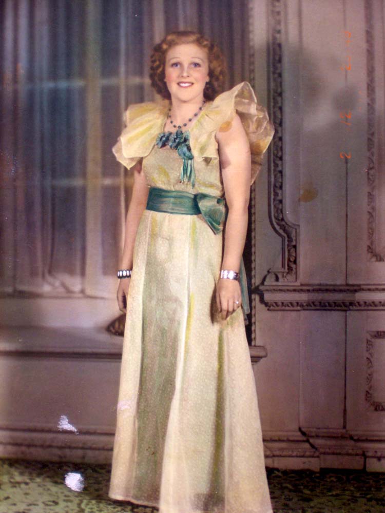
| We are fortunate that thanks to this web page on Claud, a grandson – Peter Hider, has contacted us and provided some additional information. He writes “that Claud was from a family of ten siblings and had 2 brothers who were also photographers. His son, Jim (Peter’s father), was a reconnaissance photographer in Mosquitoes in the RAF during World War 2. He personally spent summer holidays collecting holidaymaker’s films, developing & printing during the evening and returning the prints the next day, mostly from Seatown from the Anchor’s kiosk”. He has also kindly scanned a number of photographs of the great photographer and his family which can be seen here. |
|
 |
| Claud and his family move and open a photographic studio at 42 South Street, where William Brownson, a plumber and decorator had lived for many years. He was to place a shop front on the left hand side as is seen in the next photograph. |
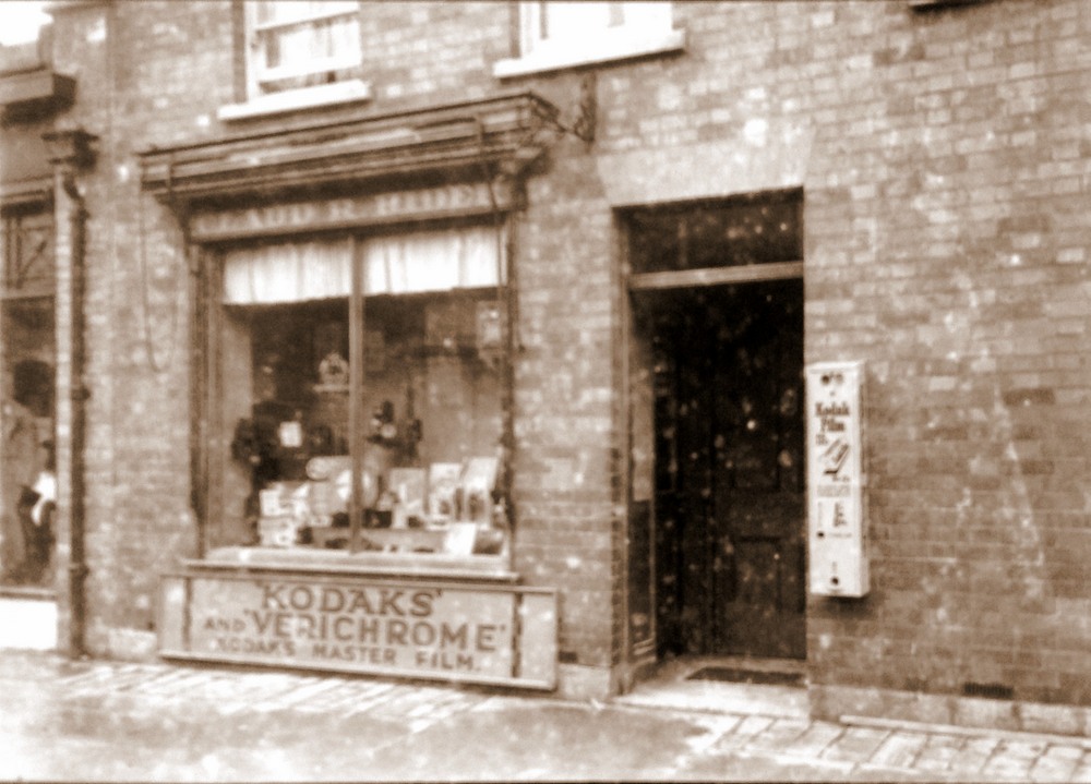 |
| The original shop at 42 South Street, Bridport with a window full of photographic equipment and a dispenser to the right of the door where Kodak Film could be purchased. |
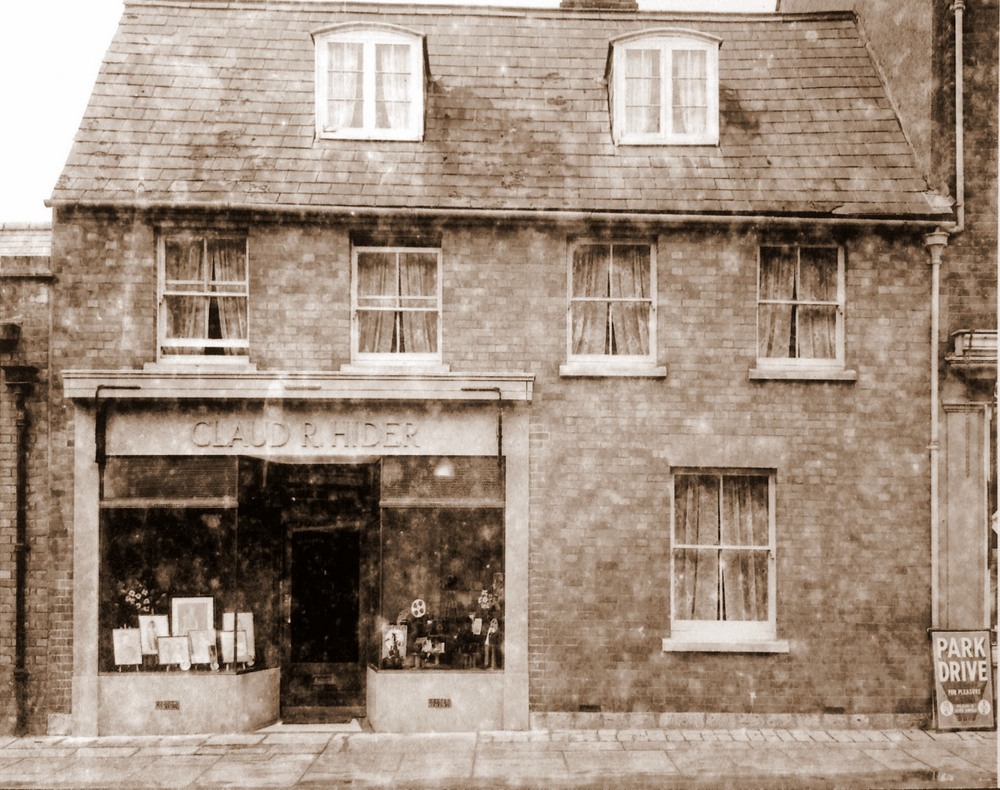 |
| The second shows the studio after it had been knocked through to create a double fronted window. Roger believes that this took place in 1936 as when the alterations were made inside the shop a partition wall was knocked down and a newspaper bearing this date was found within the wall. |
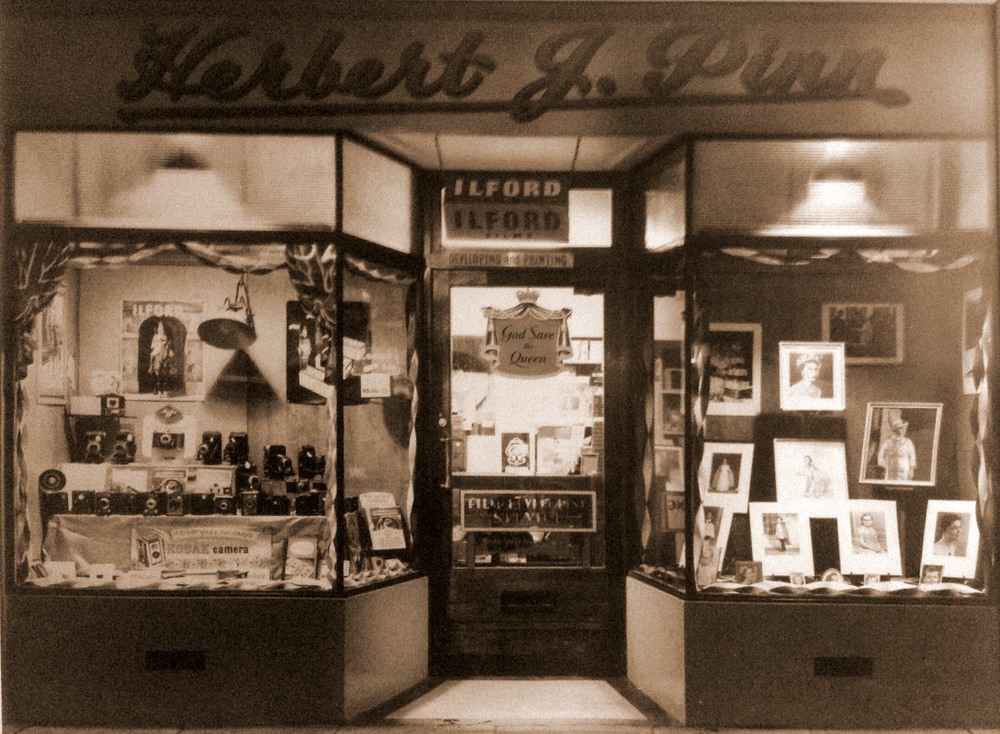 |
| The third photograph shows the shop in 1953 the year Herbert J Pinn took the studios over from Claud Hider. This was the coronation year of Queen Elizabeth II and a patriotic display can be seen in the window with the banner " God save the Queen". Herbert ran it until the late 1970's and it is continued today by his son- Roger Pinn. |
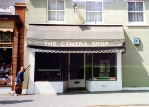 |
A Photograph of Claud`s former Shop in Bridport with his grandson, Peter James Hider taken in 1989 |
.JPG) |
| A photograph taken in the 1970`s showing Herbert Pinn`s Camera shop to the right. |
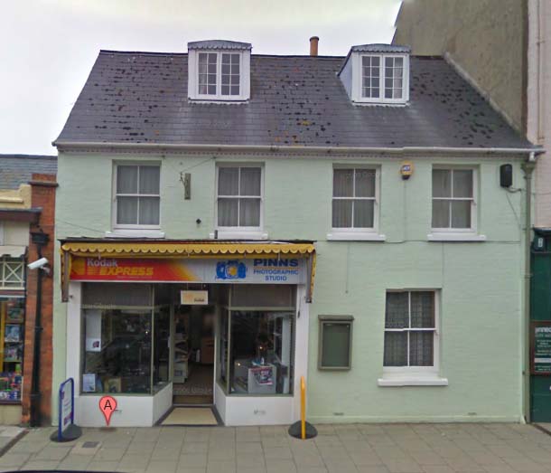 |
| Pinns Photographic Studios which occupies the same premises as Claude Hider at 42 South Street, Bridport today |
|
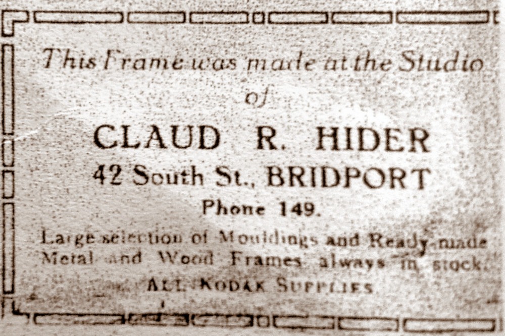
| This label on the back of an old picture reveals that Claud also provided frames for the photographs that he took. |
|
Claud photographing Charmouth fisherman. Tom Hunter by a Beach Hut next to the Heritage Centre c.1923 |
 |
 |
Claud Hider with his grandson Robert Graham |
Claud Hider |
 |
 |
Claud Hider`s daughter in law - Phylis at his Studio in South Street. |
Claud Hider`s son - Jim (James) Hider |
 |
%20-%20Copy.JPG) |
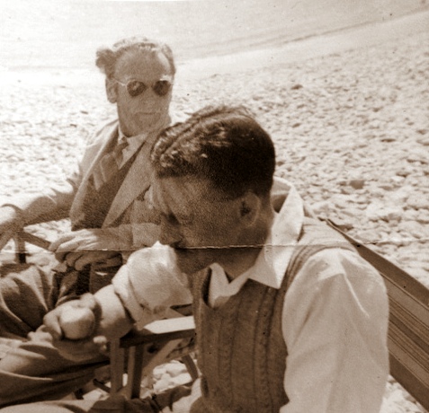
Claud Hider with David Hounsell (wife`s father) |
Claud Hider`s daughter in law- Phylis |
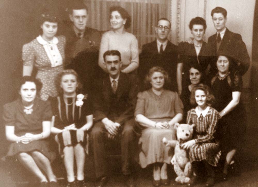 |
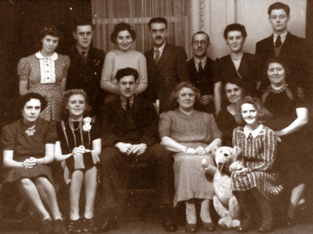
Claud Hider with members of his family. Photograph taken by his son Jim (James) |
|
| Claud Hider is seen here in the middle of the back row and his son, James Hider is in the middle of the bottom row |
|
| A photograph taken in 1945 with James Hider, last on the bottom row, who was a reconnaissance photographer in Mosquitoes in the RAF during World War 2. |
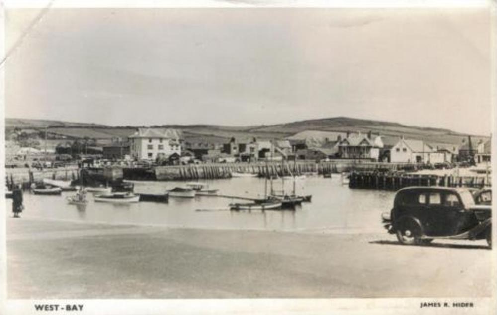 |
A Postcard from 1950 of West Bay by James R. Hider, son of Claud, showing West Bay. |
|
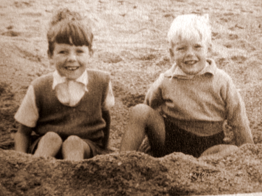
Graham & Peter Hider - Claud`s Grandsons on West Beach in 1950 |
|
This photograph brings the family up to date with a recent photograph of the wedding of Geraldine Hider with her brothers and sister, all grandchildren of Claud Hider. |
A Selection of Postcards produced by Claud Hider in the Bridport Area |
| Although the talk concentates on Claud Hiders output of Charmouth Postcards he also covered most of the Villages around Bridport and we will give a taster of how some of these places looked in the 1920`s in the following examples. If you wish to see the full selection of over photos, please visit my website - freshford.com. |
 |
Axminster - Hunters Lodge is seen on the right of the photograph with workmen erecting a new sign. In the centre stands an Automobile Association Patrol Man near his Sentry Box ready to assist motorists. |
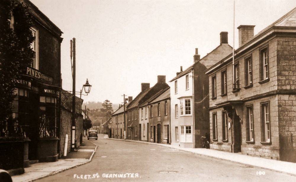 |
Beaminster - Fleet Street |
a.jpg) |
Bexington -Pool |
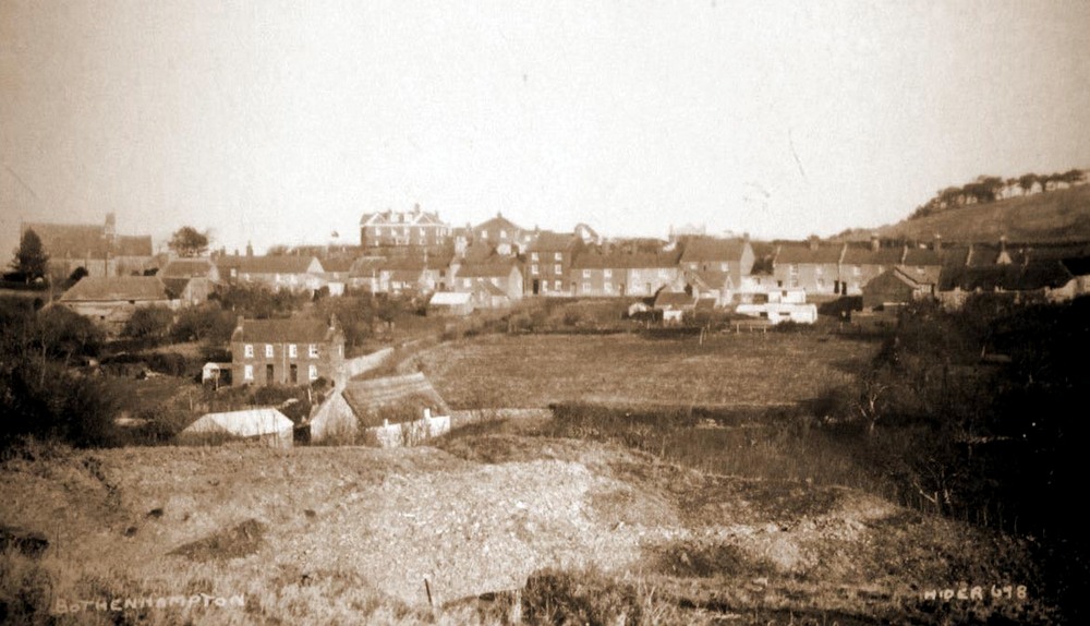 |
Bothenhampton |
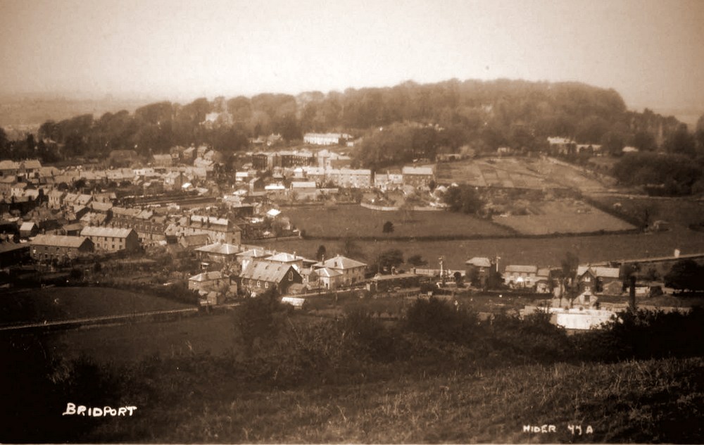 |
Bridport - Allington |
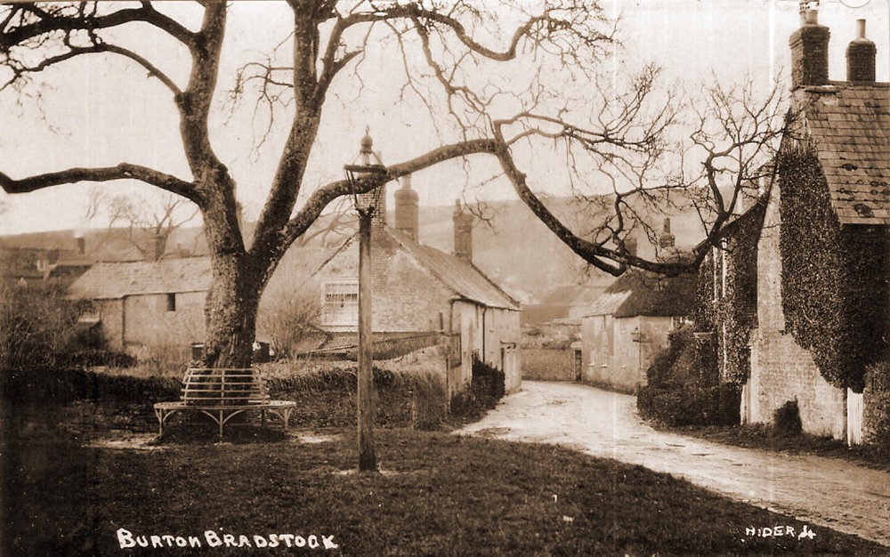 |
Burton Bradstock |
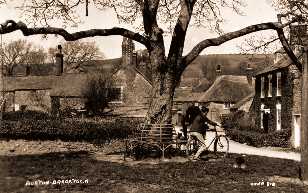 |
Burton Bradstock - same view with cyclists |
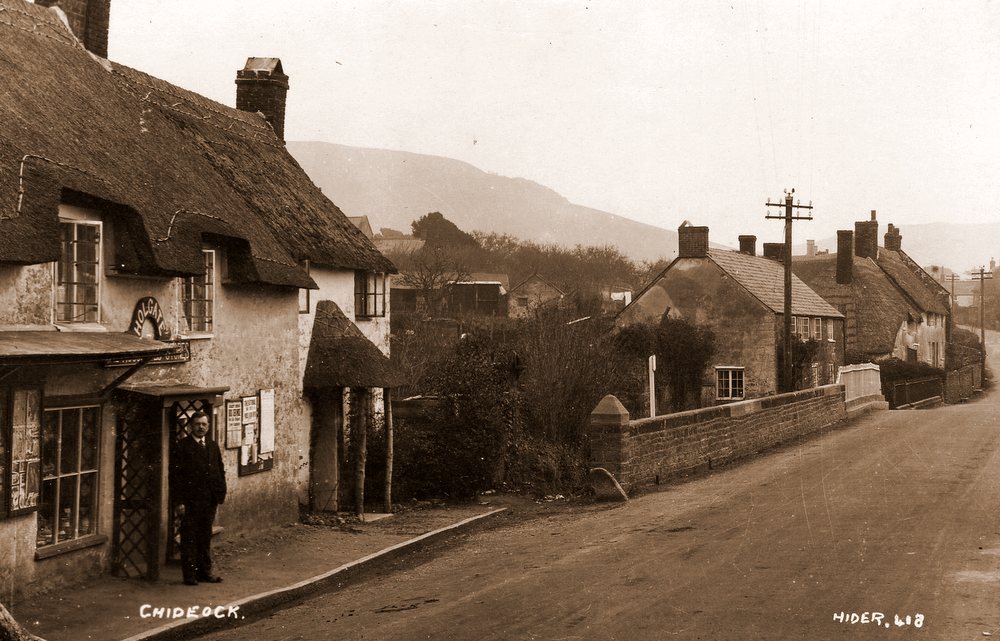 |
Chideock |
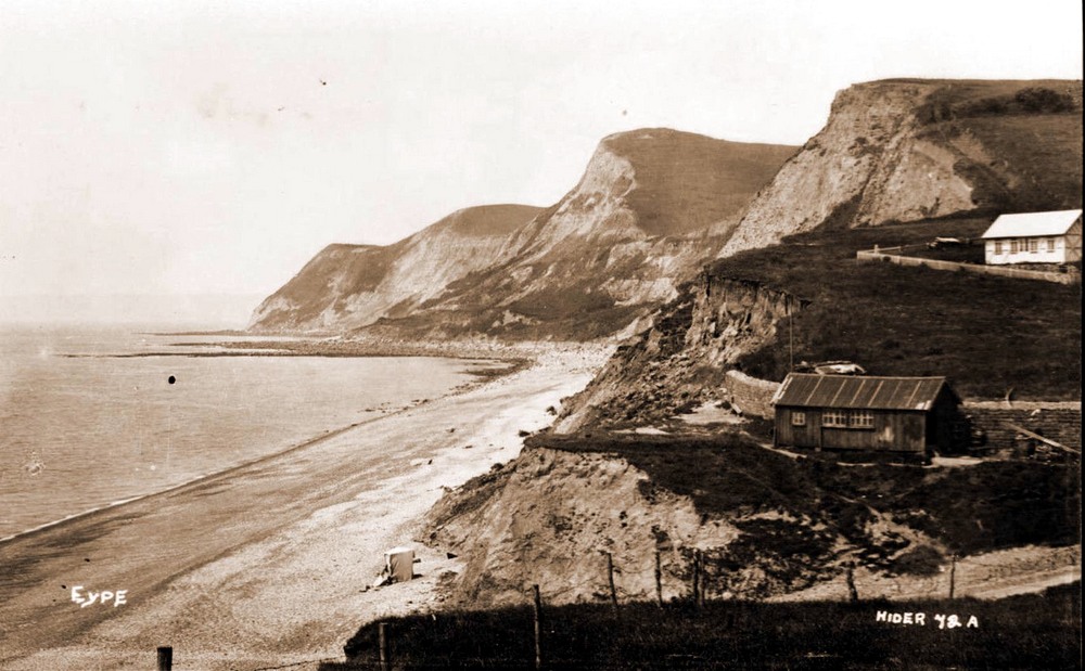 |
Eype |
.JPG) |
Lyme Regis |
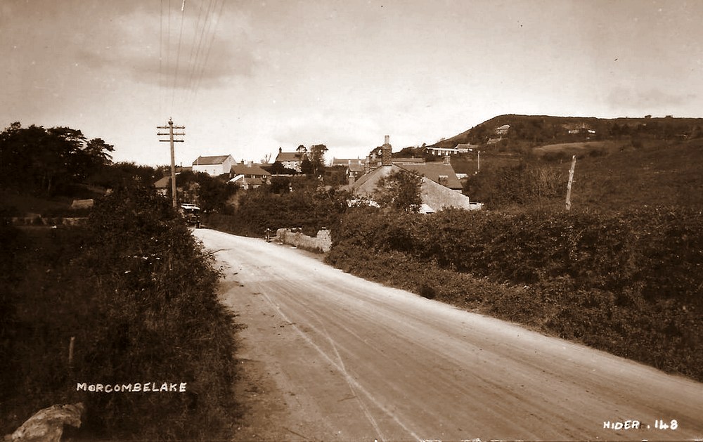 |
Morcombelake |
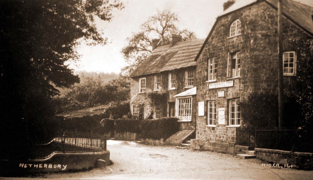 |
Netherbury |
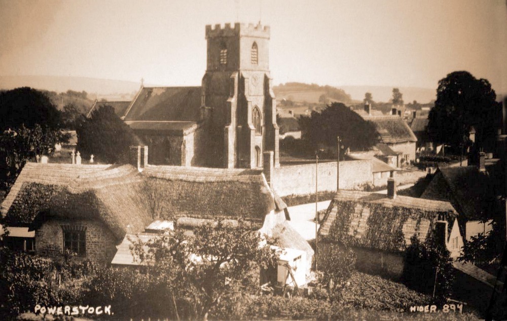 |
Powerstock |
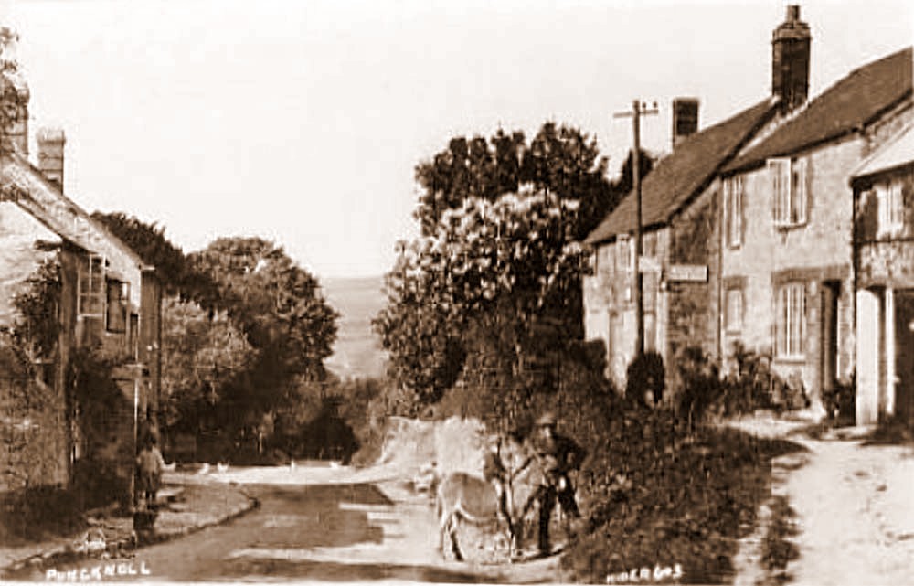 |
Puncknell |
.JPG) |
Seatown |
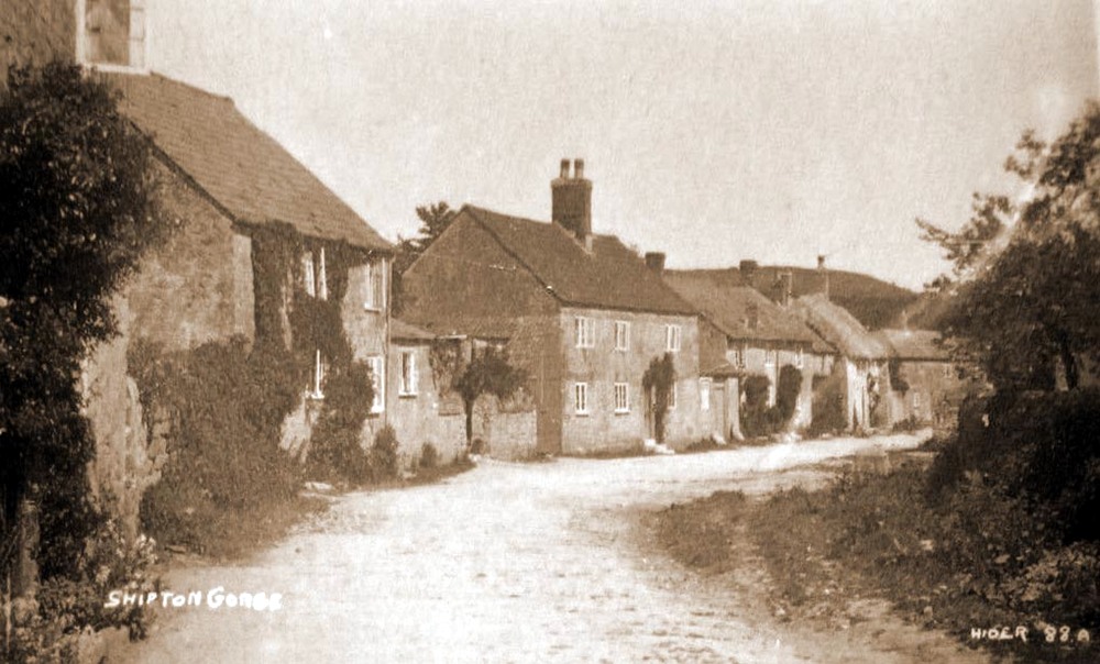 |
Shipton Gorge |
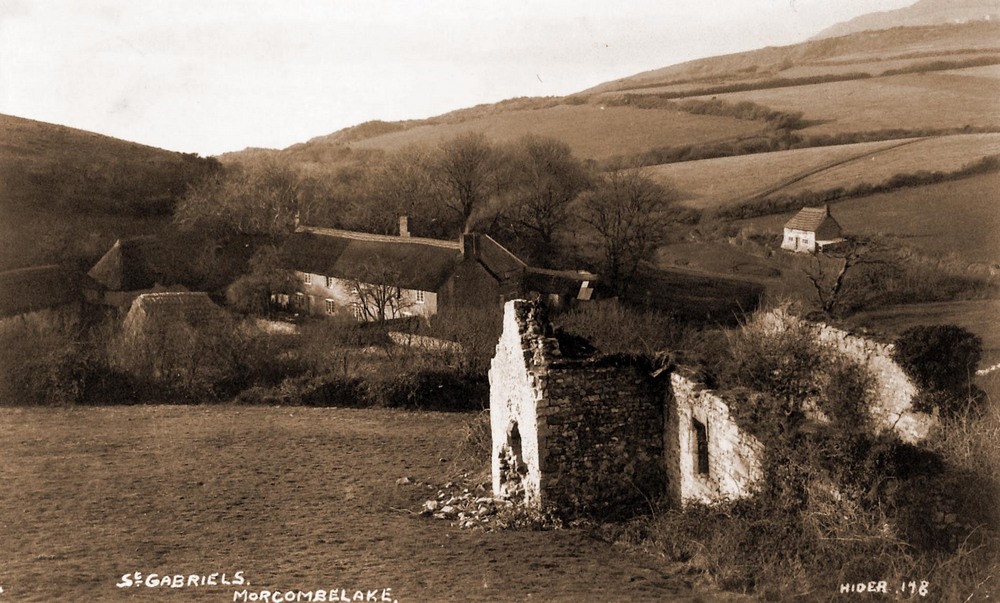 |
Stanton St. Gabriels. Morcombelake |
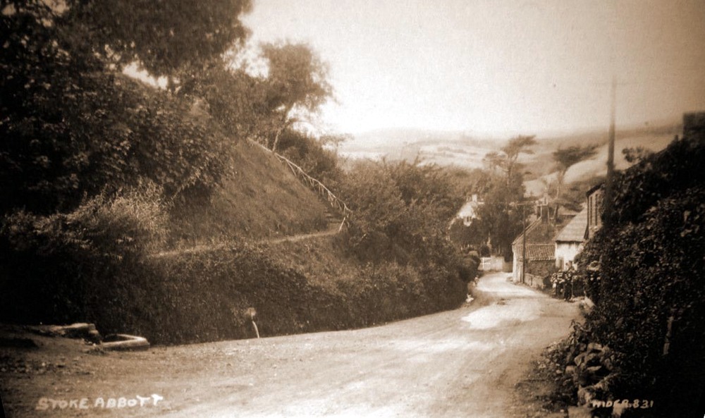 |
Stoke Abbott |
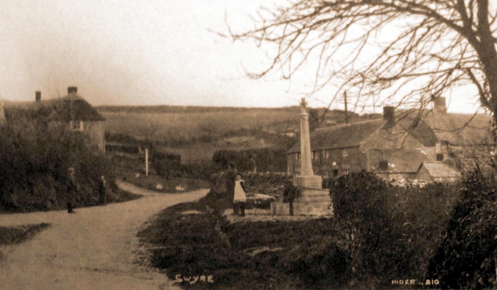 |
Swyre |
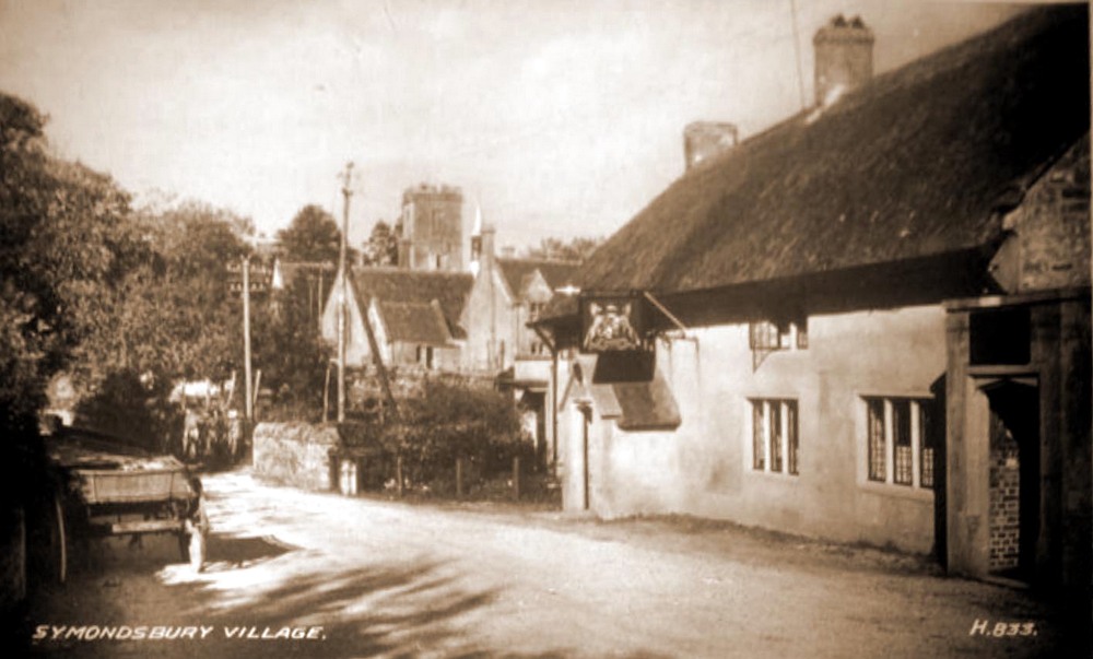 |
Symondsbury |
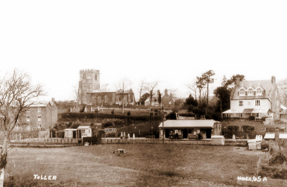 |
Toller - Railway Station |
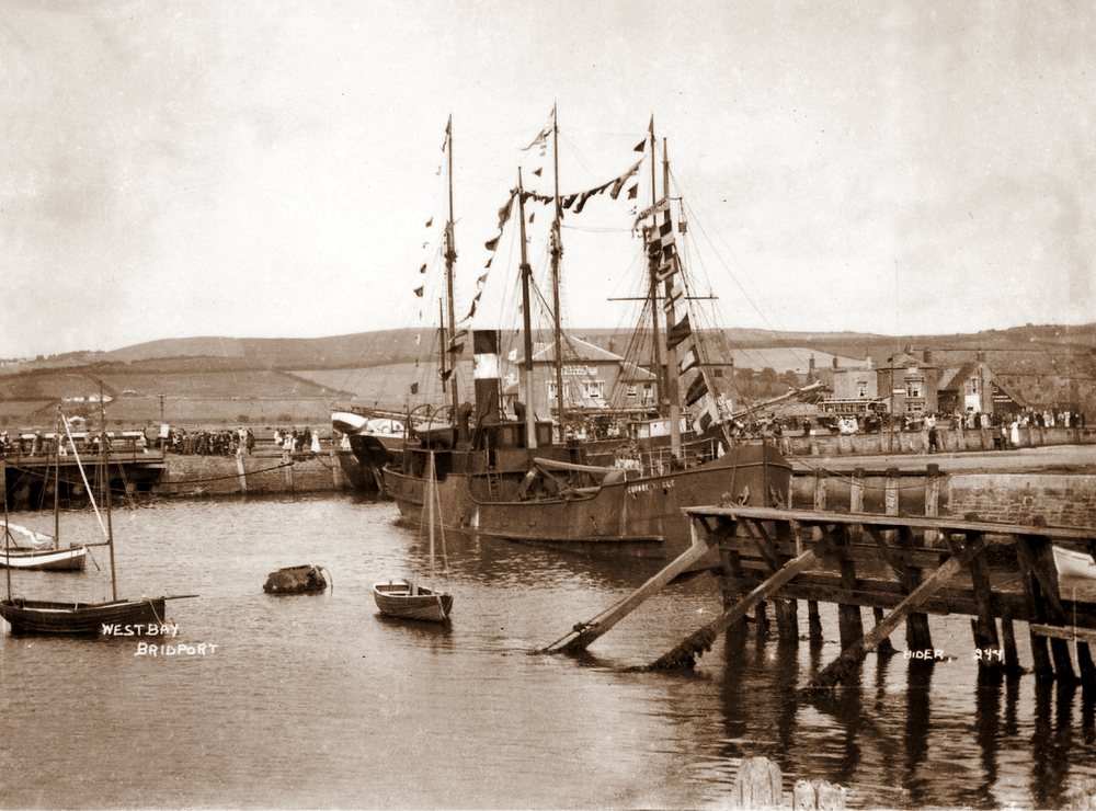 |
West Bay |
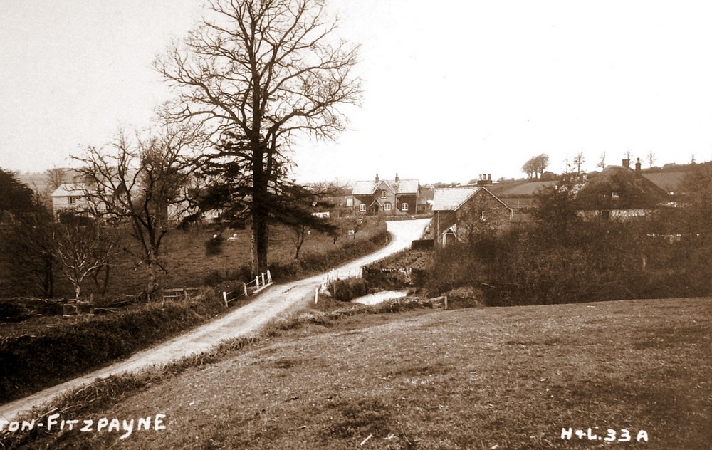 |
Wootton Fitzpaine |
| |
Claud Hider`s Photographic Record of Charmouth. |
| The next section of this Talk will cover Hider`s record of the village from 1922. we can be certain of this year as Neil`s House - Thalatta was built in 1923 for Grace Icombe and is shown in a card for that year. But interestingly he took a similar view the previous year before it was built. |
|
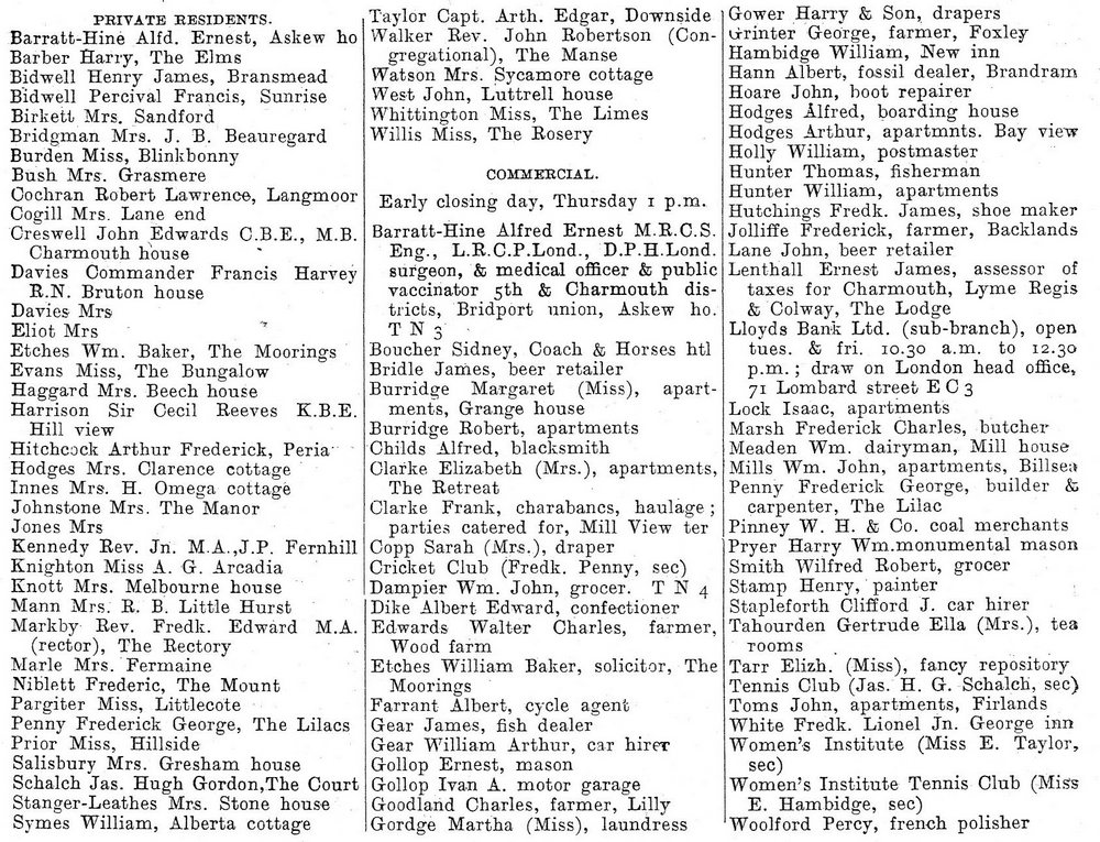
We are fortunate that the year chsoen for the Talk was one that Kelly`s produced a Directory of Private Residents and Traders for Charmouth. It is intersting reading the diverse businesses opering in the village. Amongst these were, Cycle Shop, French Polisher, Monumental Mason, Fossil Dealer and Coal Merchants. Many properties were let as appartments for the important Holiday season.
|
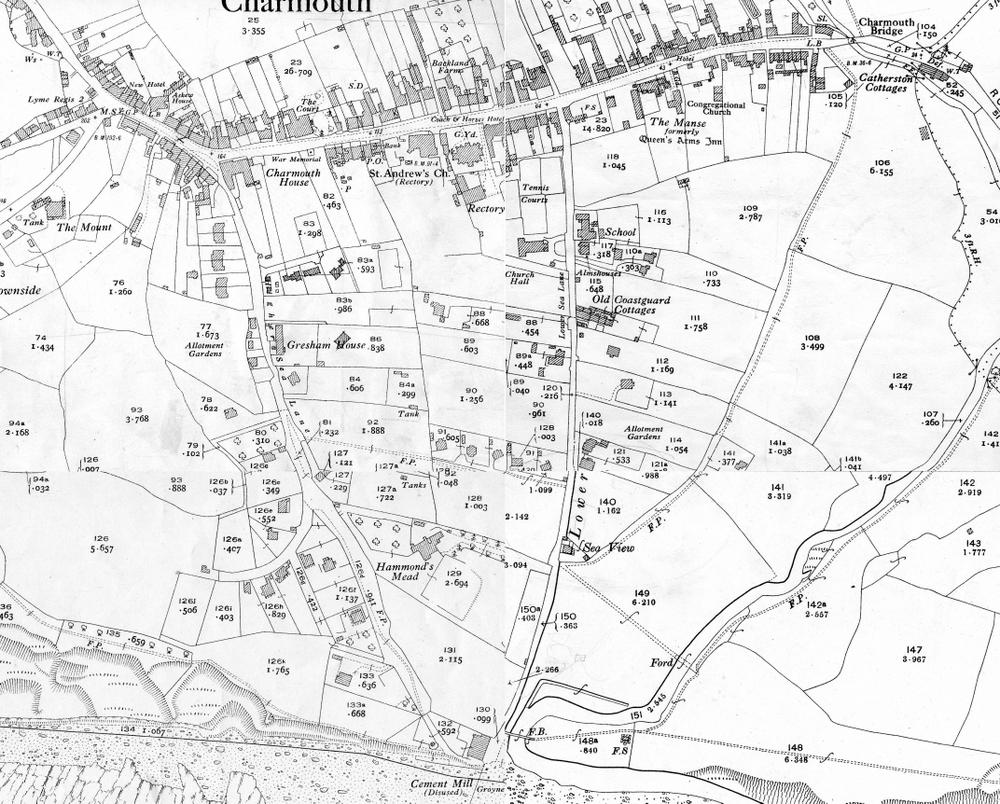 |
After the 1904 Ordnance Survey Map for the village, there was a long gap until the next one was produced in 1928.The Street contains the majority of properties, but there had been significant new houses built between the 2 maps, especially along Lower Sea Lane, with the substantial Hammonds Mead, owned by Miss Evans, with grounds stretching to the Heritage Centre. |
|
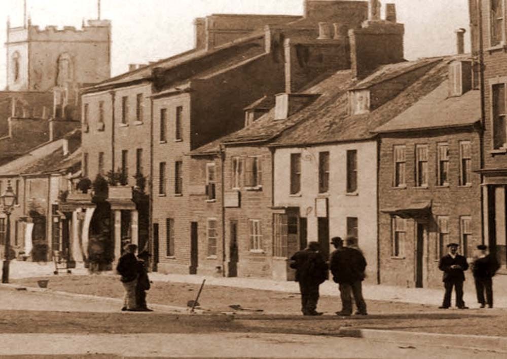
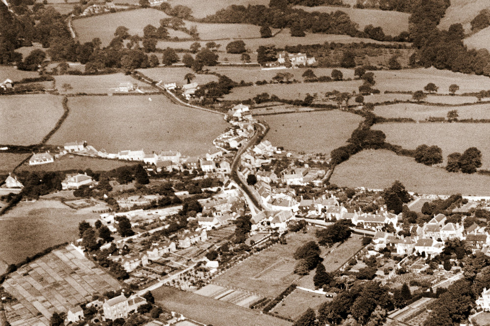
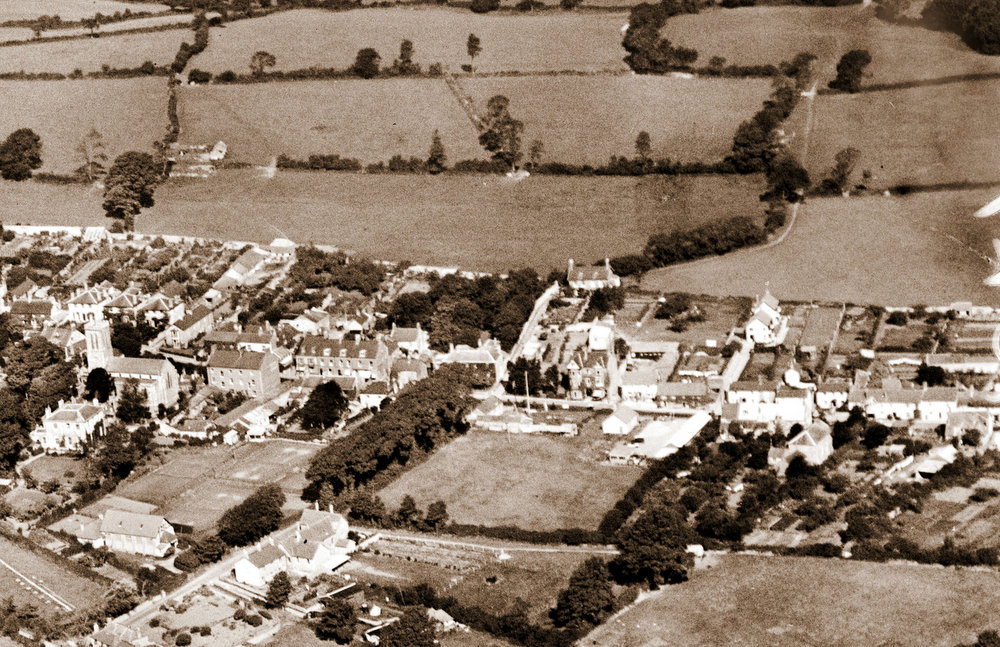
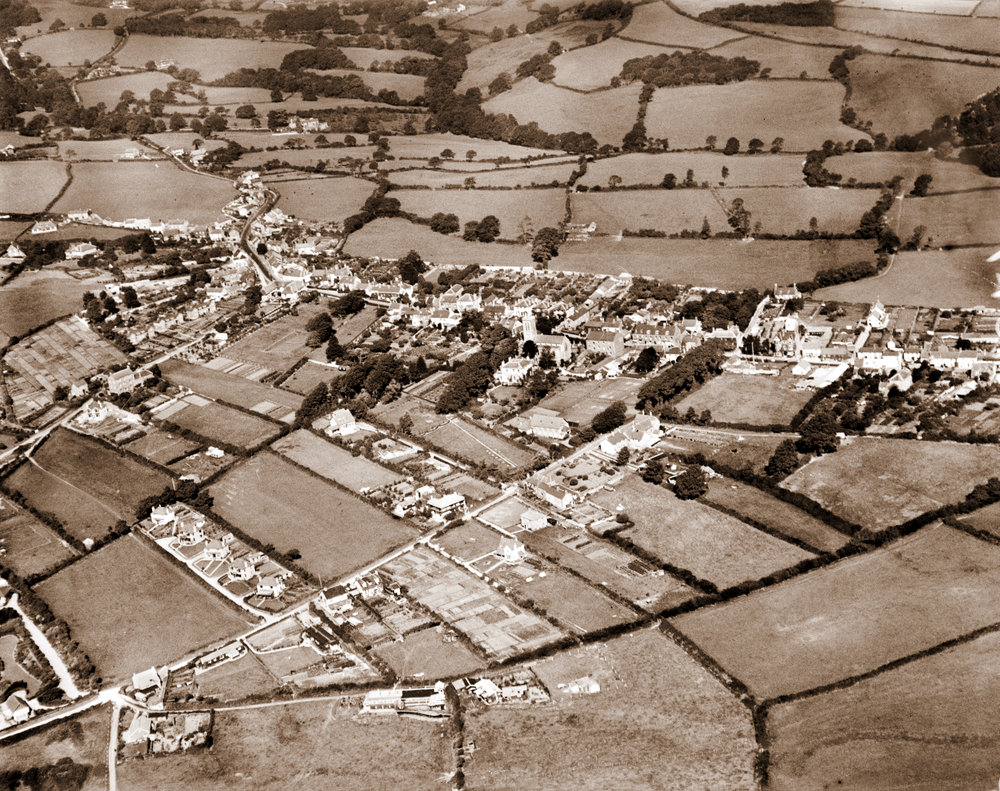
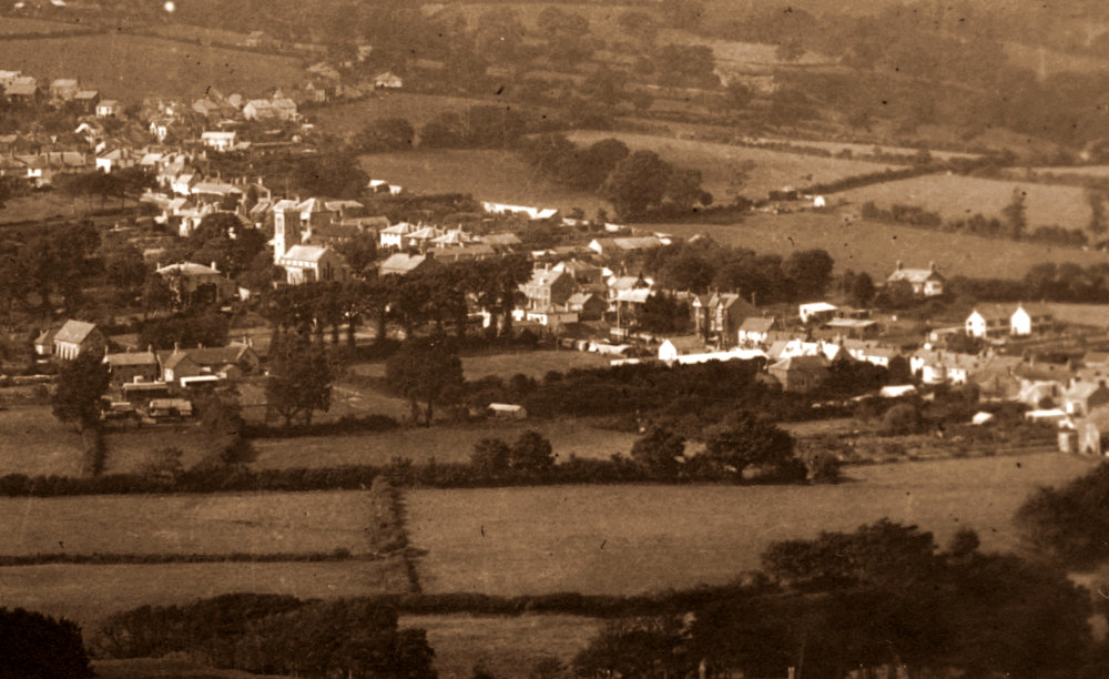
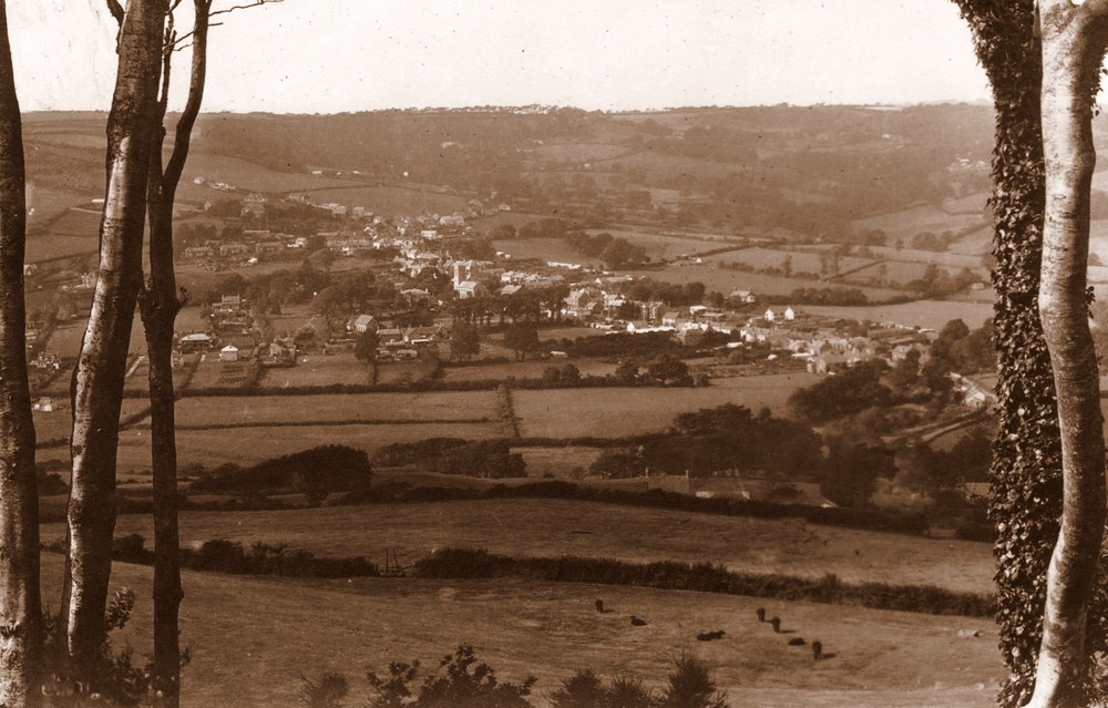
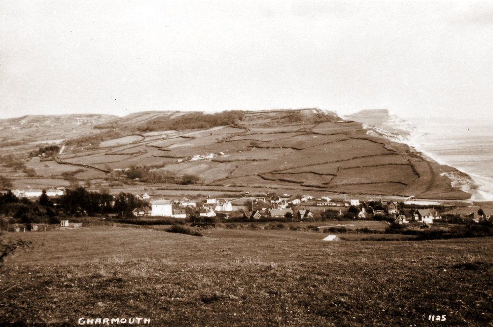
| This aerial view taken in 1927 shows the Street as the main line of buildings as it had been from at least the 12th century, with the monastic wall running along its nothern boundary.The large field on the corner of Lower Sea Lane then known as Pear Close, which was owned by Harry Pryer. It was not until his death 4 years later that houses and shops were built on this and the plot of ground at the side of Devon's edge. The line of tall trees along Lower Sea Lane were also to go shortly afterwards. The White Horse Hotel, dating back to 1800, since demolished towers above its neighbours in Higher Sea Lane. Many of todays roads, such as five acres, Double Common and Westcliff are seen as fields. We have enlarged the image to see how your area has changed over 90 years. |
 |
 |
| |
 |
| |
 |
| |
|
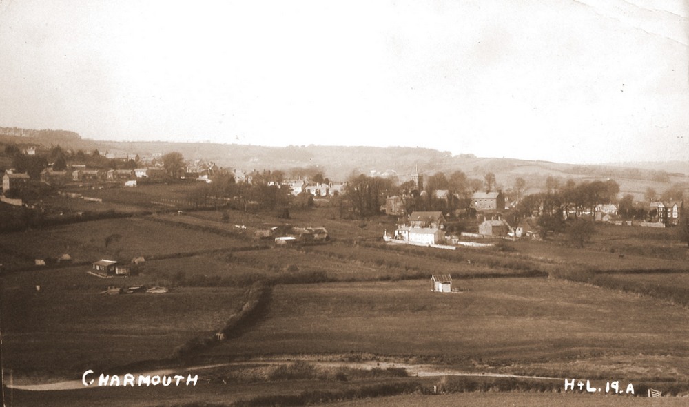
| The earliest Postcard so far found by Claud Hider, with its date stamp is the 7th September 1922.It is a real photo no.19 A from the scarce H &L (Hider & Lawrence) series. Claud seems to have briefly teamed up with Lawrence another Photographer in Bridport before striking out on his own. The H & L cards are extremely scarce and were produced not only for Charmouth and are especially important as they all date from 1922. The view is looking from Cains Folly showing the fields south of The Street. The tall building at the top is Sea Horse House in Higher Sea Lane, which was the first house built there in 1800. |
|
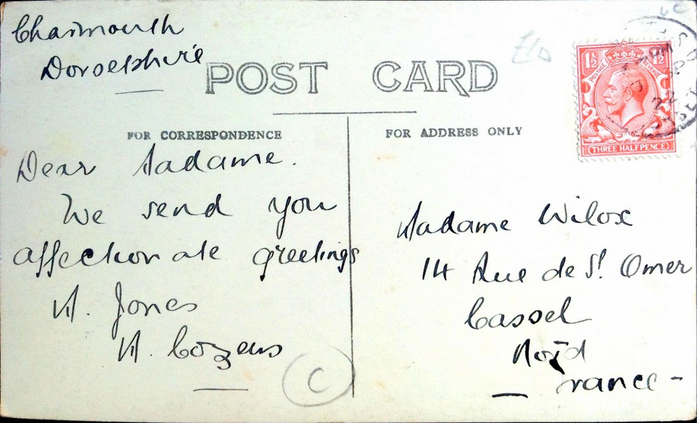
The reverse of the Postcard showing the year 1922, the earliest I have found so far. |
|
A composite postcard produced by Claud Hider c.1923. Here he shows six from the many images he had produced for Charmouth. |
 |
The Junction of road to Lyme Regis by Fern Hill, Charmouth. |
|
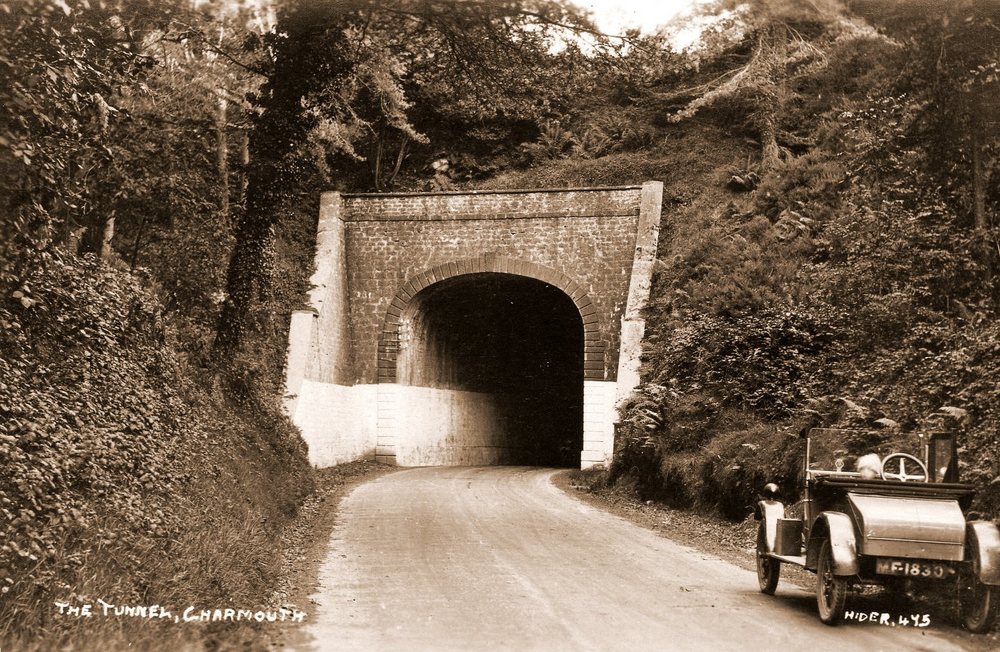
| The entrance to Charmouth Tunnel,now the Firing Range showing clearly Claud Hider`s Model T Ford Car which he drove around the countryside in 1923. One can just make out a childs face with a woolly bonnet on his head. |
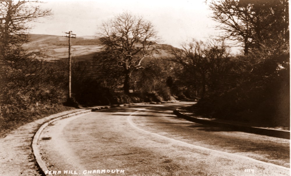 |
Fern Hill, Charmouth |
 |
A View of Old Lyme Hill with a Model T Ford Delivery Van parked on the right |
|
The same view today |
|
We will try to follow as best we can a route through the village from the top to the bottom of The Street and then the coast and surrounding area, using selected Hider postcards.
We will start
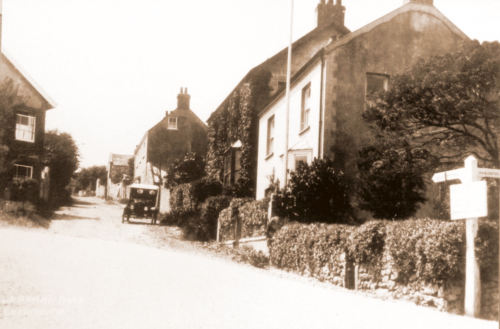
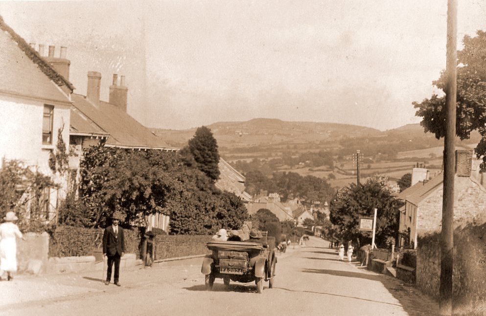
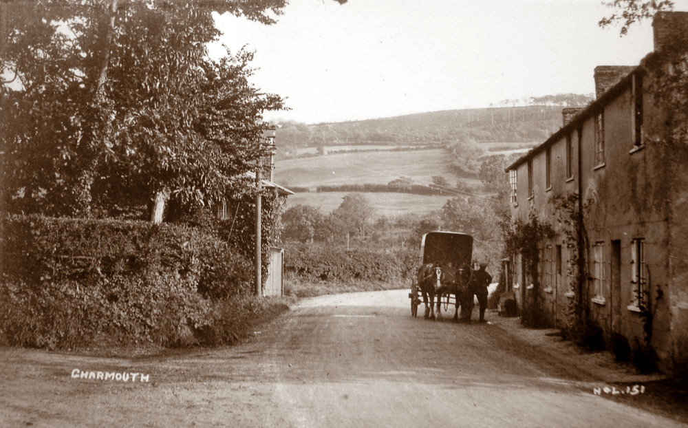
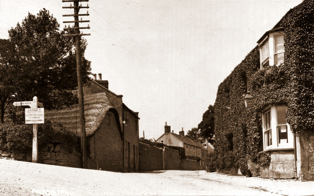
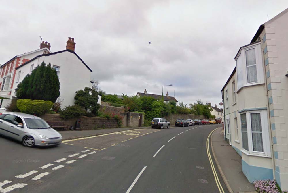
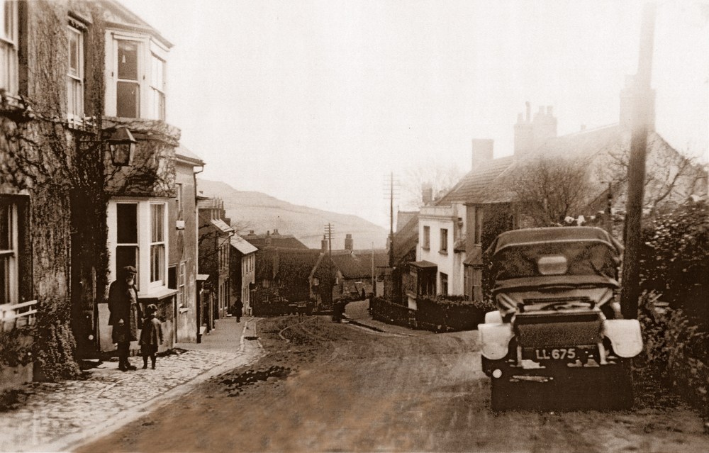
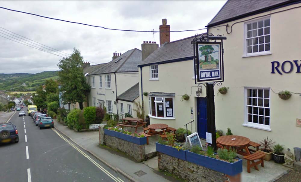
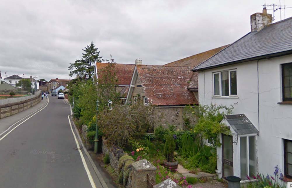
at The junction of the Axminster Road, Street, Old Lyme Hill and Old Lyme Road. The sign is informing people not to use the coastal road as in 1926 it disappeared after a Landslip between Charmouth and Lyme Regis. The pretty thatched house on the corner was to disappear to make way for a car park for the new commercial Inn directly opposite then covered in ivy. This has since closed and been converted into accomadation. |
|
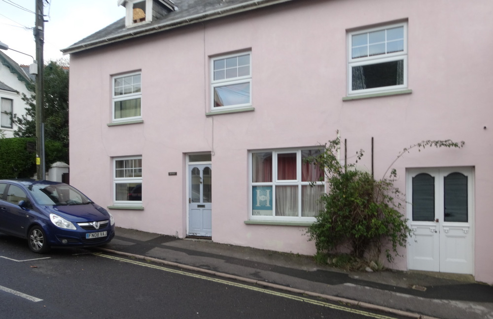
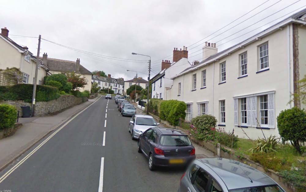
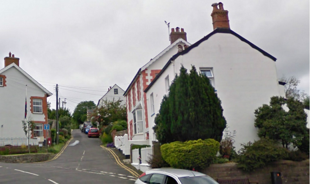
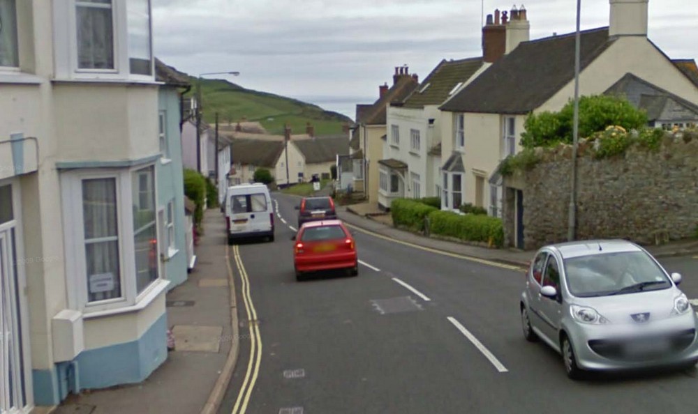
| The view today, with the area of the cottage lost by the bus stop and the New Inn seen as the cream and blue painted building on the right. |
|
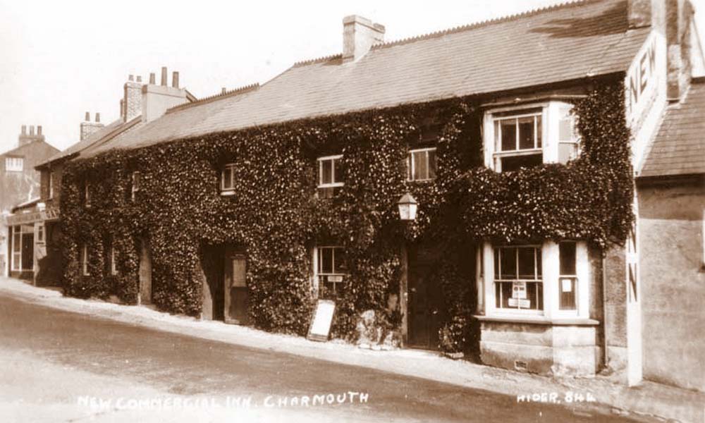
Another photograph of The New Commercial Inn, The words New Inn can be seen emblazoned on the side of the building. On the extreme left one can just make out the word Garage - this may well be that of Ivan Gollop, who appaers in the directory for 1923. |
|
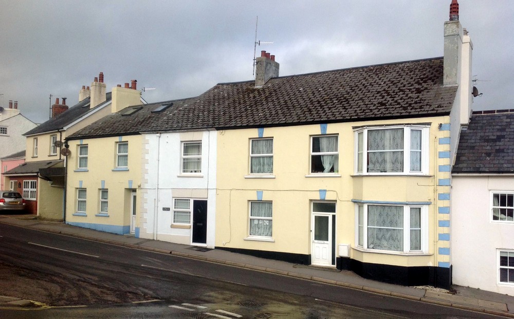
Another recent view ninety years on with the New Inn long since closed and subdivided into three properties. |
|
|
|
| A view looking down the Street towards Charmouth House with The New Inn on the left. The open top model T Ford may well have been the one used by Claud Hider on his photographic expeditions. |
|
The View Today |
|
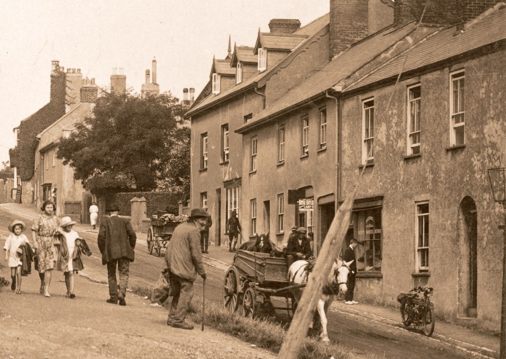
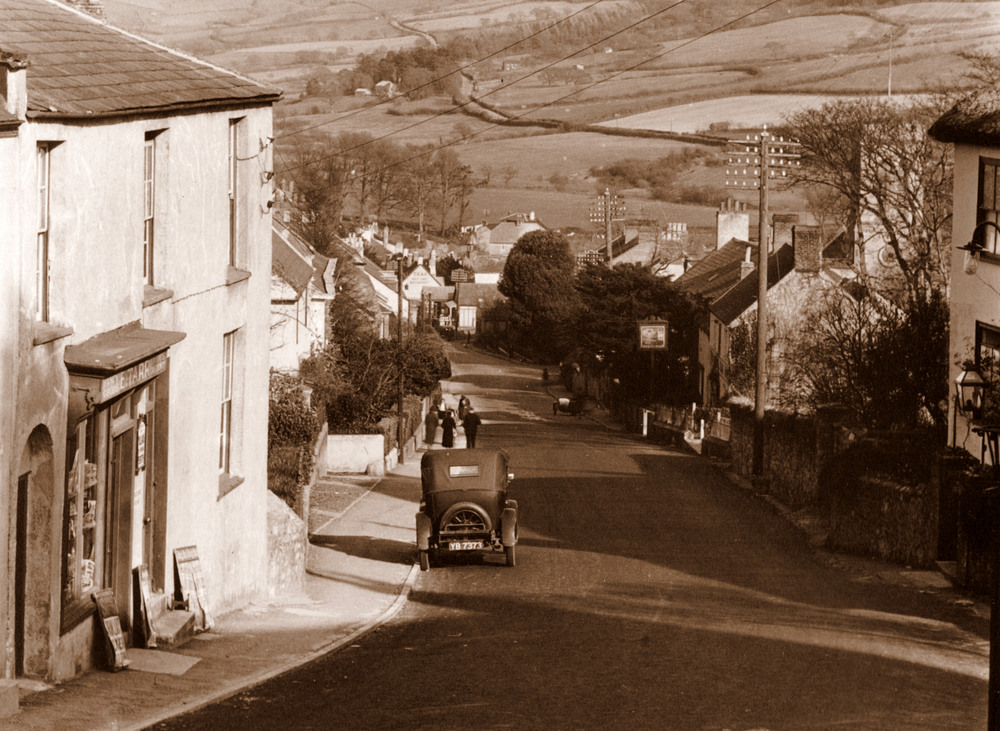
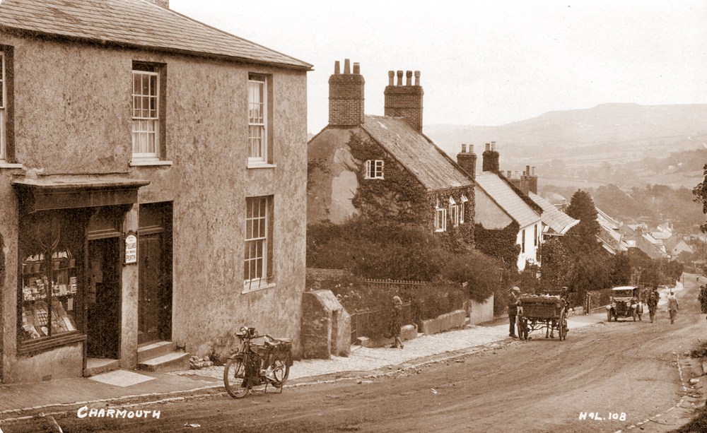
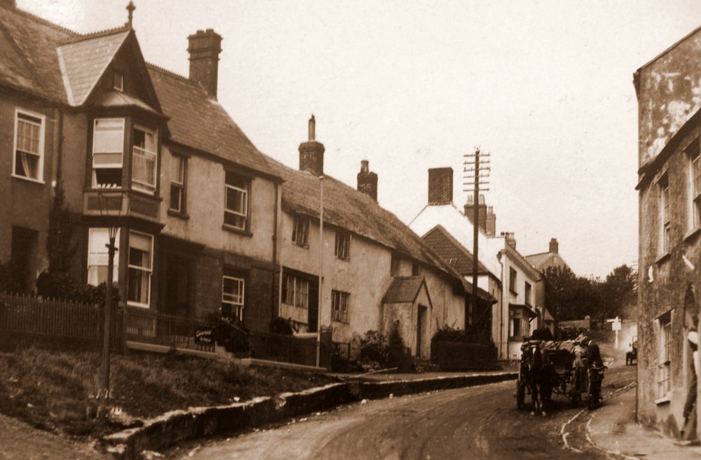
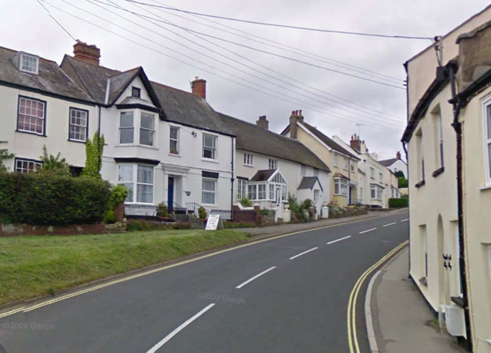
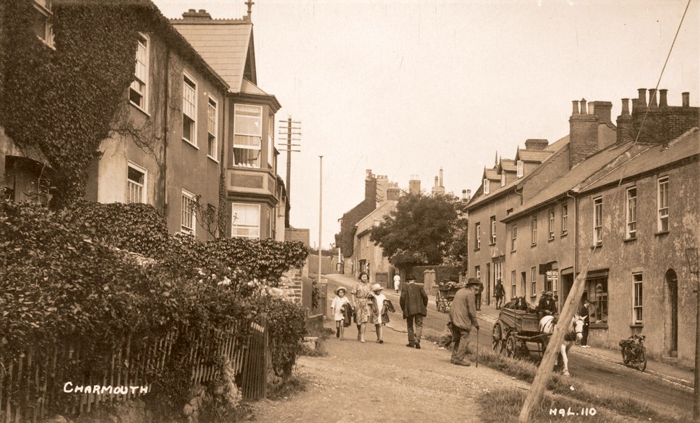
| A Horse and Cart stops on its way down the hill. In the distance can be see The Well Head,then called Bruton House, where commander Francis Davies lived.Then Badgers, which at that time was occupied by George Grinter who ran Foxley Farm with its fields stretching from Old Lyme Hill to Higher Sea Lane. Next to it is Clarement House with its board outside promoting its letting appartments. |
|
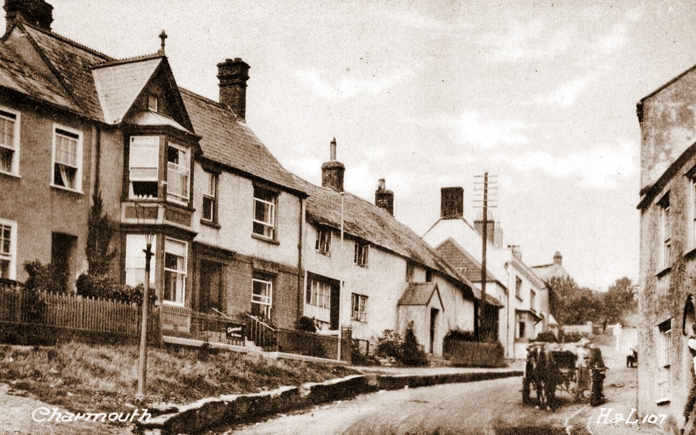
| This is an interesting postcard as it shows how Claud Hider uses the negative above to be printed as an H & L (Hider & Lawrence) postcard. |
|
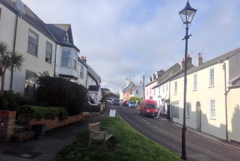
The view today which is relatively unchanged, although Badgers has a large glazed porch as its entrance. |
|
| A superbly animated postcard by H & L (Hider & Lawrence) showing the shops on the opposite side of the Street, which included Longs Grocers, Alfred Childs Hardware Shop and Hutchins Shoe Shop. |
|
The View Today, now sadly lacking its shops, apart from the Fossil Shop which occupies the former Blacksmiths which had been owned by the Childs family for many years. |
 |
A close up of postcard showing how animated it was in 1922 when there were more shops. |
|
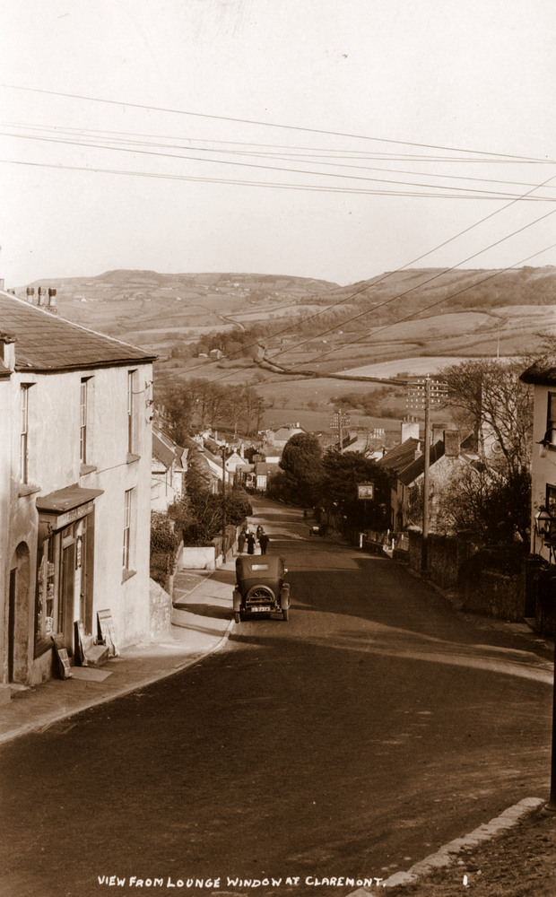
View from the Loinge window at Claremont. That is Claud`s Car in the Street. |
 |
| |
 |
| |
 |
| |
 |
| |
 |
|
|
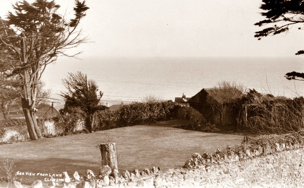
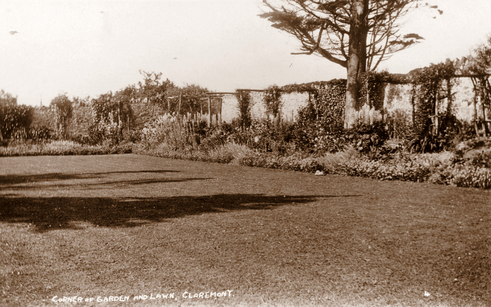
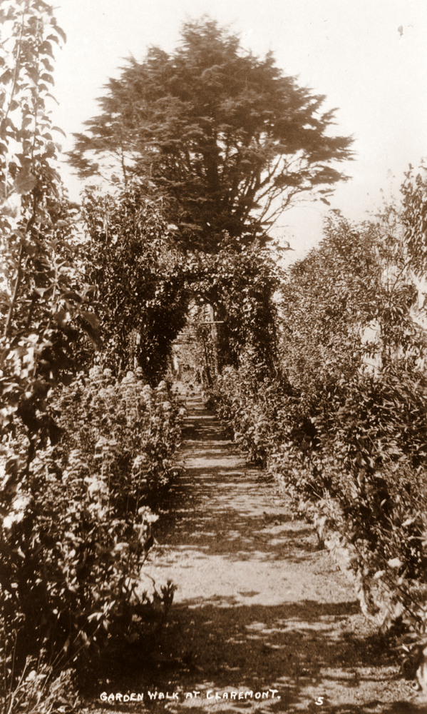
| Views of the garden behind Claremont that Claud Hider must have done specifically for the Hodges, who ran it as a Guest House. |
|
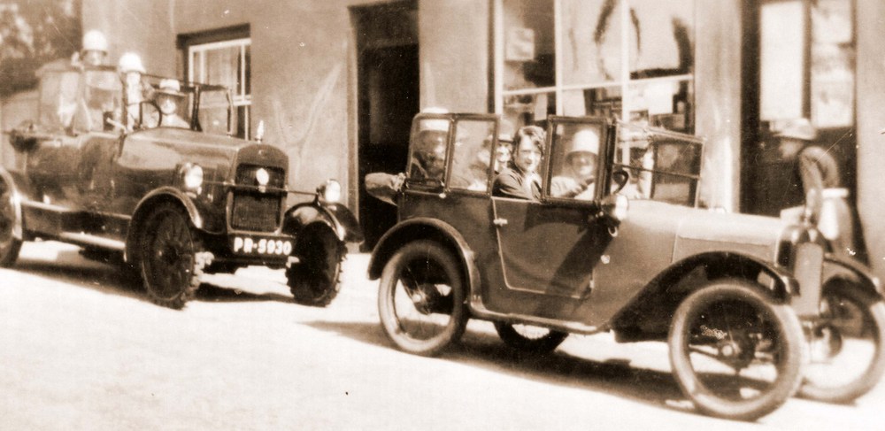
Two cheerful car loads of holiday makers make their way past Longs Grocery Store, now Melville House. |
 |
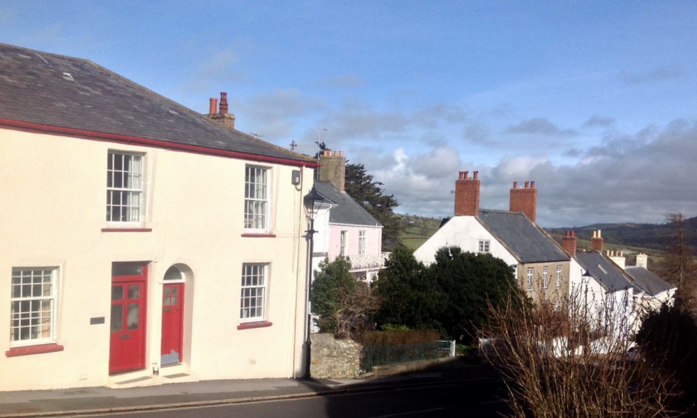
The view today |
|
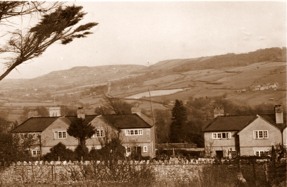
The rear of the Council Houses on Higher Sea Lane taken from Claremont House, shortly after they were built in 1926. |
 |
| An H & L (Hider and Lawrence) from 1922 photographic postcard looking down The Street with Miss Elizabeth Tarr`s Stationers Shop on the left. Click on image for larger version |
|
| The same negative has again been used here to produce a cheaper printed copy of the same view by H & L. (Hider & Lawrence) |
|
The shop on the left almost unrecognisable today from how it was 90 years ago. |
 |
| A candid shot of the Street with a chap with a walking stick posing as Claud take his photograph of an early open top automobile carrying a full load of passengers. |
|
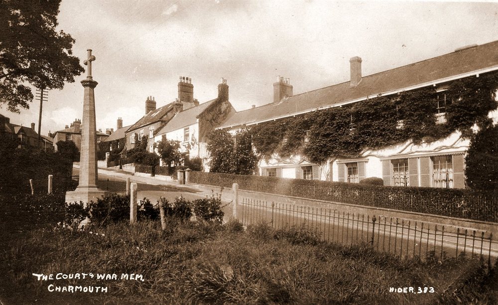
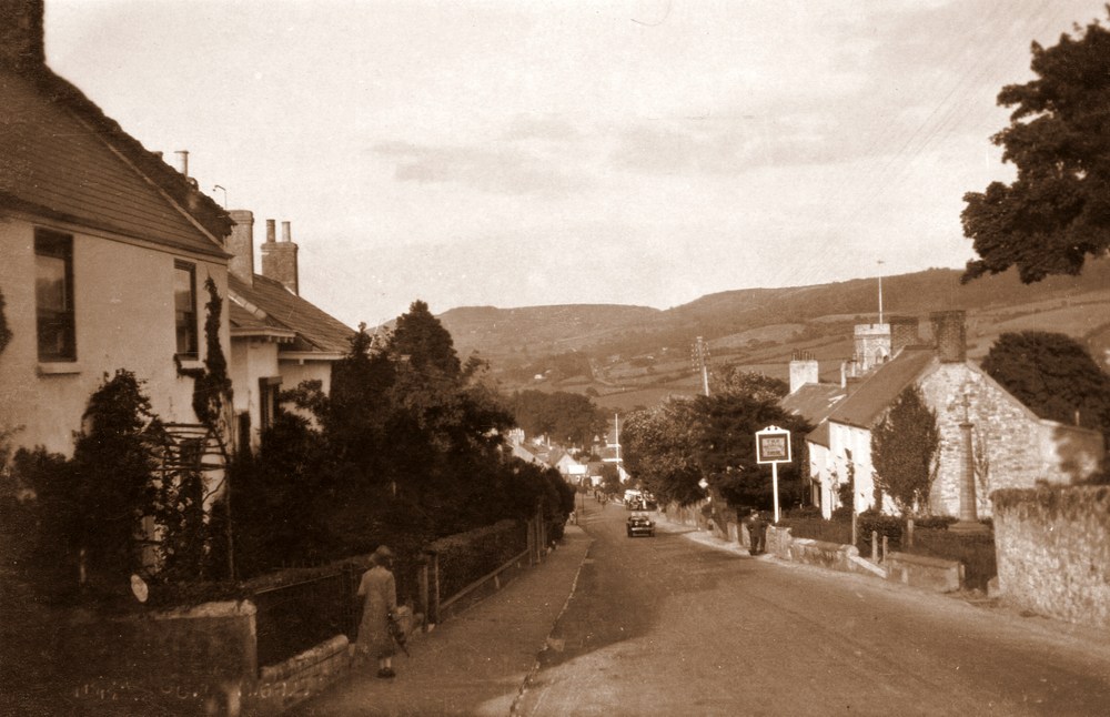
| A view looking down the Street with Monks Rest and The Court on the left where Hugh Schalch lived. the The Royal Oak and War Memorial can be seen on the right. |
 |
A later photograph from the same spot by Claud Hider c.1940`s |
|
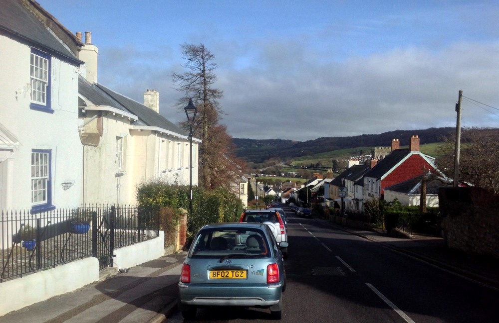
The same view today relatively unchanged apart from the cars parked along the Street. |
 |
A view looking down the Street with The Royal Oak and War Memorial on the right. The road surface is seen here as nothing more than a track. Click on image for larger version. |
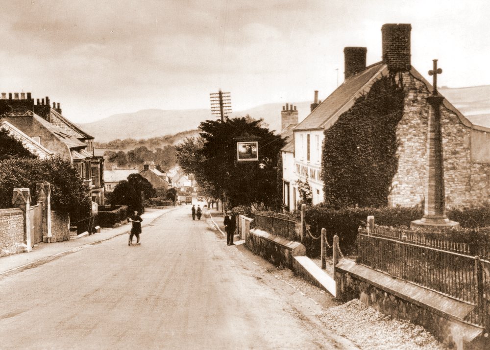 |
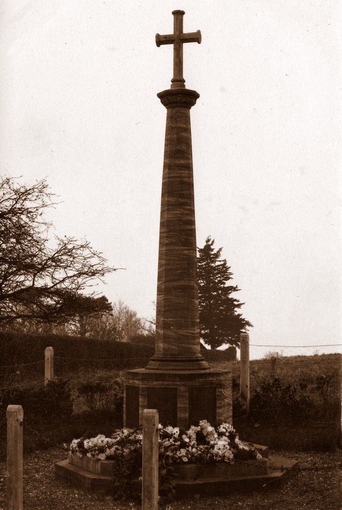
| A young girl is seen here cycling up the street towards the camera. The War Memorial had only recently been erected on the right. |
|
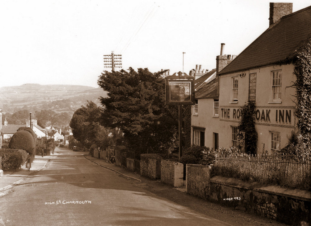
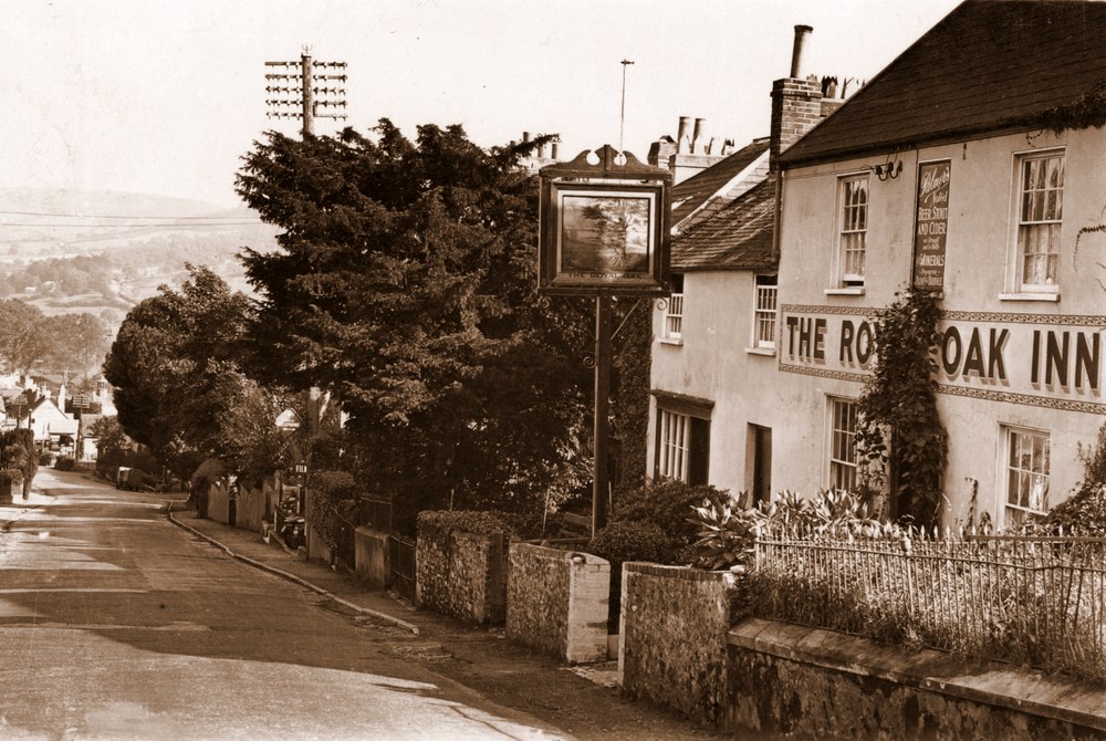
| James Bridle was the Landlord of The Royal Oak when this photograph was taken in 1923. Prior to its opening in 1860 it had been a Butchers and their shop window can still be seen on the left. The first image of The Royal Oak Inn is from the original negative which is still in the possesion of Pinns. The picture below is of the postcard that Claud Hider produced from this, with a reduced border. |
|
| |
|
The same view today with outside seating in the previous garden. |
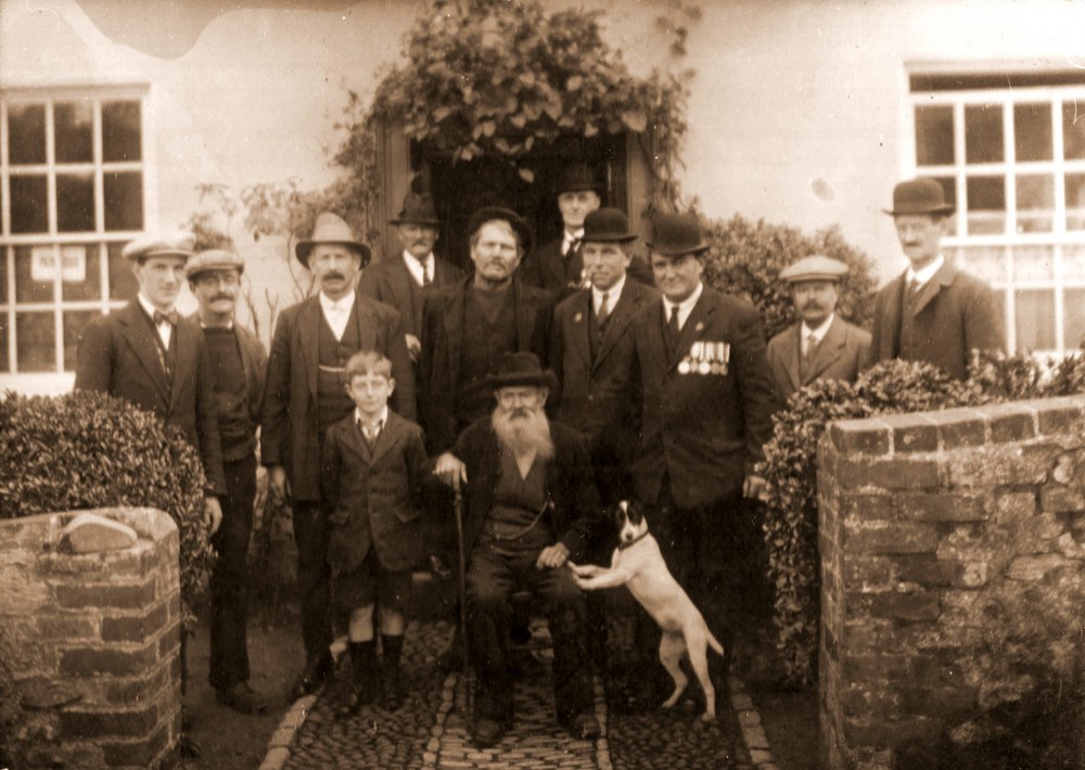 |
| This photograph of a group outside the Royal Oak on Remembrance Day in 1925 shows a number of members of important village families at that time. They are from the back: Alby Cook, Andrew Dunn, Jim Bridle - Landlord, Charlie Larcombe, Shane Burridge, middle row: Billy Gear, Reg Rattenbury, Bill Gordge, Ted Hunter, Fred Hitchcock and front row : Jim Bridle Junior, John Hodder, familarly known as "Scutter" & Boy, his dog. He lived at Rose Cottage in Bridge Road and kept a horse and cart in a shed, where the modern bungalow "Phantasy" has been built by Barney Hansford, and did all the hauling in the village. |
|
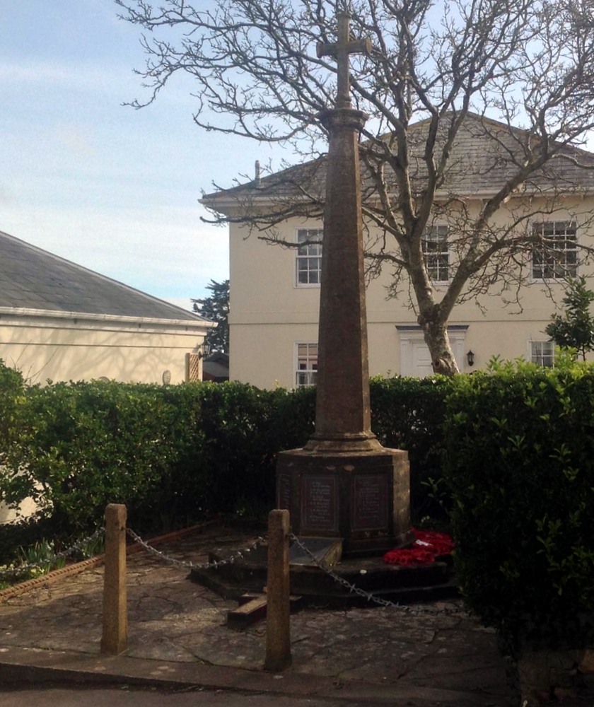
THe War Memorial erected after the First World War as shown in the Postcard by Hider & Lawrence (H&L). |
|
The View Today with a house now built on the ground behind it, which had previously been called Fountains Mead and had been the scene of many of the Village celebrations and Fairs in the past. |
 |
The long shuttered building filling up the view is The Court, which is directly opposite the War Memorial and at that time was occupied by James
Schalch. |
 |
The same view today |
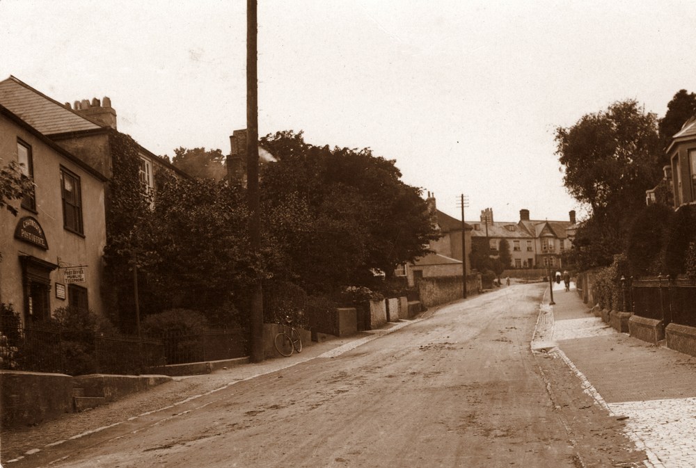 |
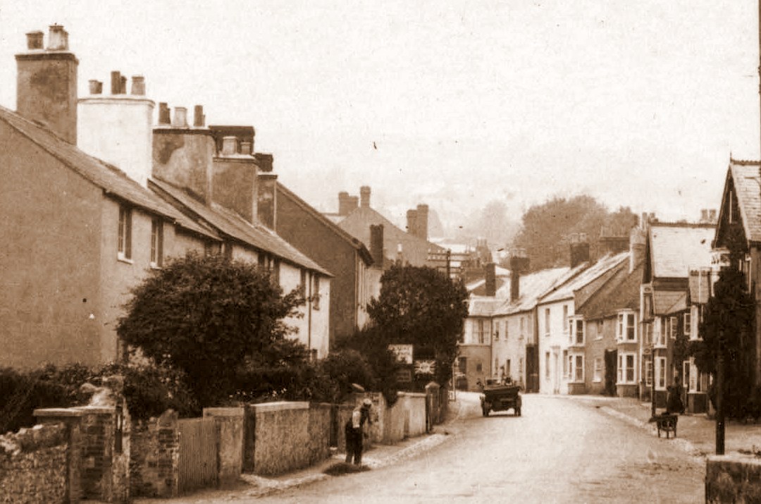
| Looking up The Street, with the Post Office at that time run by William Holly, on the left. Note the awful state of the road and pathways, with the former cobbles showing through in places. |
 |
An H & L postcard of the Old Post Office with the former Lloyds Bank on the left. |
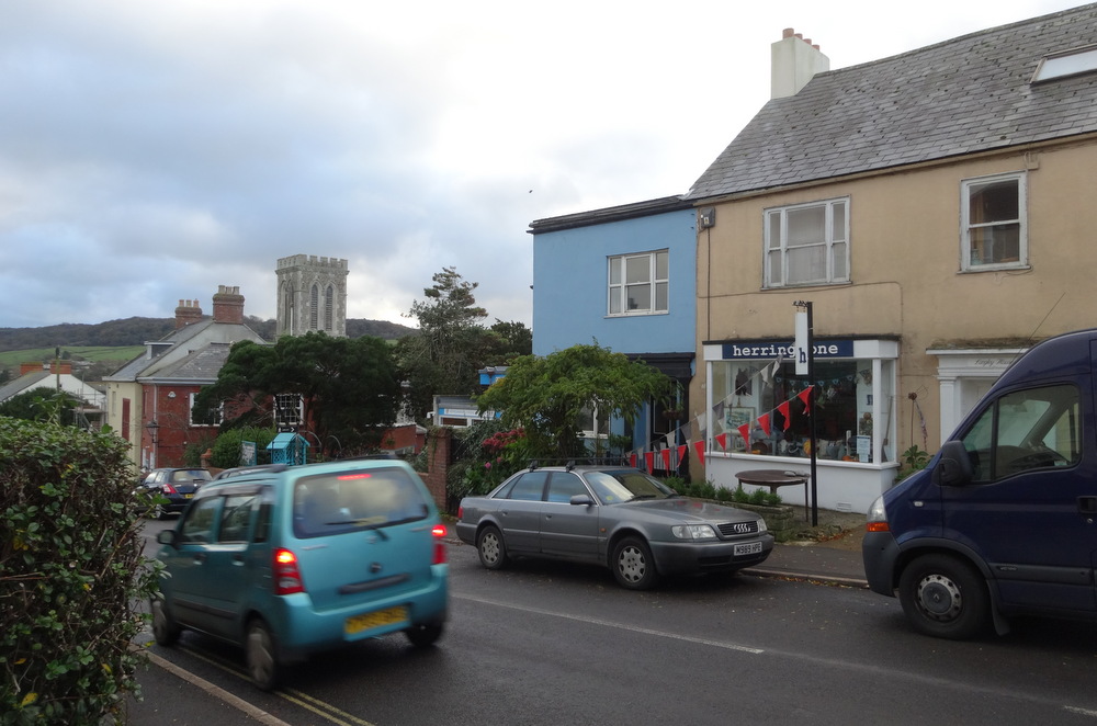 |
The Village Shop "Herringbone" now occupies the former Post Office |
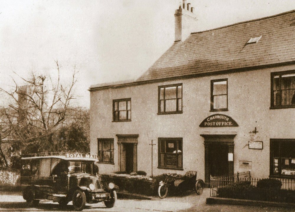 |
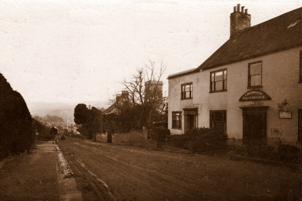
| When William Holly sold the Axminster bus in 1900 he became Postmaster and his son William Holly Junior took on the post when he retired. The Post Office remained at “Wistaria” for 40 years, when it moved in 1940 to “Sunnyside”.
Lloyds Bank occupied the left hand section of the building and opened just Tuesday and Friday for 2 hours each day. |
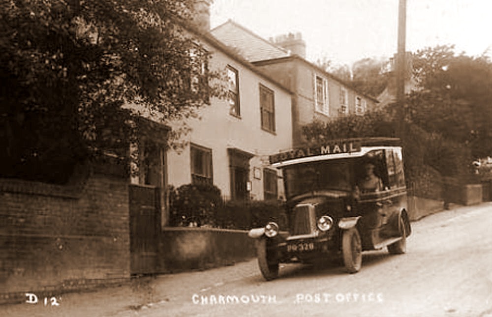 |
The same Post Office Van from the opposite direction. |
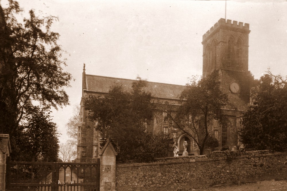 |
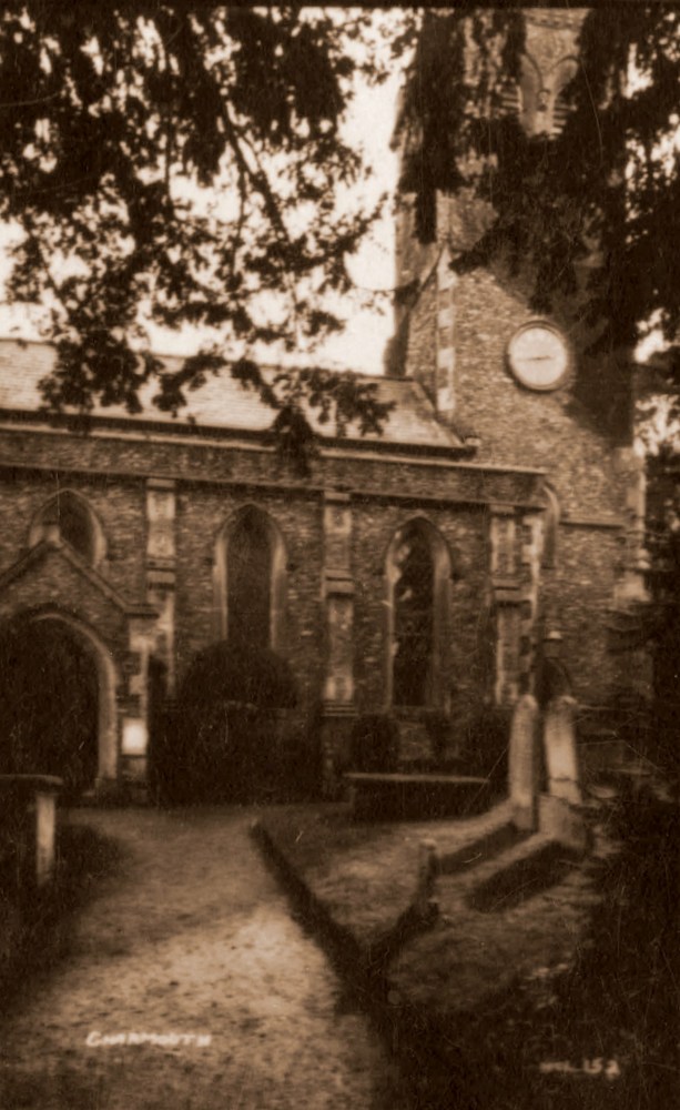
| The Reverend Frederick Markby was the Rector of St. Andrews Church in 1923 and lived at the rear of the Church in the Rectory. The Church replaced an ancient building which was demolished in 1826 |
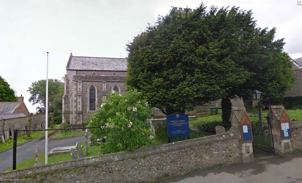 |
The View Today |
|
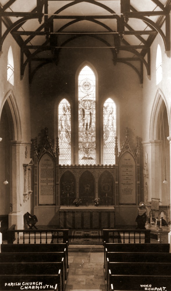
Interior of Charmouth Church |
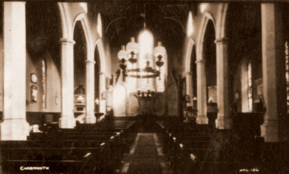 |
| A Postcard from 1922 when Hider was in partnership with Lawrence and coded H&L 154 |
.jpg) |
The same image as above, but now coded Hider 154 |
|
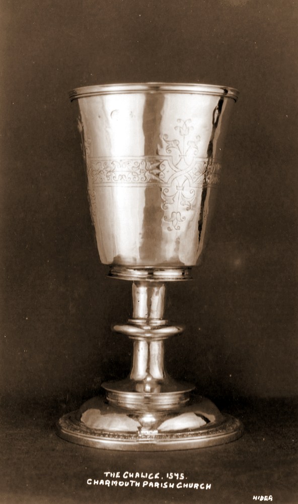
| A Postcard from 1922 when Hider was in partnership with Lawrence and coded H&L 152 |
|
Claud was able to produce small quantities of postcards and in this case records the Silver Chalice, dated 1575 given to the Church by Sir William Petre, which was later sold and replaced. |
|
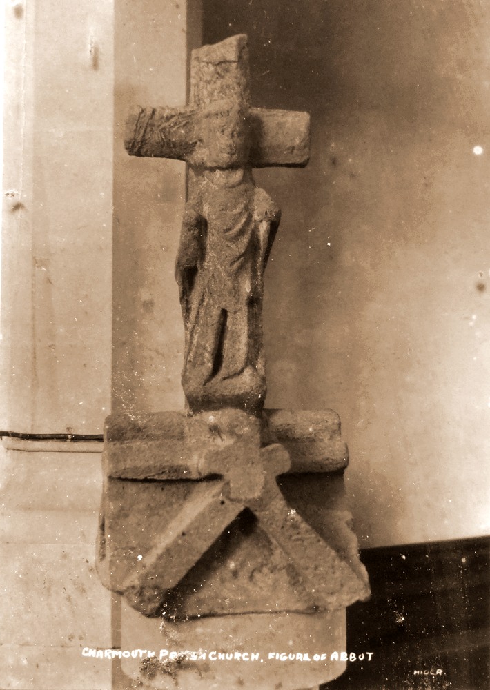
| Claud took a number of photographs for use of postcards of St. Andrews Church, Charmouth. This is of a stone carving representing an Abbot, dating back prior to the reformation of 1539.This came originally from the roof of the old church, which was demolished and replaced with the present church in 1538. |
|
Billy Gear can be seen here with his cap and bow tie in one of his vehicles which he hired out from the former stables of the Coach and Horses.
|
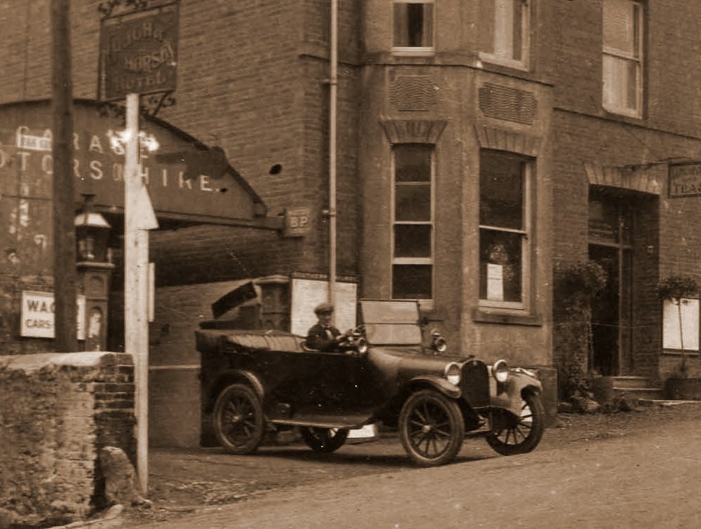 |
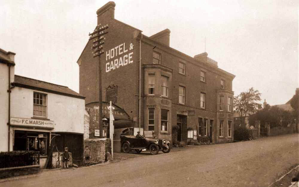
| The first reference to him is in the Kellys Directory of 1927 where he is described as a Car Hirer. He garages his first cars in the two sheds Harold Pryer, the Stone Mason, owned before his death on the east side of a narrow lane alongside the Butchers at “Devonedge”. The business prospered and his next move was to the rear of the George Inn and then finally almost opposite at Pear Close. |
|
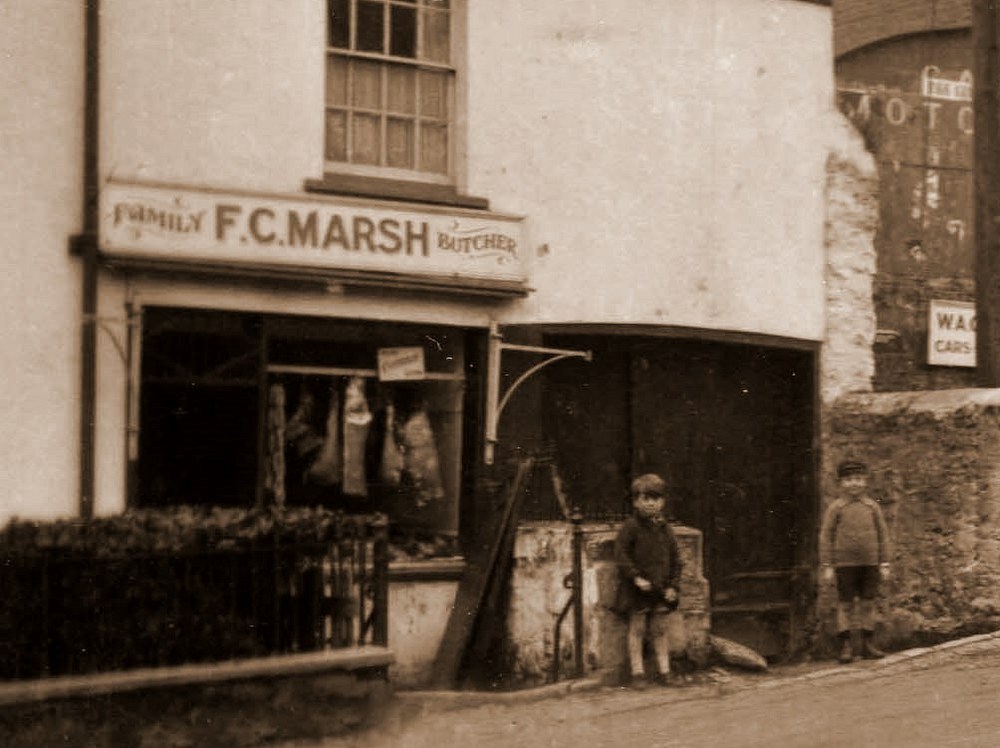
| Astonishingly one of the two children has been identified as the son of Frederick Charles Marsh, who ran the Butchers Shop behind them. He is now aged 96 and living in Christchurch in Dorset. His own son, Steve Marsh, who lives in North Carolina saw the picture and gave us this valuable link with the past. |
 |
| |
 |
The view today |
|
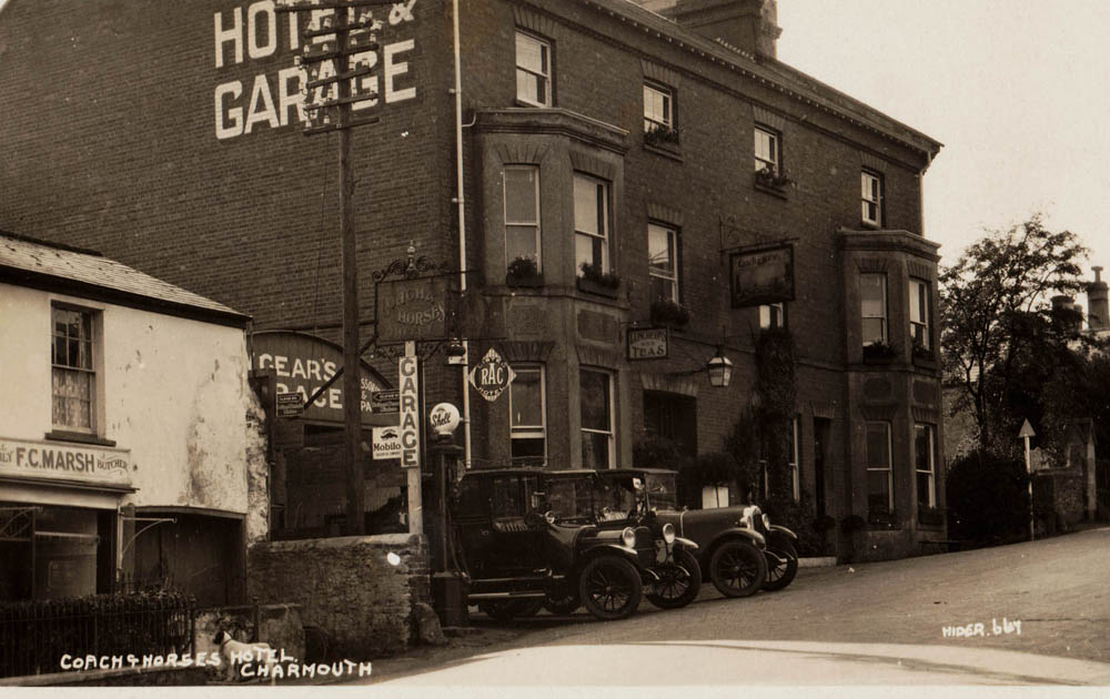
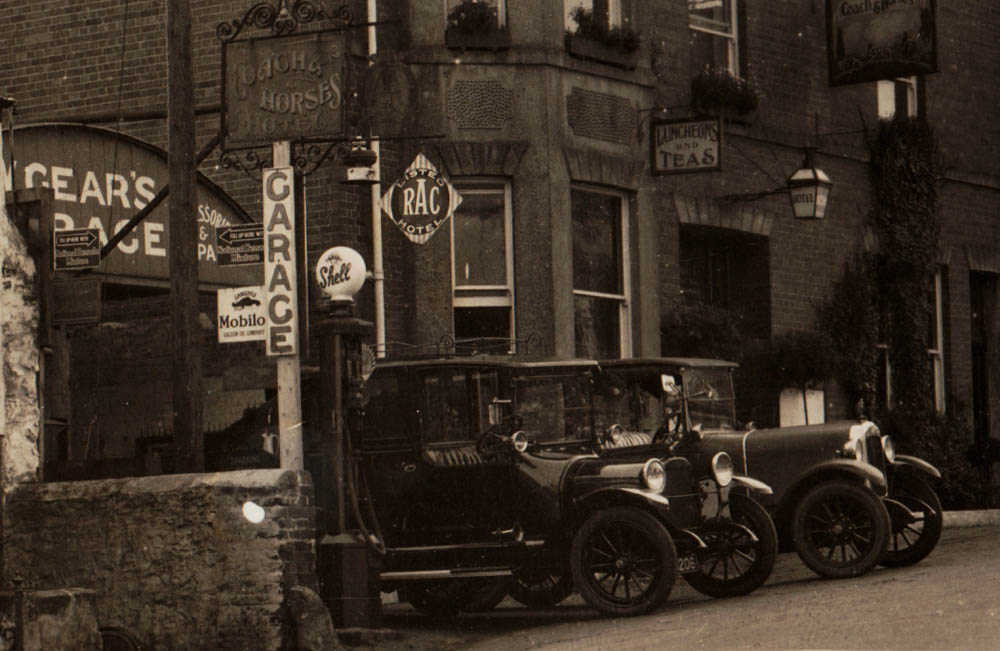
| Charles Sydney Boucher was the owner of the Coach & Horses Hotel in 1923. To the left in the former stabling Billy Gear ran his garage and two of the vehicles he hired can be seen in its entrance. |
|
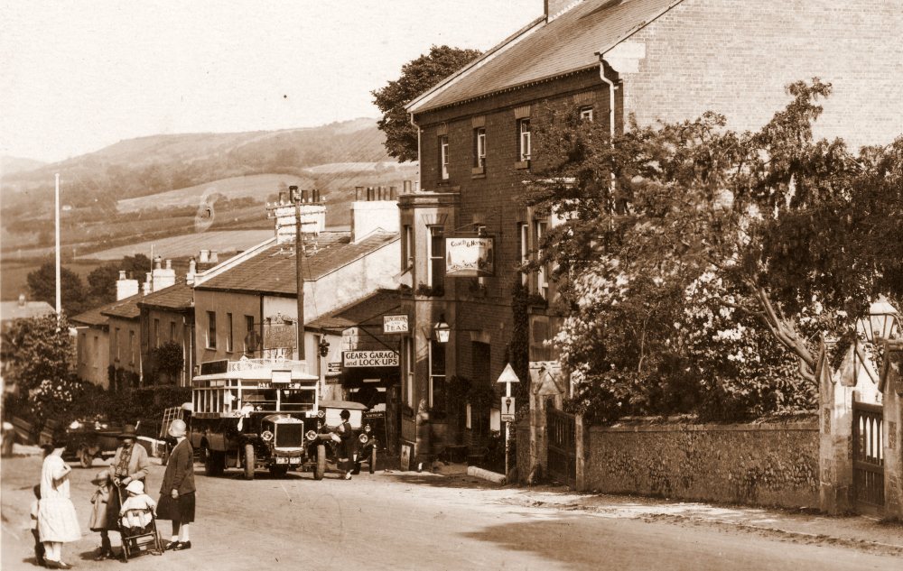
| The equiavlent to the X31 Bus stops by the Coach and Horses on its journey to Lyme Regis from Bridport. The Hotel had been a famous Coaching Inn formelry called The Mail Coach for centuries. It is interesting to see the ladies chatting on the left, two of them have obviously carried on the conversation outside Alberry House in the next photograph. |
.jpg) |
A close up of part of the postcard |
 |
The view today |
|
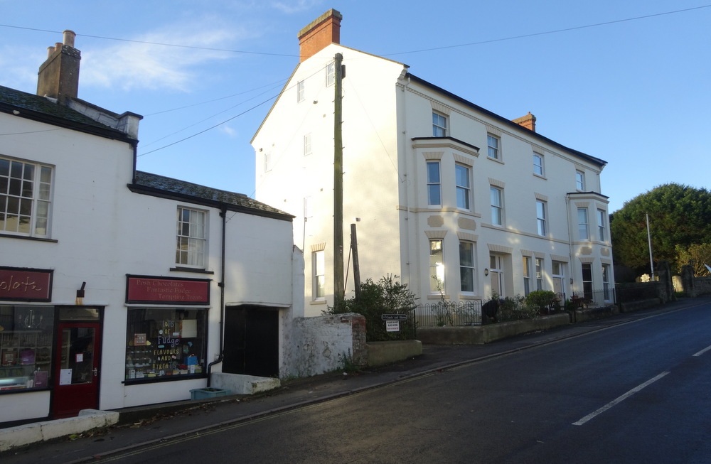
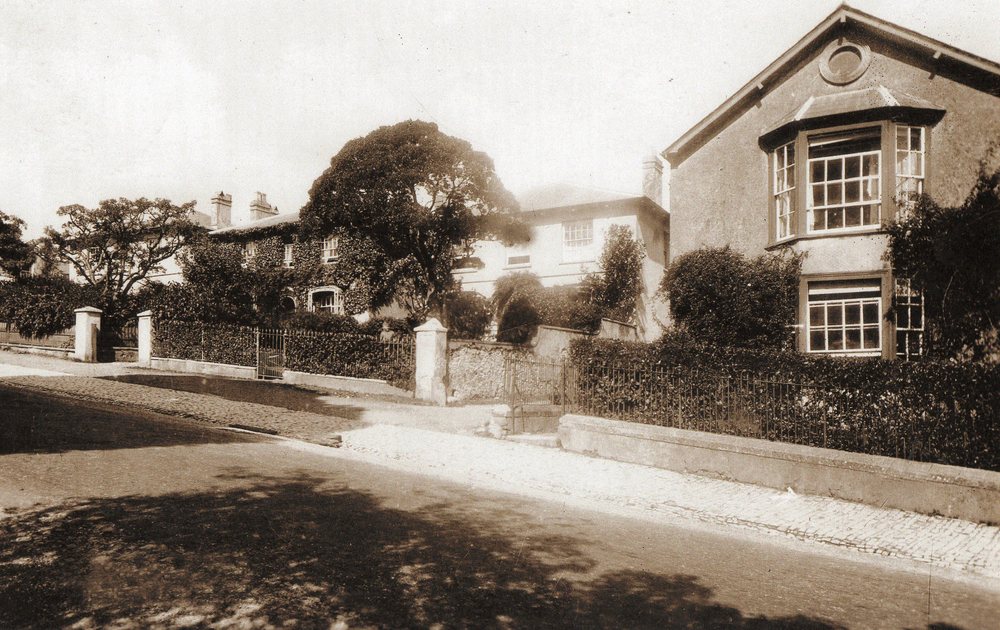
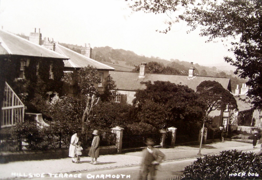
| Hillside Terrace covered with Ivy. The long building in the centre was the Dairy for Backlands Farm which covered much of the area to the rear of the ancient boundary wall at the back of the Street. |
|
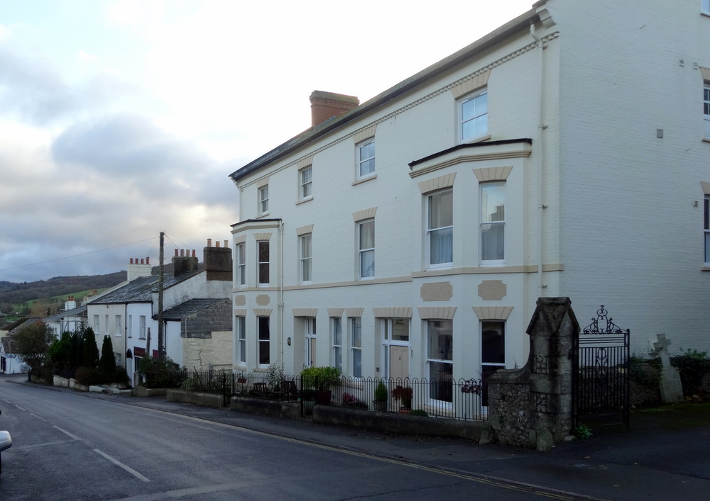
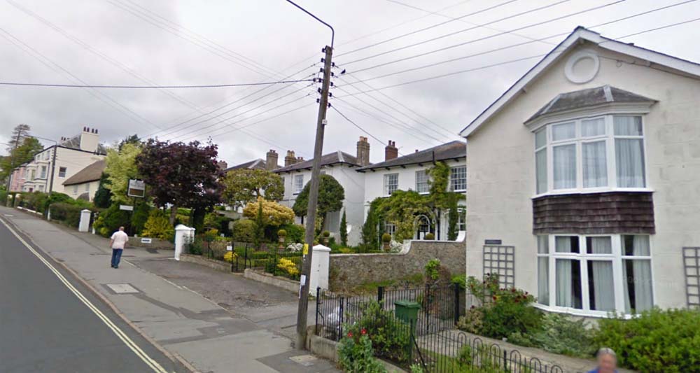
The View Today |
 |
| The Dairy on the right with Nos. 1-3 Hillside to the left of the passageway which led to Backlands Farm at the rear. A herd of cows moving down The Street was a regular sight on their way to be milked in the Sheds behind the building. |
 |
The same view today |
 |
The Pryer Family outside Stanley House,where they lived. The house was one of 4 rebuilt by their ancestor Giles after a disastrous fire in 1864 and were called Prospect Place. |
|
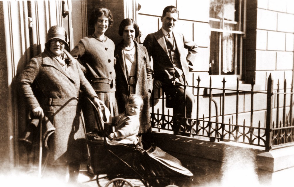
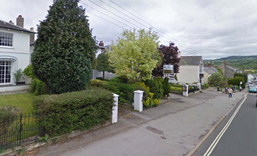
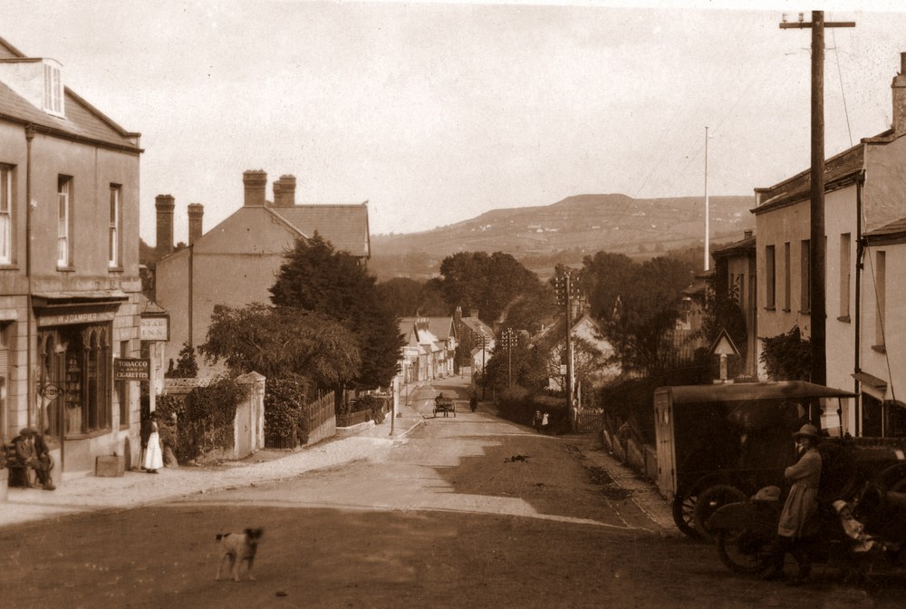
| This is one of more candid postcards by Claud with a number of villagers and a dog facing towards the camera. William Dampier`s wife is no doubt standing outside their shop. At the rear can be seen the sign for The Star Inn which was run by John Lane at that time. The large imposing building that is Devonedge towers over the garden belonging to Harry Pryer that was later to have an arcade of shops built upon it. On the right of the picture a young lady is leaning on her childs pushchair. The Model T Ford alongside her could well have been the delivery van for Marsh`s, the butchers whose shop front can just be seen. |
.jpg) |
A close up of part of the postcard |
 |
The view today |
|
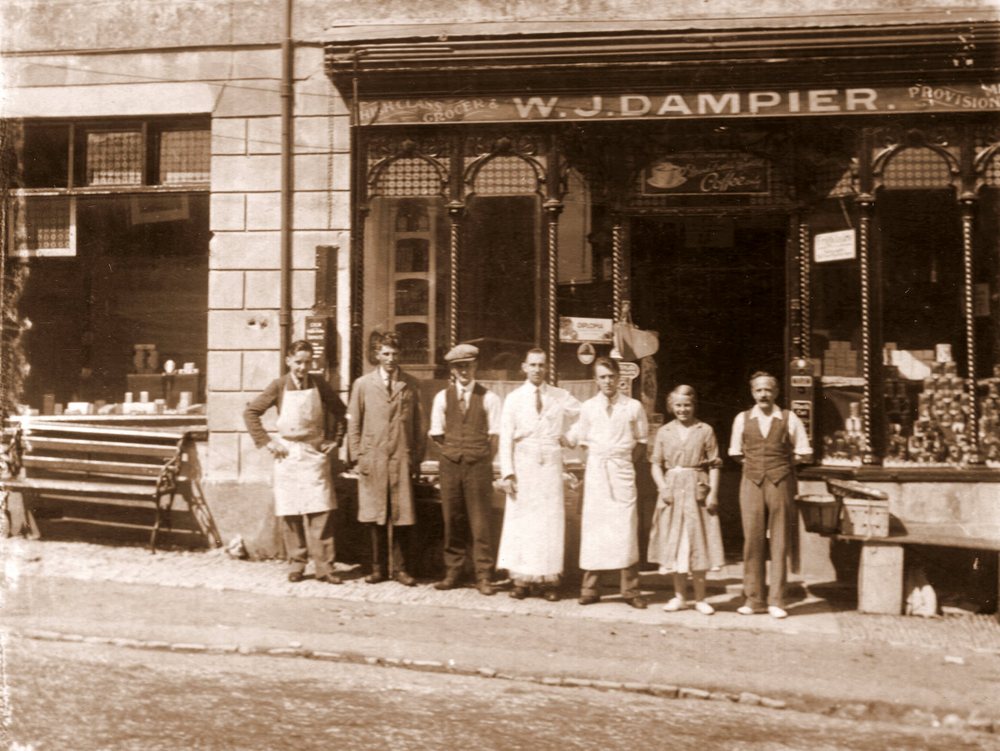
| William John Dampier moved from Dorchester where he worked for the department store of Boons and Sons to Charmouth in 1918 and took over the Stores which his family continued to run until the year 2000.This photograph shows William on the right with his staff and son Donald who was to take the store on after his father. The Directory shows their telephone number as just 4 at that time. |
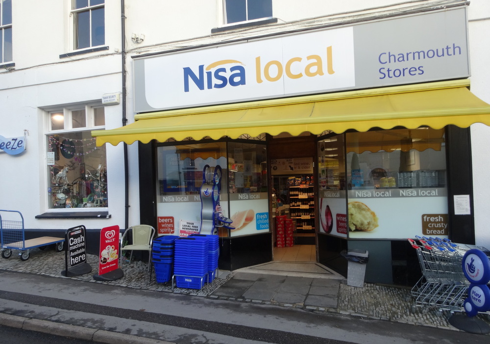 |
Charmouth Stores today now called Nisa Local |
|
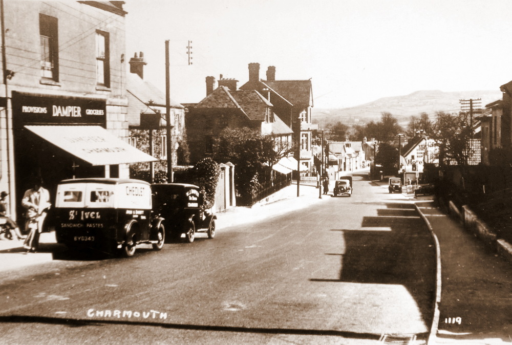
| A later photographic postcard showing Dampiers Van outside their shop, with a van for Chedleys, one of their suppliers. |
|
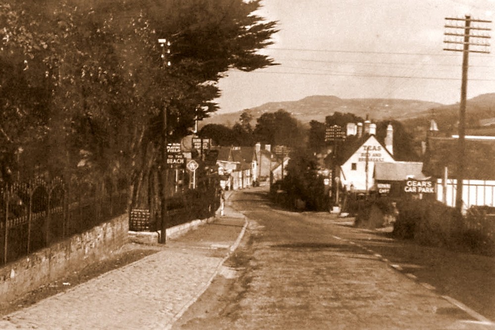
| A View showing the row of Lime trees that lined the property that is now Charmouth Lodge where the Whittington Sisters would have lived at that time.The shops on both sides were not to be built until after 1926, when the owner of the land died and it was sold. The narrow entrance of Lower Sea Lane can be seen by the sign for Gears Car Park which is the large area near the Heritage today. |
|
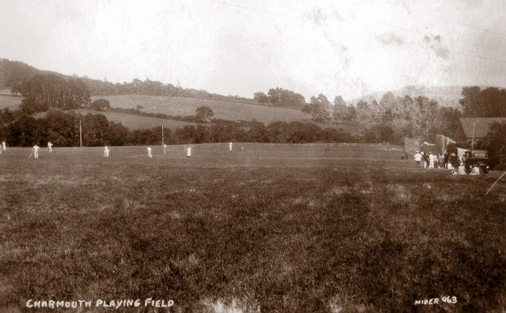
| Cricket Club whose secretary in 1923 was Frederick Penny are seen here playing on the Recreation Field whose entance is in Barr`s Lane. |
|
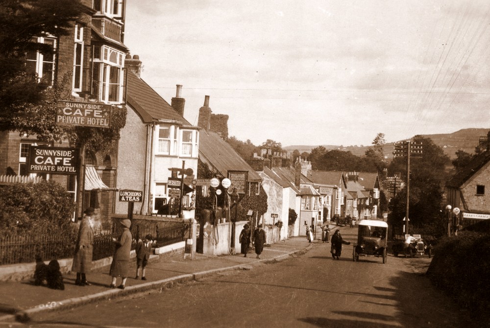
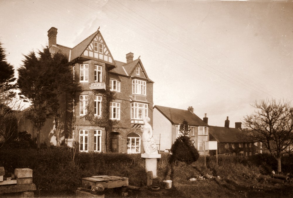
| The building on the left - Sunny side", now known as "Devons Edge" was run as a Bakers and tea room by the Cole Family with a Hotel on the upper floors. It was rebuilt after a disiatrous fire, when the former thatched buildings caught alight in 1894.At this time the village had 2 Garages facing each other. Billy Gear`s Garage was to survive for many years and its offices are now part of the Fish and Chips shop. |
|
A close up of the left hand part of the postcard |
.jpg) |
A close up of the right hand part of the postcard |
|
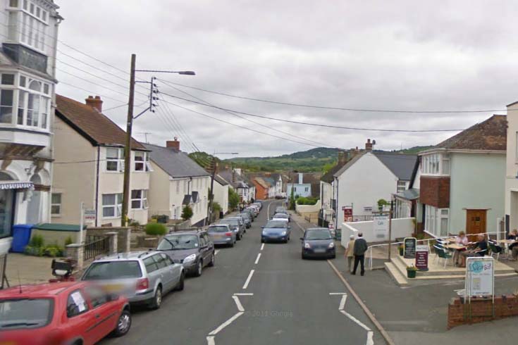
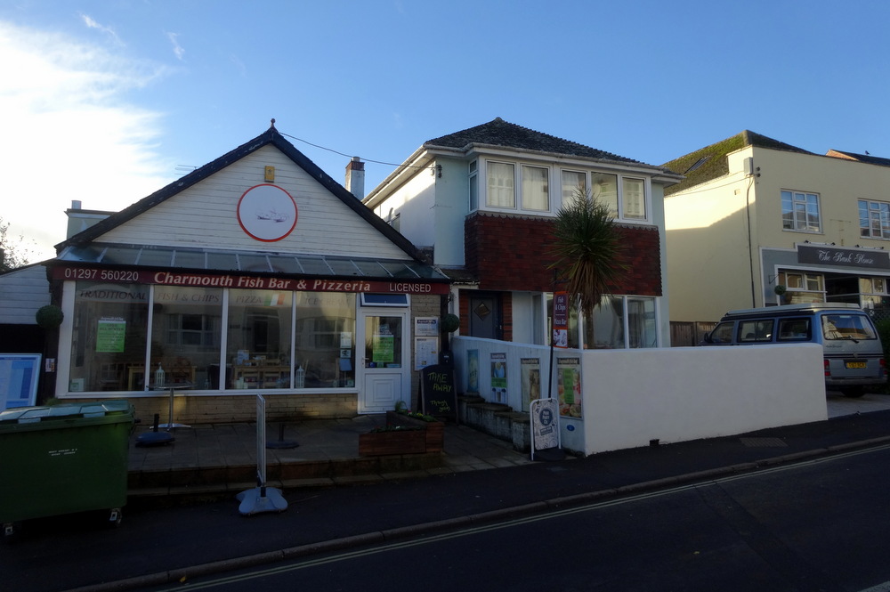
The View Today |
|
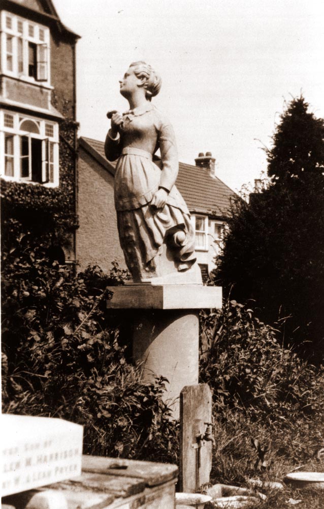
| An unusual view looking toward Devon Edge before shops were built on both sides. The carved figurehead was washed up on the beach and was placed in the grounds of Harry Pryers workshops and was a landmark until his death in 1931. |
|
A Close up of the figure head, which was washed up on Charmouth Beach |
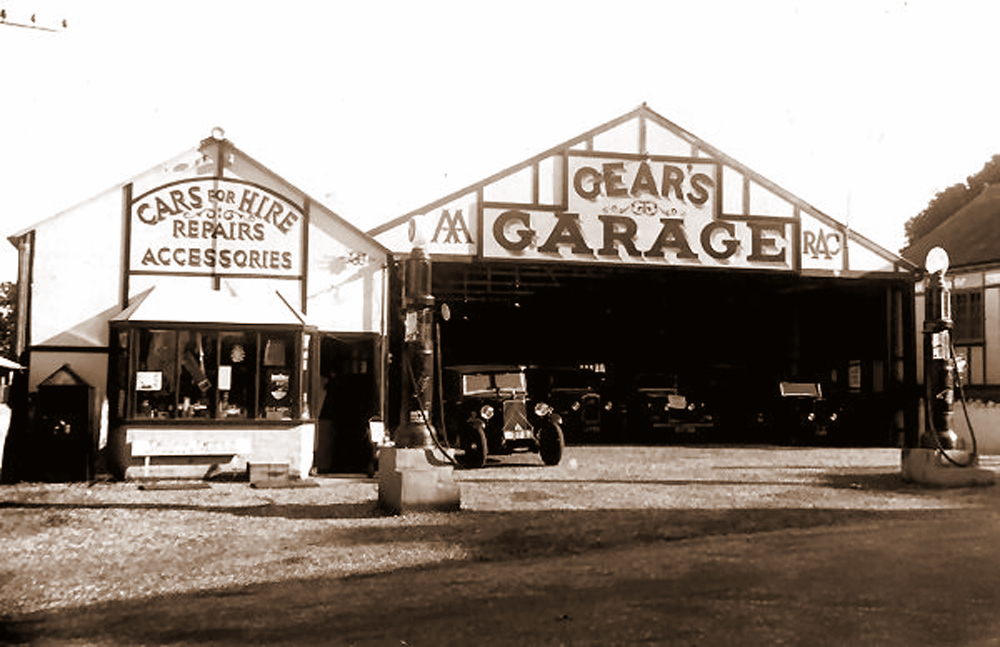 |
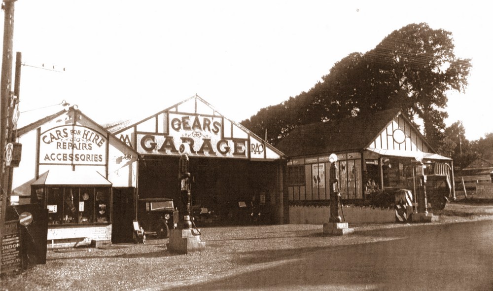
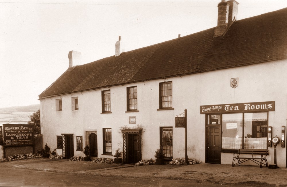
| For a short time Billy ran a Garage next to the Coach and Horses, but then he moved his business to a permanent site next to the Queens Armes where it was to trade for many years. Alhough the workshops have been built on since, their former showroom is incorporated today in the Fish and Chips shop. |
|
| |
|
The view has dramatically changed today to when it was Gears Garage between the wars. |
|
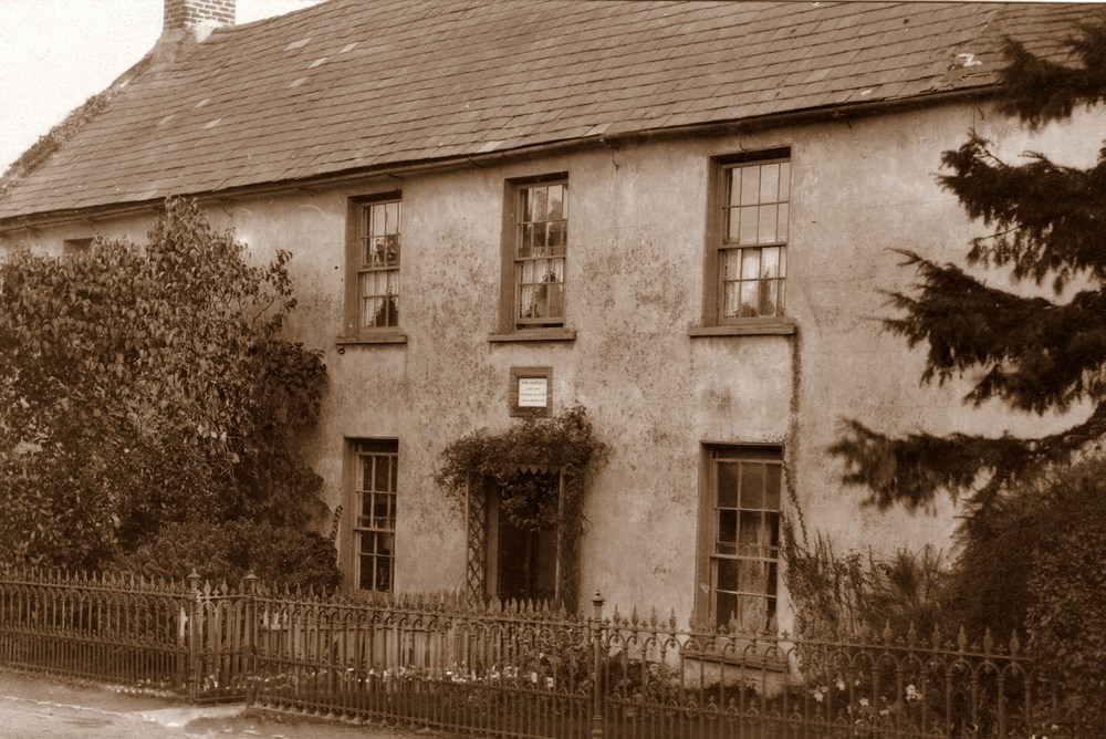
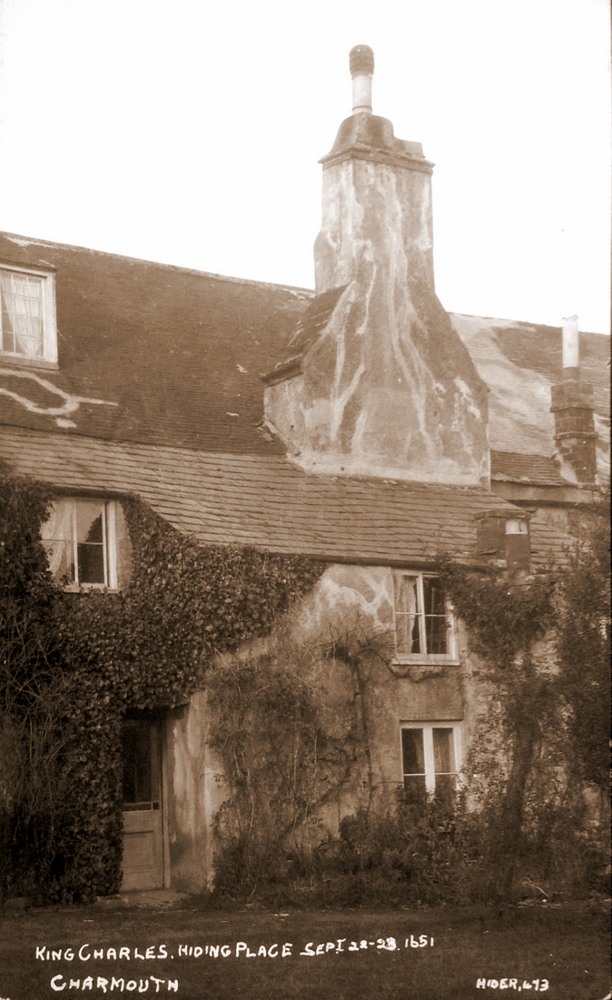
| The famous Queens Armes was the building where Charles II stayed for one night in 1651 before trying to escape to France. But it had to be abandoned and he went on to Bridport and finally boarded a boat at Shoreham. |
|
The rear of the property before restoration |
|
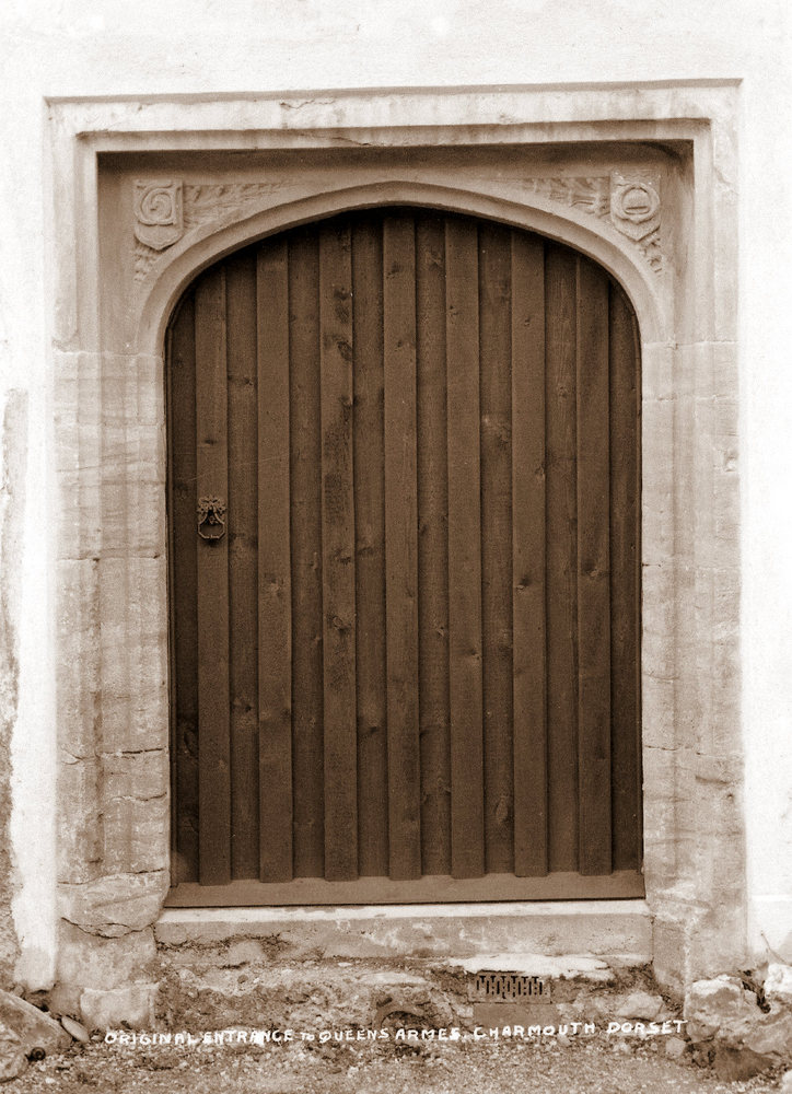
| Claud Hider quite often would record an event that only had a limied appeal. This is the case with the postcard of the carved stone entrance to The Queen`s Armes. The Owner in the 1920`s on restoring the building had revealed the original fine entrance which confirmed that the work had originally been carried out under the supervison of Abbot Thomas Chard of Frome Abbey prior to the dissolution in 1539. |
|
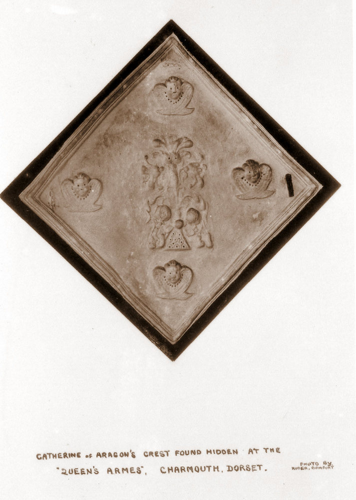
Another postcard in the series for The Queen`s Armes (Abbott`s House) of the plaque that was found there of Catherine of Aragon`s Crest. |
|
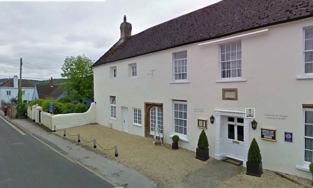
| Claude Hider often returned to take updated photographs, here he shows the former Manse as a hotel and Tea Rooms after restoration . The building is now Known as "The Abbots House" which relates to its links with Forde Abbey. |
|
The View Today with the stone tablet above the door comemorating King Charles II abortive attempt at escape in 1654. The ancient doorway revealed in Hiders earlier photograph, now forms a large window. |
|
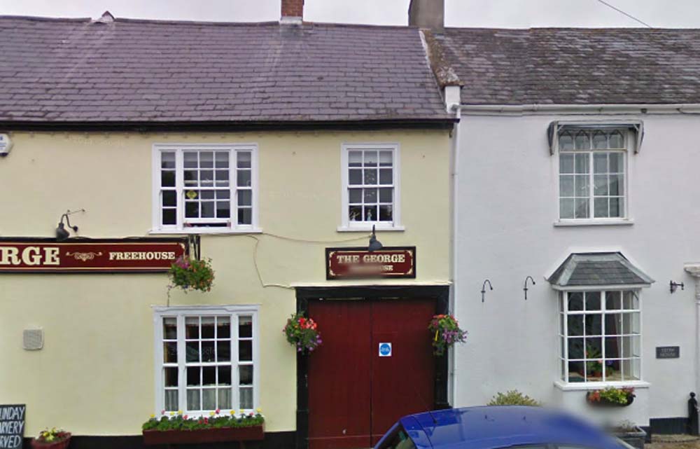
| A print taken from an original negative, still kept by Roger Pinn of the bottom of the Street taken in the 1920`s. The negative would have been larger, and Claude has drawn the lines for the outline of the postcard. The title and his distinctive number were drawn on by hand.
Frederick White was the Landlord of the George Inn on the left. |
|
| Billy Gear and his workmen outside his first Garage which used the stabling of the George Inn which is behind them in this picture. |
|
The View Today with the wooden gates marking the original entrance to Gears Garage. |
|
|
The bottom of the Street with a close up of the view |
|
A real photo postcard of the County Bridge as it enters The Street in Charmouth by H&L ( Hider & Lawrence) |
|
The same image, but this time produced as a printed postcard by H &L( Hider & Lawrence). |
|
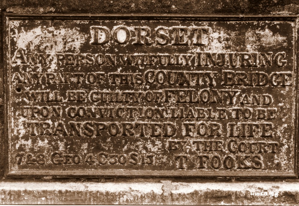
The old mill bridge was built by the County in 1824 and was one of several bridges which contained the following warning:-"Dorset. Any person wilfully injuring.any part of this county bridge will be guilty of felony and upon conviction liable to be transported for life by the Court. T.Fooks." During the war in 1940 when a German invasion was threatened the word "Dorset" was cut out. The bridge had a dangerous hump, was narrow and curved. In 1937 a lorry collided with the south parapet, which had to be replaced by an iron railing. In 1957 the bridge was rebuilt and the crown lowered. |
.jpg) |
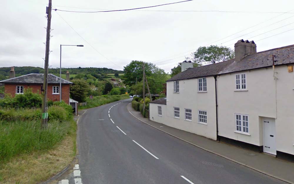
The County Bridge, Charmouth |
 |
A wagon passes the Old Toll House, built in 1826 , which would originally had a wooden gate across it, whose Ivy clad front can be seen on the left side. |
|
The view today with the Toll House extended. |
|
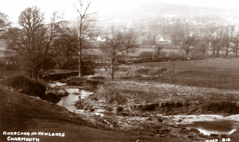
The River at Newlands |
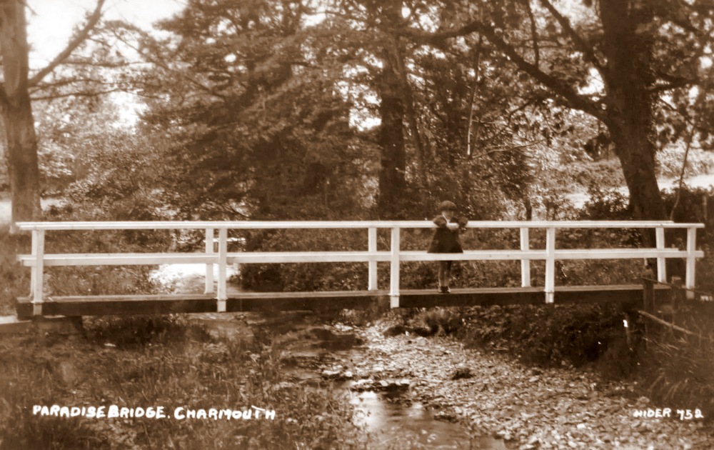 |
Paradise Bridge on River Char. |
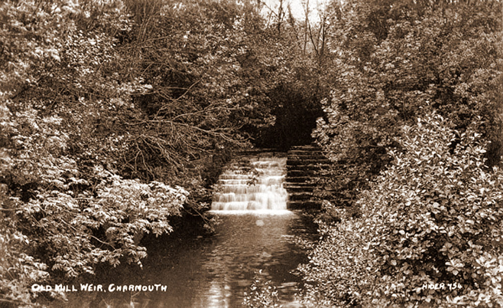 |
The Old Mill Weir |
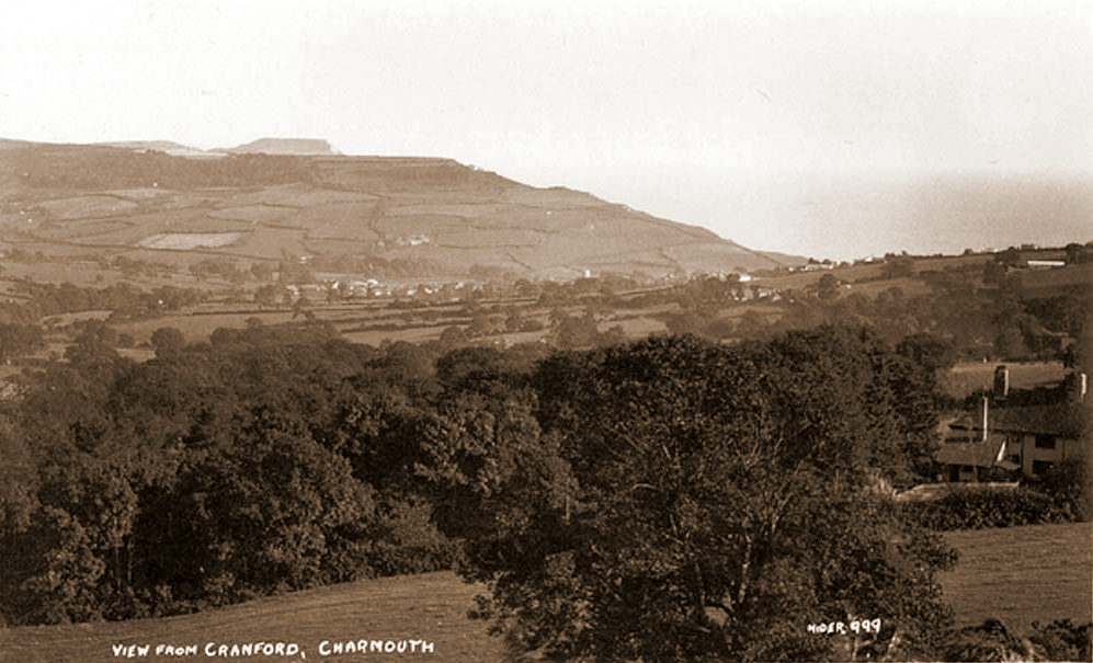 |
This unusual view shows the fine Arts and Crafts House, Cranfords, built in 1907, on the right.It stands today opposite Thistlegate House on the edge of the village. |
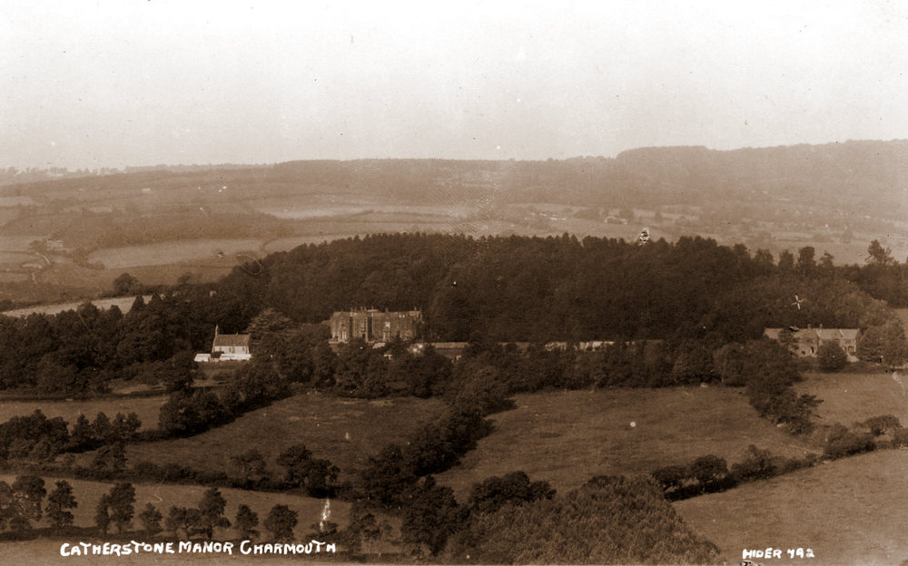 |
| A view of Catherstone and its Manor House and Church, at that time lived in by Colonel John Bullen, who farmed nearly 1000 acres surrounding the property. |
|
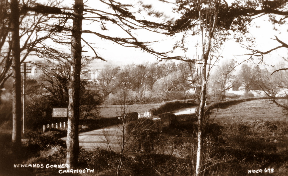
Newlands Corner, now the site of Newlands Caravan Site. The large advertsing board is for the Coach and Horses, which was Charmouth`s largest establishment at the time. |
|
| A close up of Lower Sea lane. clearly showing Pear Close, then owned by Harry Pryer, who ran a Stone Masons Yard from it. after his death in 1926 it was developed into the shops we know today. |
|
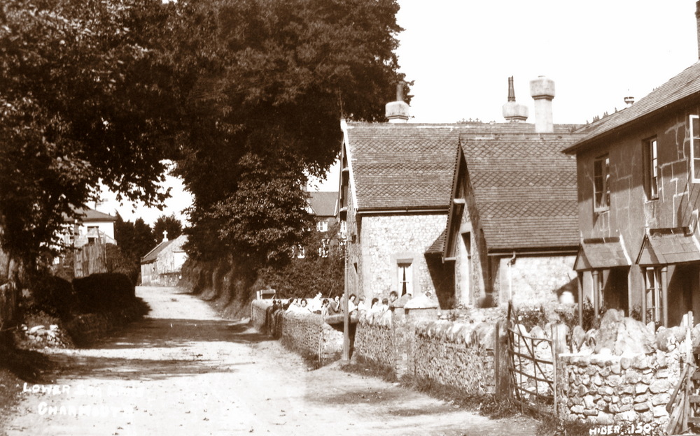
| The old Village School, which was rebuilt at the bottom of Lower Sea Lane in 1992 can be seen here on the right, with children in its small playground.To the right of it are the Almshouses built in 1867 to replace the originals next to the Court.The building at the junction of The Street with a stone cross on it is Pryers Stone Masons Yard. At that time, the entrance to the lane was very narrow, and in 1958 a house was demolished to widen it.
Opposite the School was the Village Tennis Club, founded in 1880,whose secretary was James Scalch of The Court. |
|
The same view today with both the Village School and Almshouses converted into residences. |
|
A view of "Tin Town" which was a row of shacks at the bottom of Lower Sea Lane, which supplied cheap rentals to villagers. They have long since been demolished. |
 |
A Postcard by Hider and lawrence (h & l) in 1922 of new bridge. |
|
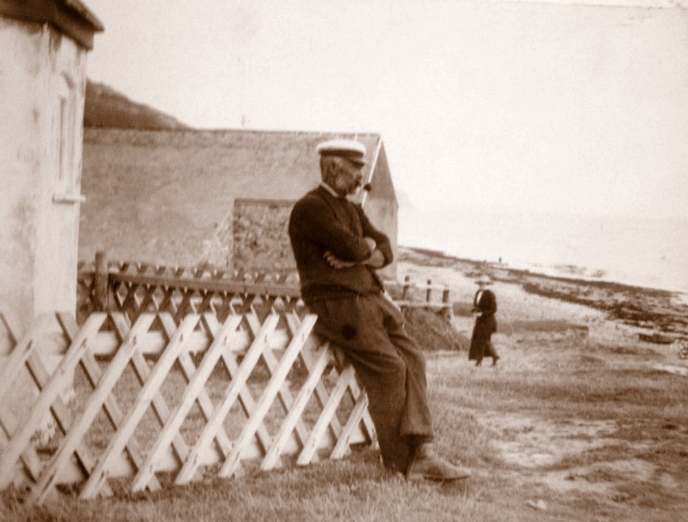
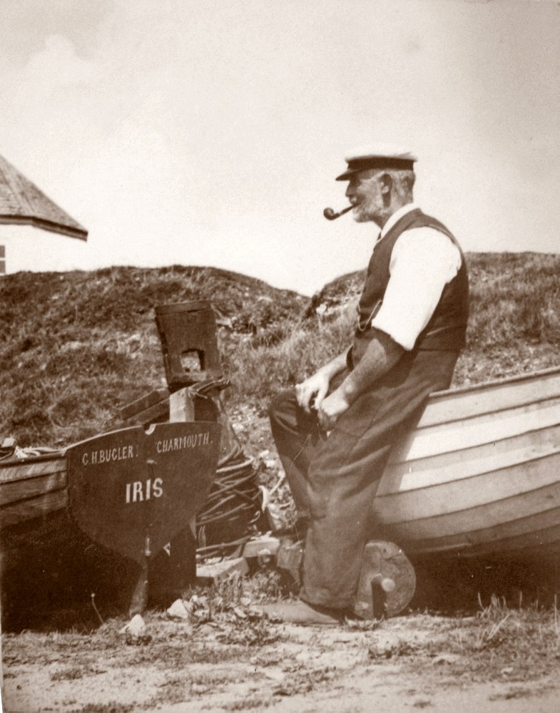
Tom Hunter (1856-1936), a local fisherman was photographed by Claud Hider, c.1923 in the following images by what is today, the Heritage Centre, Charmouth. |
|
| Tom Hunter sitting against the railings surrounding the Look Out c.1923 |
|
| |
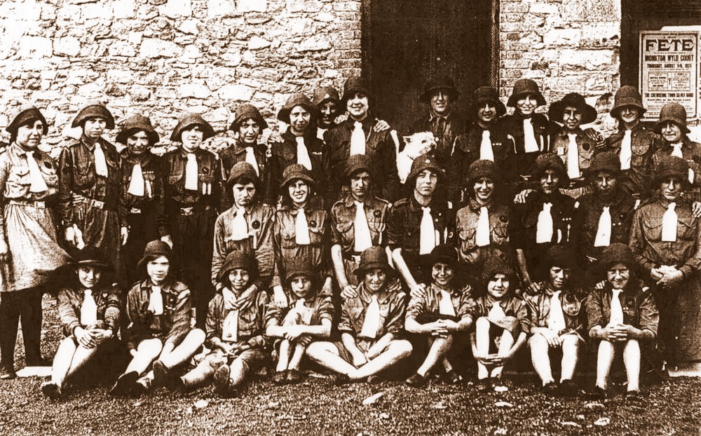 |
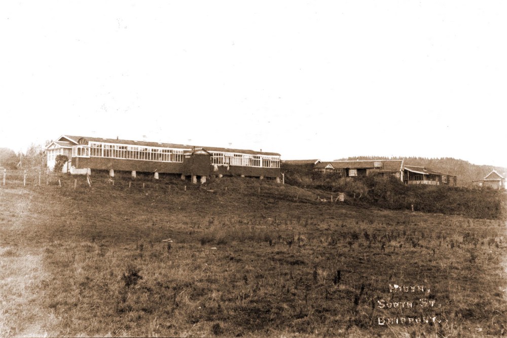
| A Postcard produced by Claud Hider of a Guide Camp at the former Cement Works (now the Heritage Centre) in 1923. See letter below: |
My mother, whose name then was Dulcie Horsley,
lived at Wyke Regis, their Guide Captain was a Miss Jill Warner but one year she went to India for a visit and arranged that some of the Wyke Guides should camp with the Abbotsbury Guides, the Abbotsbury Captain was I think named Miss Blandford and was a school friend of Miss Warner. The camp took place in the upper storey of the Charmouth barn, cooking was done on the fire with the chimney, as this was not usual Guide practice the cooking was done by a servant of the Captain's, who was also a Guide.
The Guides may have gone there again the next year, including Miss Warner then but I am unsure of this. The photograph of which I enclose an enlarged photocopy, has an impress - Hider, South St, Bridport and the number 1731 on the reverse. Also I had written on it at my mother's request sometime, - Guide Camp at Charmouth, held in the barn and joined by guides from Abbotsbury 1924 or 1925 Dog named Corrie! From the enlargement it is obviously taken in 1924. My mother is the end one on the right sat in the front and the one next with the dark fringe is her friend Effie Jennings, I do not know any others, presumable it is Miss Biandford [if that is correct name] holding Corrie.
Miss Shirley Anderson, 35 Langdon Rd,
Cheltenham,
Glos.
GL53 7NZ. (1999)
|
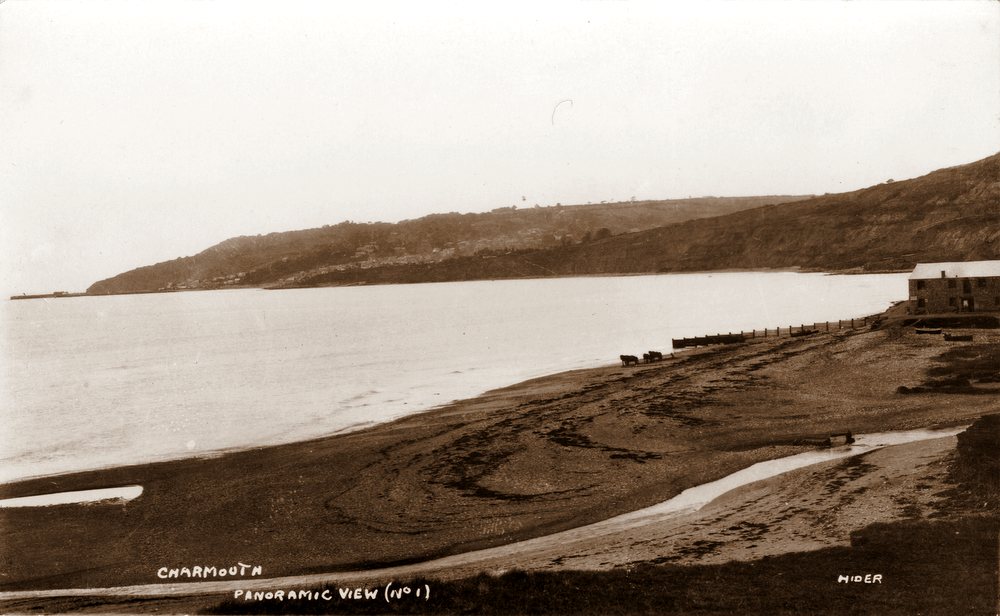 |
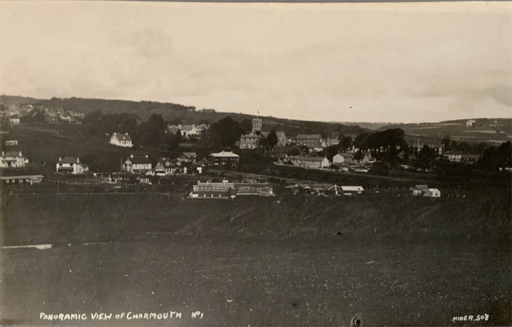
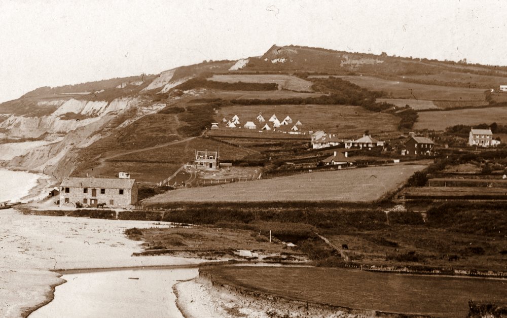
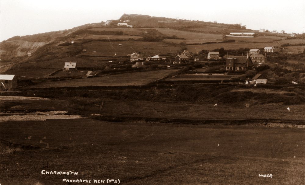
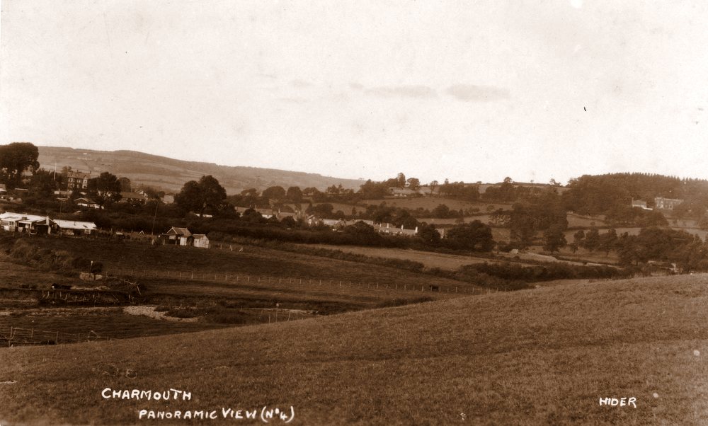
The most common postcards of Charmouth by Claud Hider that come up for sale are those of a panoramic montage along the shoreline. They are of interest to us today as they show many of the new built houses in Higher and Lower Sea Lane in 1923, when the photographs were taken |
|
Panoramic View No.2 showing the newly built Thalatta and Hammonds Mead |
|
Panoramic View No.3 showing the Tin Shacks and other properties in Lower Sea Lane. |
|
Panoramic View No.4 looking towards Catherston. |
 |
| |
|
Old Lyme Hill |
|
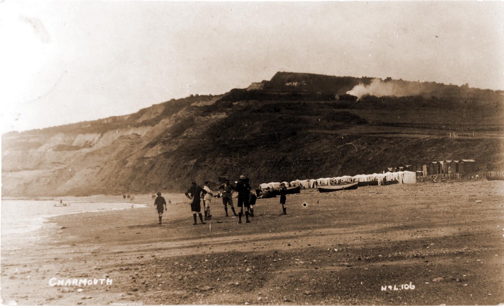
| A group of Scouts plays on the beach.The smoke in the background is from the village Rubbish Tip, near Old Lyme Road. |
|
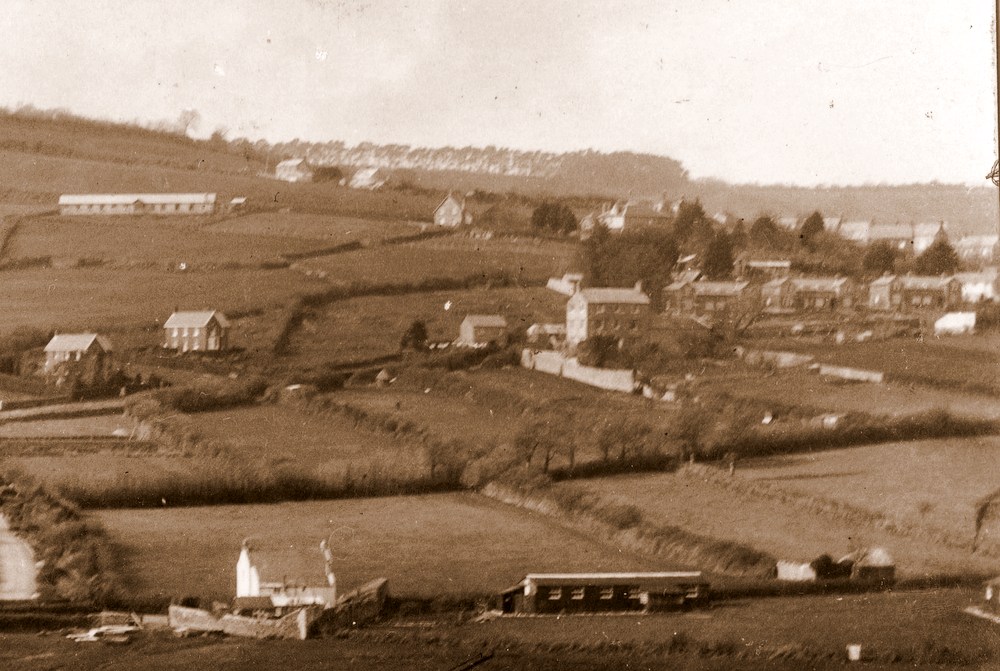
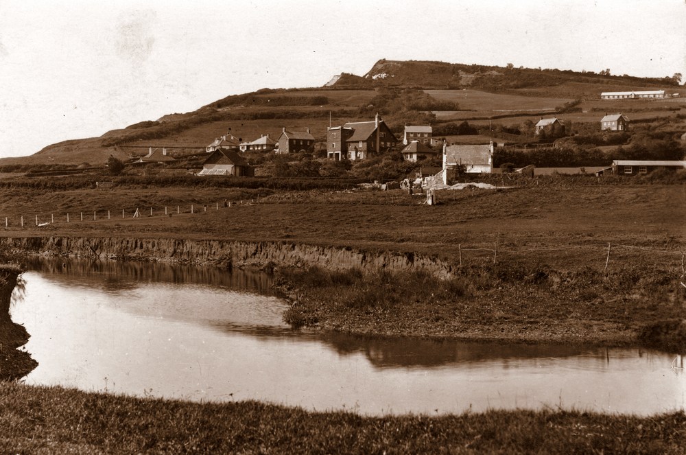
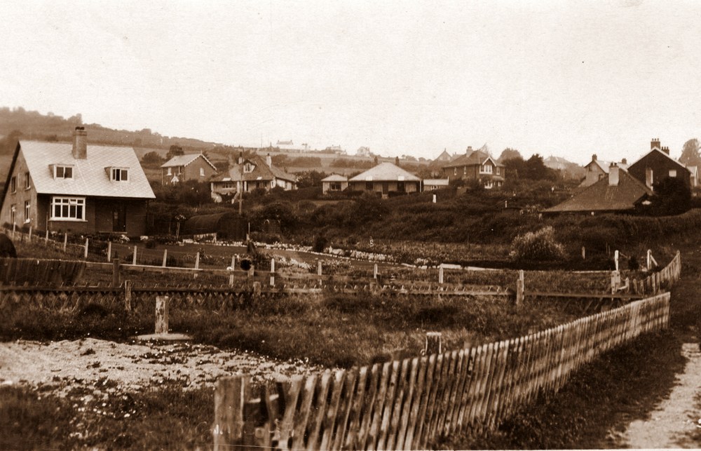
| A view looking towards Lower Sea Lane across the River Char.The nearest House is Sea View, where the local fishing family, the Hunters used to live. In the background can be seen Hammonds Mead and on the hoirizon is the long outline of Downside. |
|
| A fine H &L Card, dating to 1922 when a Battery can be seen at the beginning of Higher Sea Lane, which was used by the Coastguards for their ammuntion and was demolished in 1923 when Thalatta was built. |
 |
| A close up showing Battery used by the Coast Guards, before Thalatta was built in 1923. |
 |
The tall building in the middle is The White Horse Hotel as it was in 1922 |
|
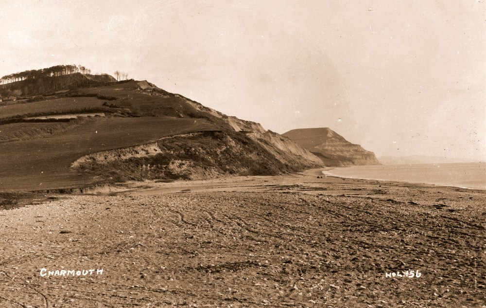
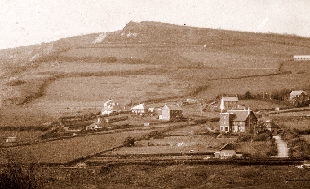
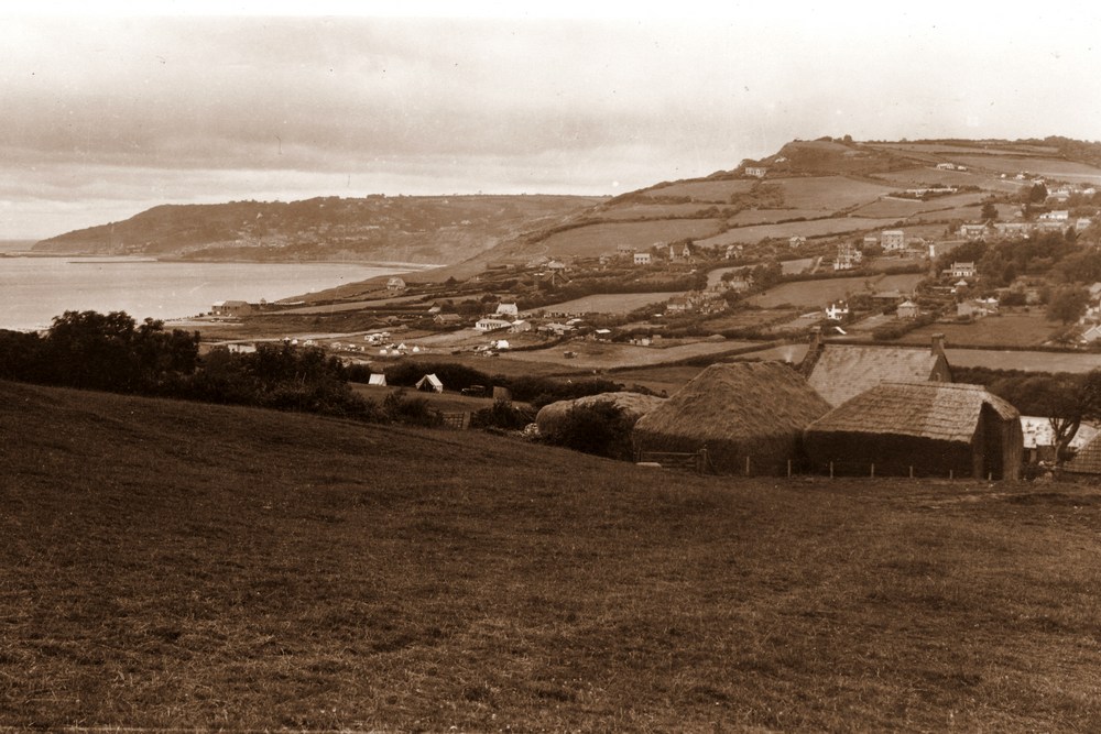
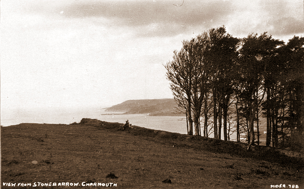
| Another wonderfully detailed view from Cains Folly of the village. Stonebarrow Farmhouse with its associated outbuildings and barns can be seen in the foreground. |
|
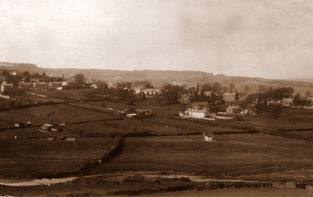
| An early H &L View from 1922 looking across to Lower Sea Lane before it was developed. The Customs Houses, Community Centre and School can clearly be seen in front of the Church. |
|
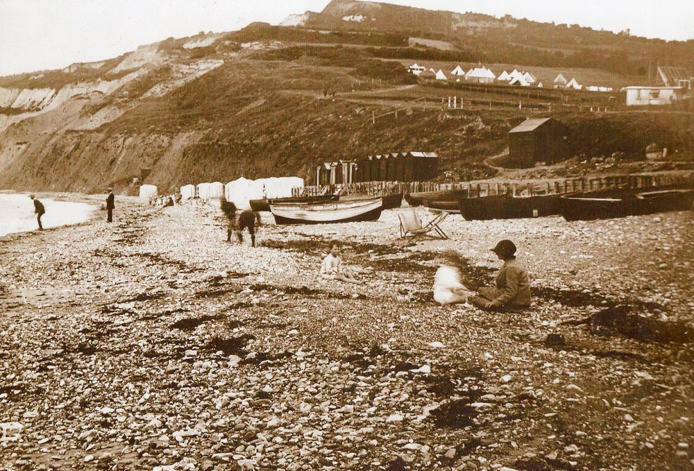
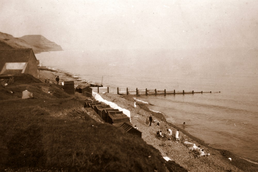
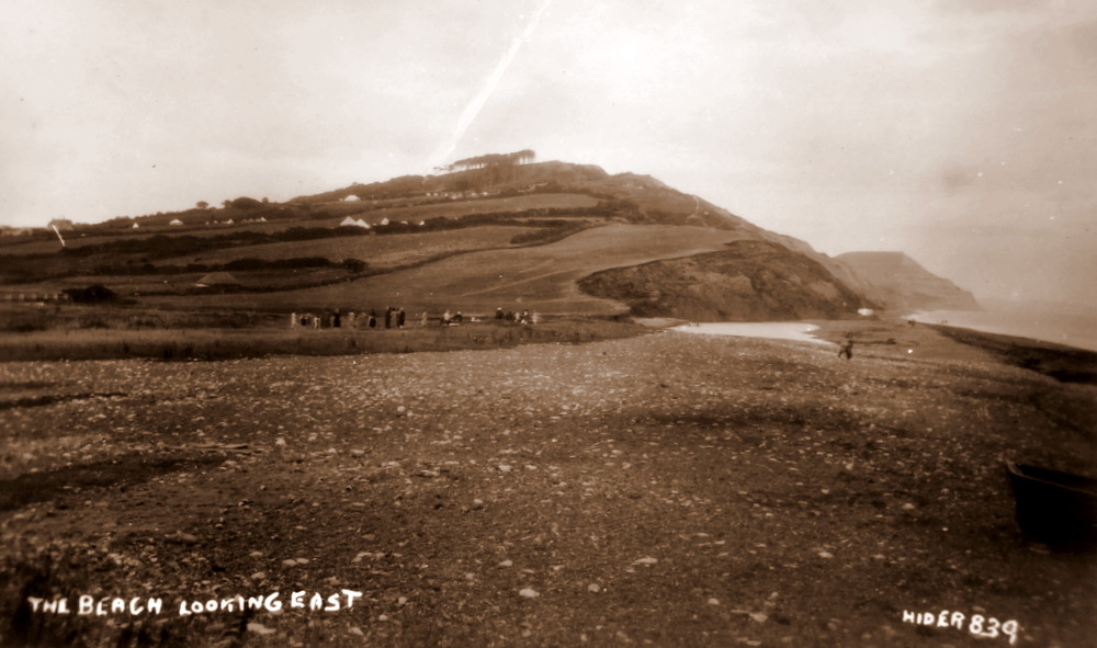
| The shore by the Heritage Centre, which had formerly been a Cement Works founded in 1854 by George Morcom. Noticethe line of Beach Tents and Huts which have long since been replaced. |
|
| |
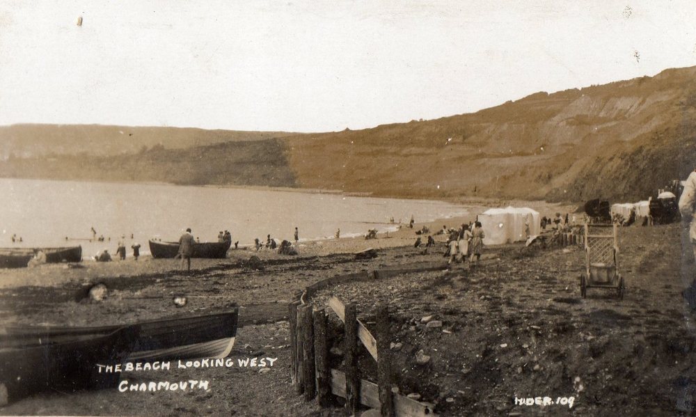 |
| The Beach on a summers day with a number of vistors enjoying the waters. There were still a number of men fishing along its shores. |
|
| |
 |
 |
|
| |
 |
| |
|
| |
|
| |
|
| |
|
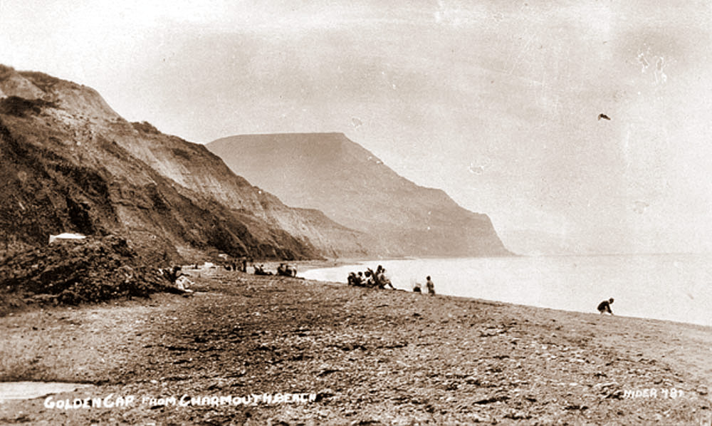
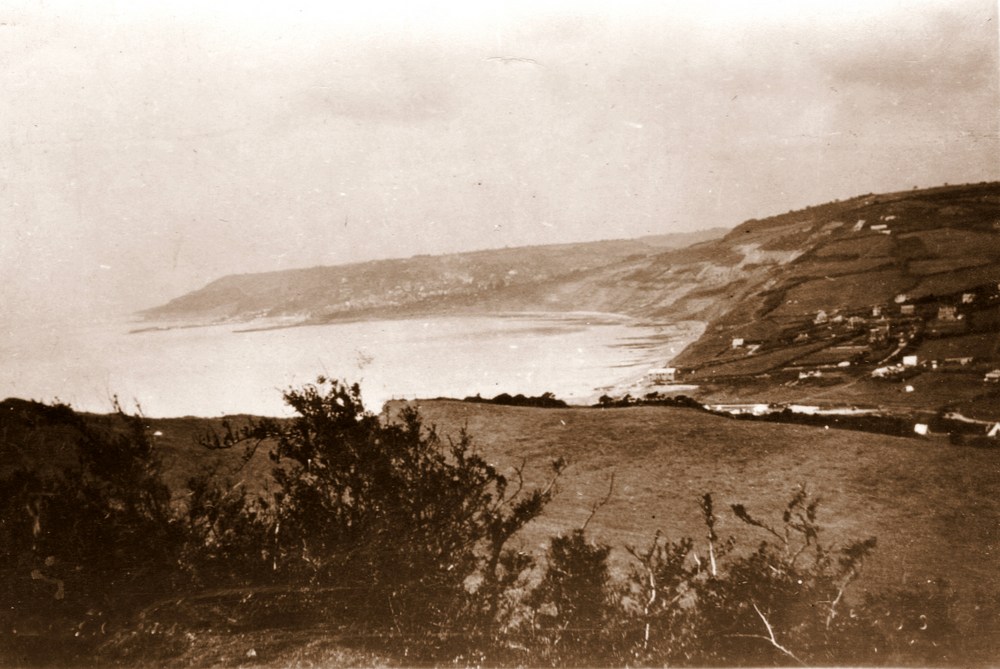
A view from Cairns Folly looking towards Lyme Regis |
 |
| |
|
| |
|
| |
|
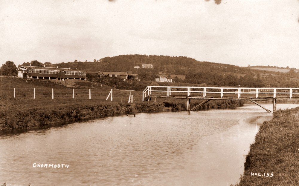
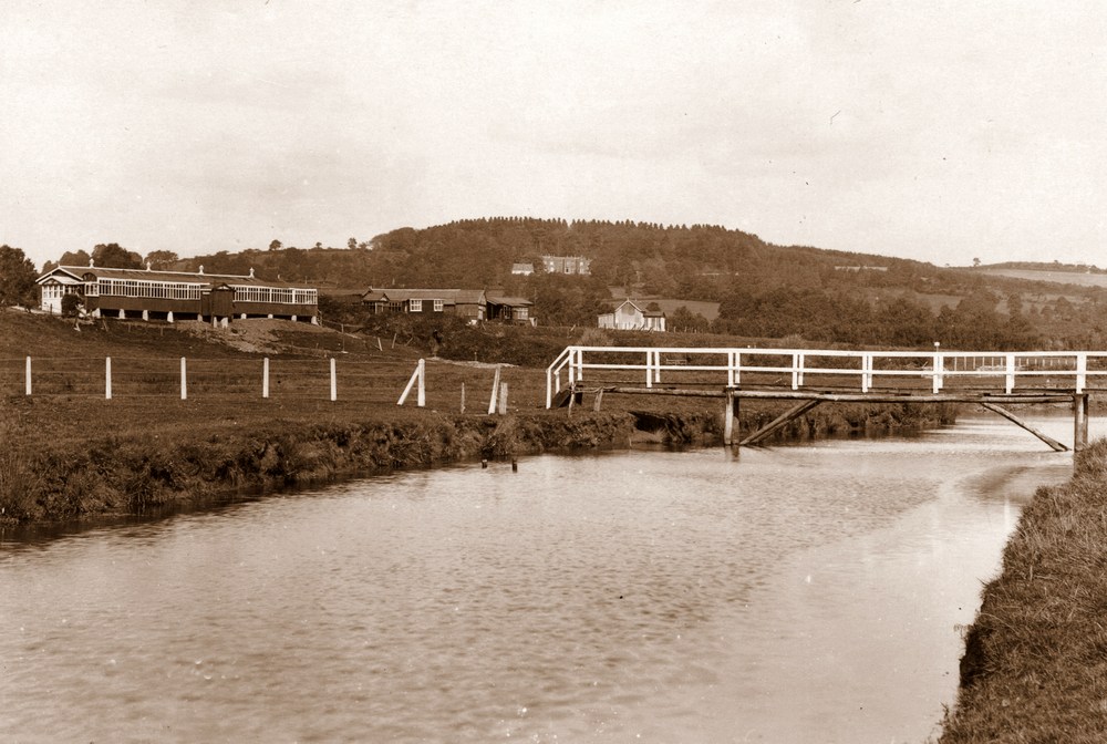
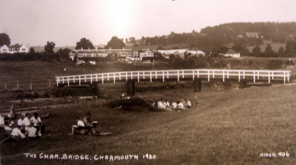
| A view of the timber Bridge crossing the River Char which has been replaced a number of times. In the background can be seen the Shacks forming "Tin Town". |
|
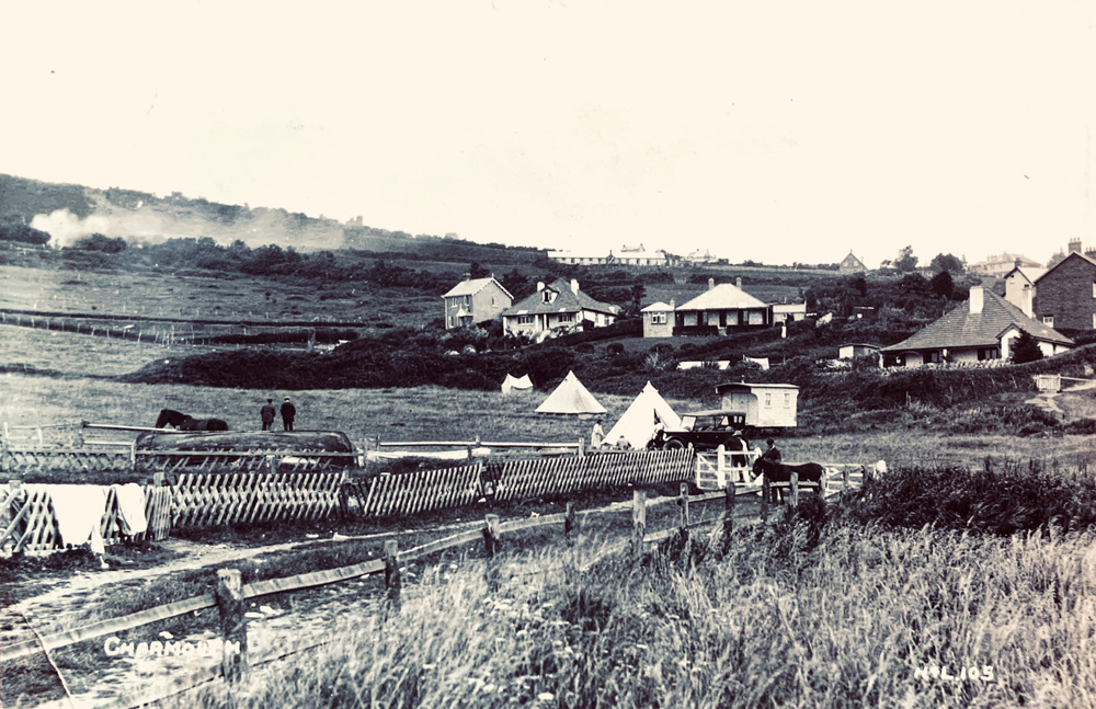
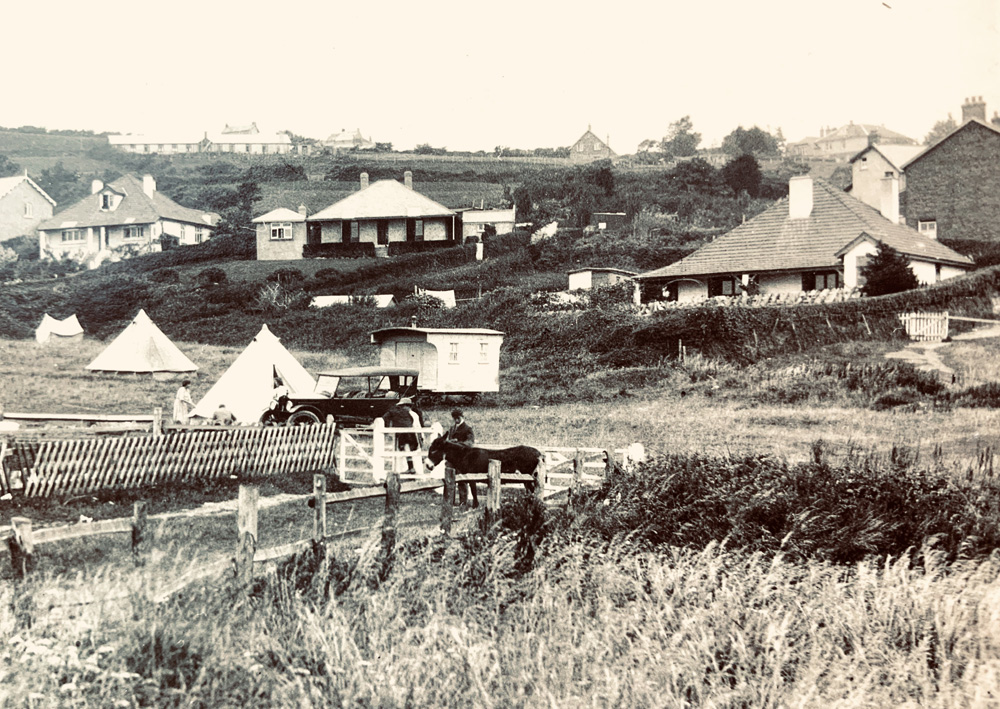
| At the beginning of the 20th century almost all postcards would include a scattering of tents in views of Charmouth. Here is one of the better examples in the fields at the bottom of Higher Sea Lane. The local historian, Reg Pavey had been Head of Clifton Preparotory School in Bristol and was instrumental in bringing the scouting camps to the village. The Bridge shown in the previous image had been replaced by 1930, the year shown on the card. |
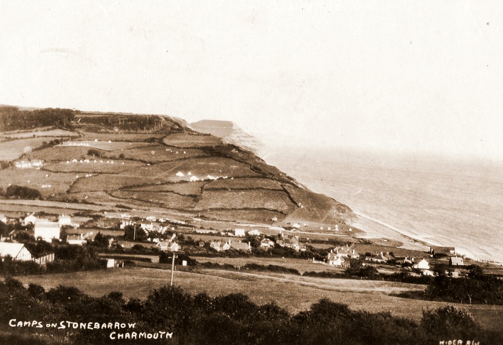 |
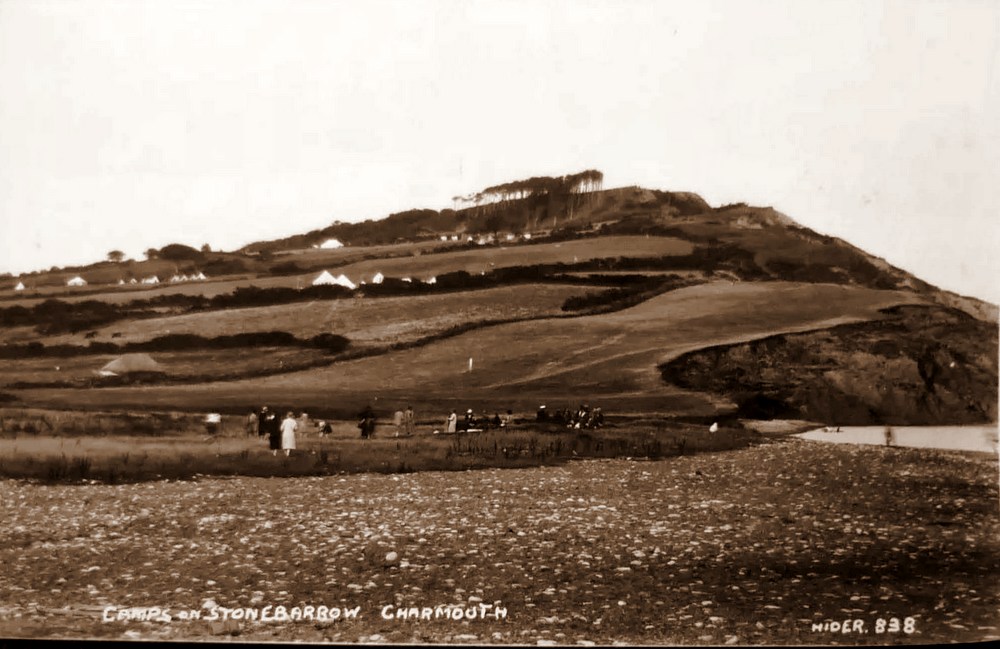
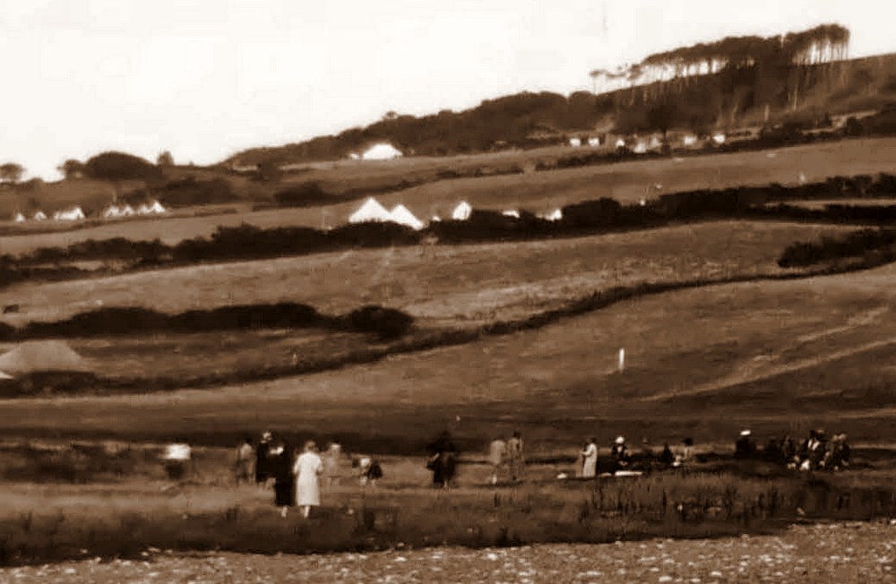
| Another view looking across to Stonebarrow showing the many scout camps which covered the fields above the shore. |
 |
A Hider and Lawrence Postcard from 1922 showing in the middle distance The Battery used by the Excise Men based in the Look Out by the beach for storage of Ammunition for their Cannon which was fired in practise once a day. They would later retrieve the Cannon Ball when the Tide was out. |
 |
| The field in 1922 shorthy before Thalatta was built on it . The Red Bungalow, Cove Cottage and The Moorings can be seen behind it. |
 |
| An enlargement of the photograph above. The donkey is Patience, who belonged to the owners of the Red Bungalow. |
 |
| The same view, the following year in 1923 with Thalatta being built near the former site of The Battery. Notice the Horse and Cart which would collect the stone from the Beach, which were crushed to produce Roman Cement which had the benefit of setting under water and was used extensively on Portland Harbour. |
 |
| A View from the beach looking towards the partly constructed Thalatta. In the background can be seen one of the many Scout encampments which covered fields at that time. |
 |
The newly completed Thalatta is seen here in 1923 |
|
| We are very fortunate that Claud recorded the house on completion with its garden in its formative stage. Behind it can be seen some of the houses that form part of the bottom part of Higher Sea Lane in 1923. |
|
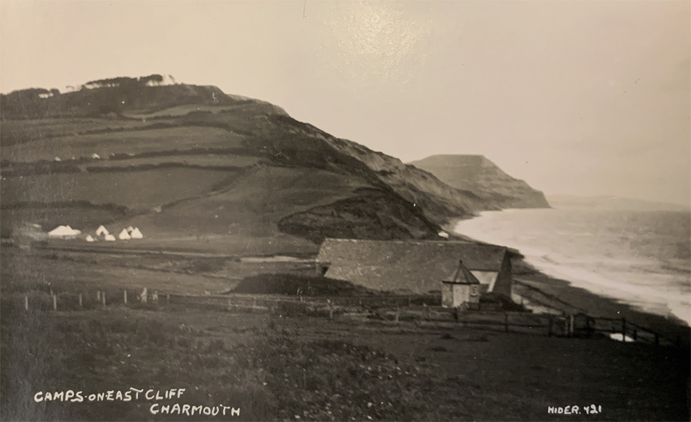
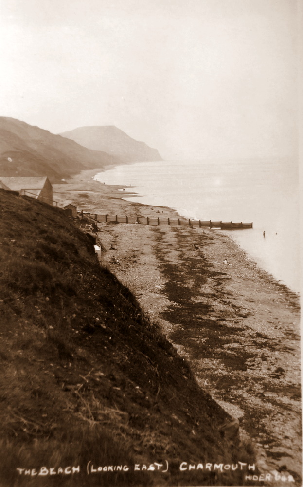
Another popular view of the village towards East Cliff |
|
A View from Cains Folly encompasing most of the village in 1923. |
|
| |
|
| A view across 5 Acres field towards Sea Horse House, which is the large white building in the centre in Higher Sea Lane. |
 |
| |
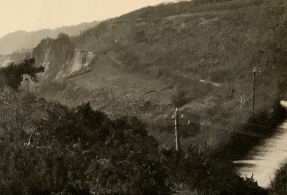 |
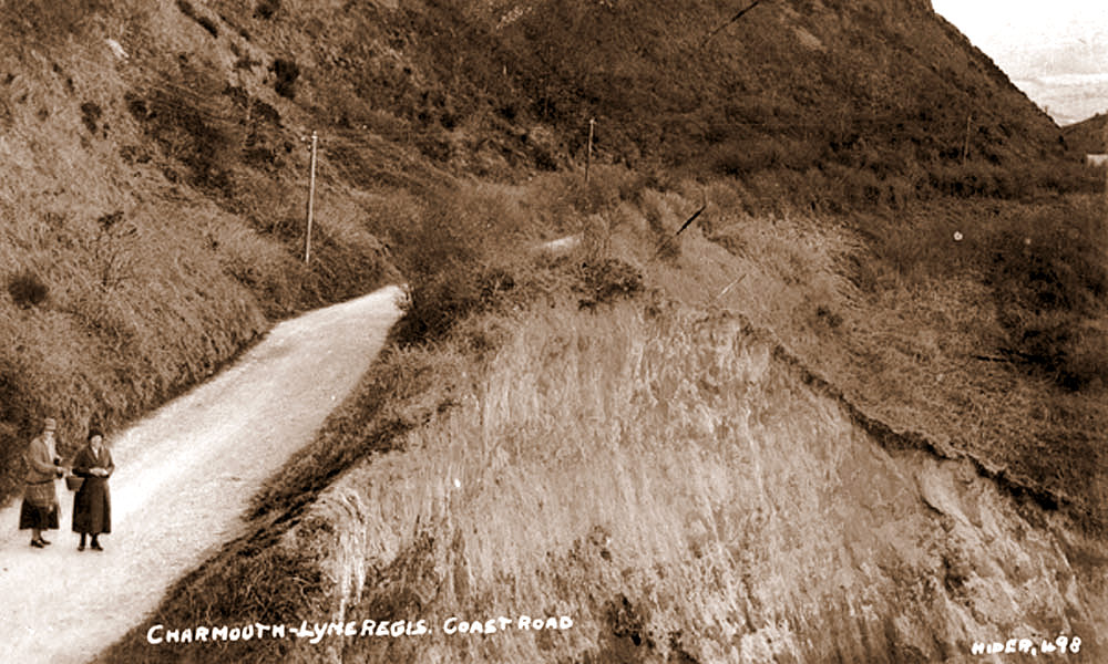
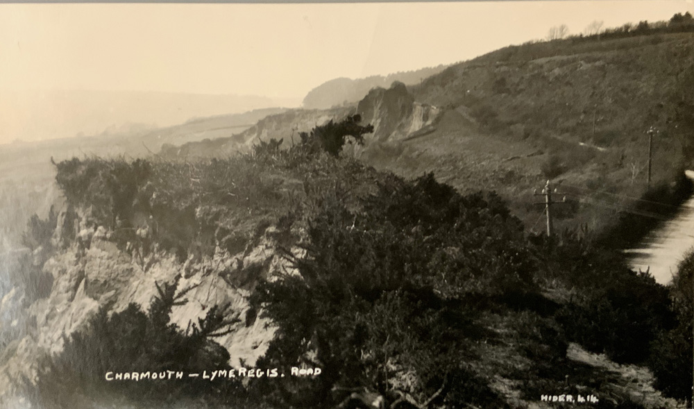
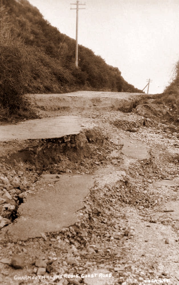
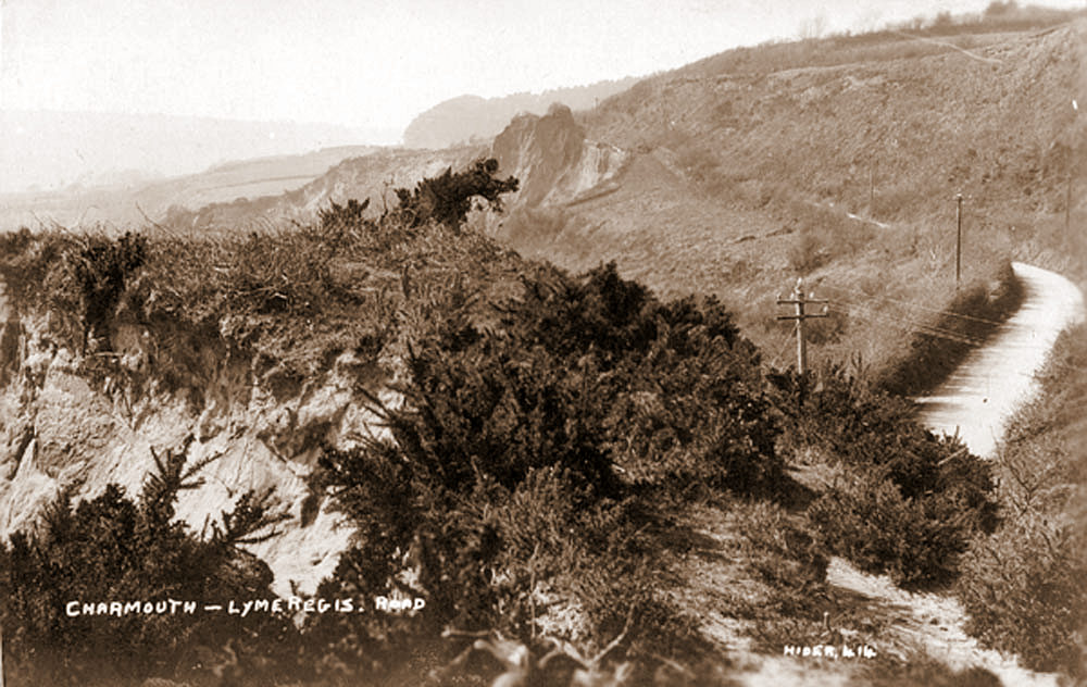
Close up of road before landslide |
|
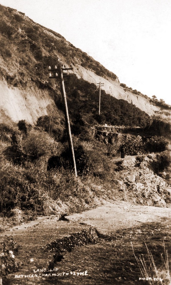
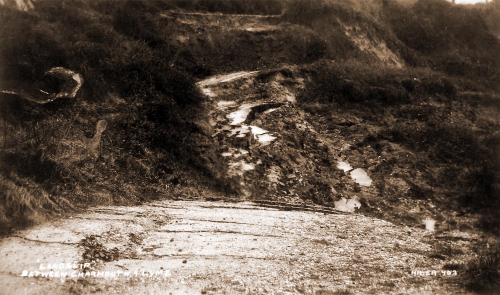
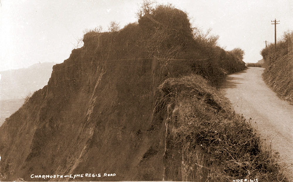
| The Bridport News reported in May 1924 that " As a result of the torrential rains, which accompanied the thunderstorms during the week, Dorset main coast road is being seriously endangered between Lyme Regis and Charmouth. A big landslide took place at the highest point, 400 feet. Above the sea level, where it runs through towering cliffs. A thousand tons of cliff are gradually moving towards the sea, and there is now a sheer drop of 150 feet, from the coast bank of the road. Danger flags are being flown, as the road itself may subside at any moment, but despite this a number of motorists are running over it."
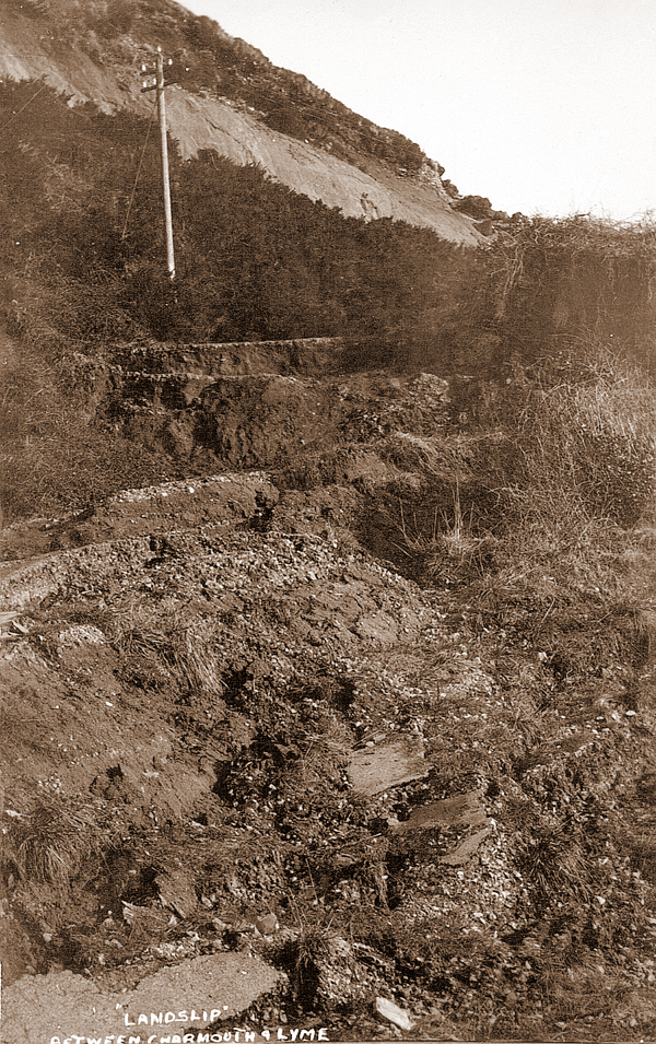
Claud Hider obviously felt that this was an opportunity to sell a series of postcards of the event. They graphically show the dramatic affect they had on the former coastal road between Charmouth and Lyme Regis. |
|
Landslide Photo 1 |
|
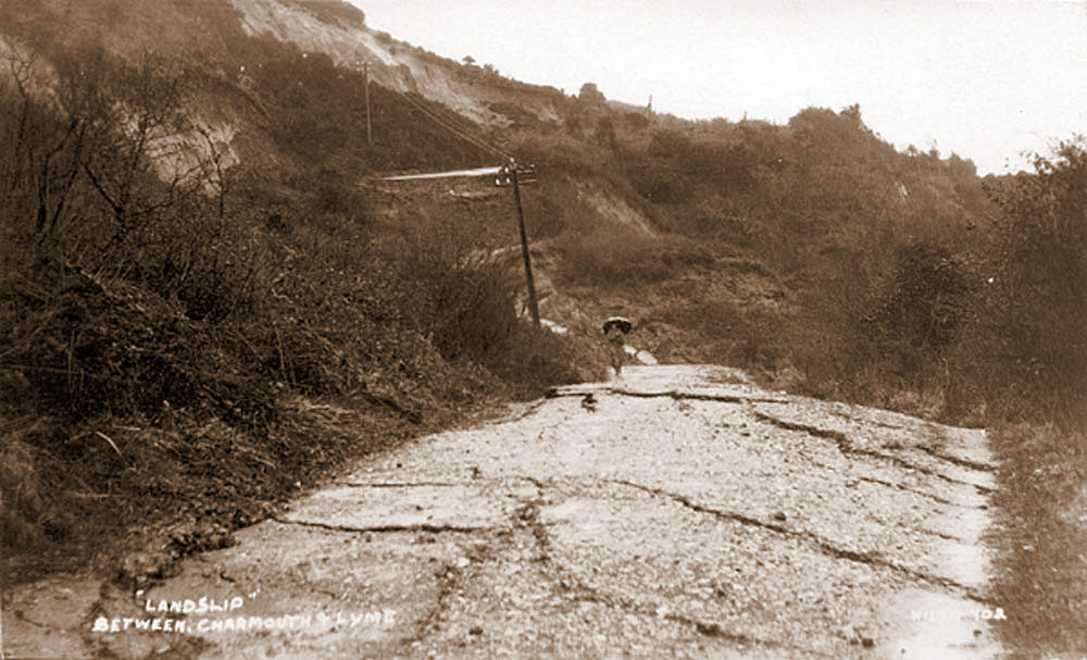
Landslide Photo 2 |
|
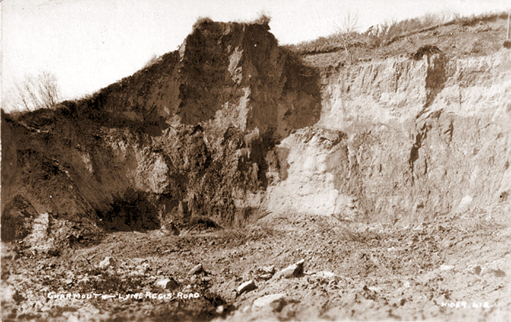
Landslide Photo 3 |
|
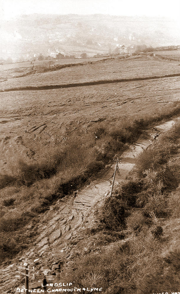
Landslide Photo 4 |
|
Landslide Photo 5 |
|
Landslide Photo 6 |
|
Landslide Photo 7 |
|
| |
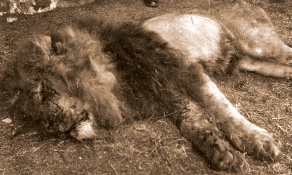 |
Claud Hider postcard of Lion shot in Charmouth in 1929 |
|
Motorists proceeding along the main Axmister- Bridport Road, near Charmouth yesterday were startled to encounter a lion roaming along the roadside. Deeming better part of valour, those who could believe the evidence of their eyes stepped on the accelerator and gave the animal a wide berth. Pedestrians and beast, however, had not the advantage, and there was considerable consternation among the inhabitants of the district when the lion was finally shot. “Pasha”, the lion, which was the property of Chapman's Travelling Menagerie, was being conveyed along the road in its cage drawn by a tractor, when it secured its release owing to an accident to the van. It was valued at £250, and was a noted performer. After visiting Bridport, Chapman's London Olympia Zoo was moving on to Lyme Regis. On Fern Hill, Charmouth, a tractor, with a cage – car as trailer, had engine trouble, and moved backward against a tree. In the cage were three tigers, divided by a partition from Pasha, the lion, at the back. The collision with the tree damaged the cage enough for the lion to escape. Pasha sat and then lay at the roadside, apparently enjoying the change. The lion tamer had gone ahead to Lyme Regis, three miles away, and his return was requested urgently.
“ The lion squatted there for half an hour” said an eye witness to a Western Morning News reporter, “ Crowds gathered on the road about two hundred and fifty yards away in each direction, and there was long lines of cars held up. The tamer walked towards the lion with a rope. The lion got up and walked down the road. The spectators to that side went away, too, and stated to shout. Becoming frightened the lion bounded over a hedge, and the tamer went through after him. The lion smelled the ground and set out on business.
Away he went over another hedge on to a high mound, and saw some cows about 20 years away. He reached them in a bound or two, and got one by the throat.“ the manager of the zoo and a Charmouth butcher, Mr. F.C. Marsh, fired at the lion, which was then at Lily Farm. One shot wounded him in the hind- quarters, the other in an eye. Then the lion went mad and raced around. The crowd scattered, and one man was chased by the lion round an old building. As the lion did not come back into view another gun had come, and the men crept near the animal and finished him with about eight more shots”.
“ He was a handsome, lively beast, and would have had a good run if he got well going. He was free about an hour.” Added our informant. Mr Percy Smith, the postman, also assisted in the armed chase.
At the offices of Mr. George Chapman, in Tottenham Court Road, “ The Western Morning News” was informed that Pasha was worth £250. He was an exceptional performer, as well as a finely maned specimen. He was one of a group that was at the Blackpool Tower at Easter, and some weeks ago was on tour throughout the west." 22nd June 1929 |
|
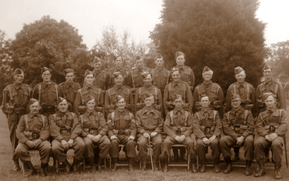
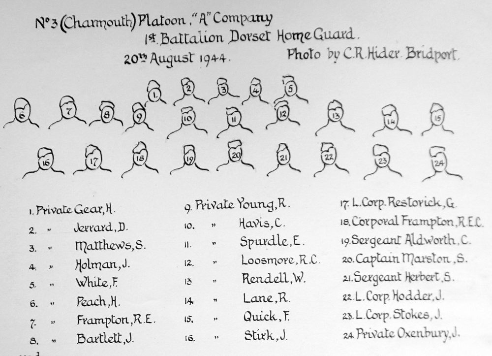
No. 3 (Charmouth) Platoon, A Company 1st Battalion Dorset Home Guard - 20th August 1944. Photo by C.R.Hider |
|
A key to the members of the Charmouth Home Guard |
|
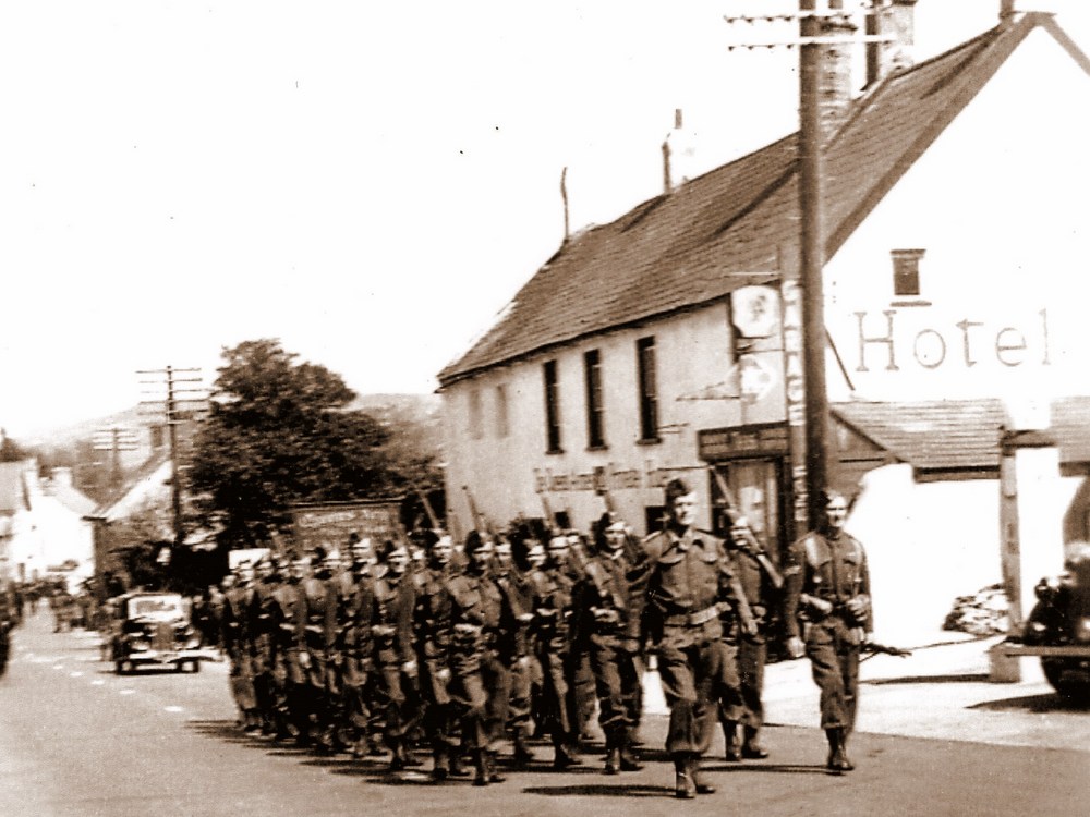
Another photograph showing the Home Guard marching past The Quenes Armes on The Street. |
Althoiugh the majority of Claud Hiders output was in the 1920`s, he still supplied photographs for both the Charmouth and Bridport Official Guides most years.The following images are from "The Bridport Rural District Official Guide" for 1953. It contains a wealth of information on the area around Bridport and is especially detailed about Charmouth, with a number of adverts pertaining to the village. the booklet must of been one of his last jobs as he was to die in the same year. |
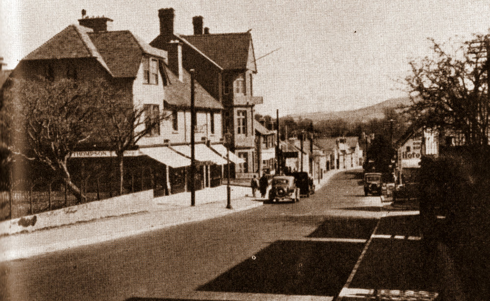 |
The Street in 1953, showing Thompsons, a General draper and Outfitter on the corner where the Post Office is today |
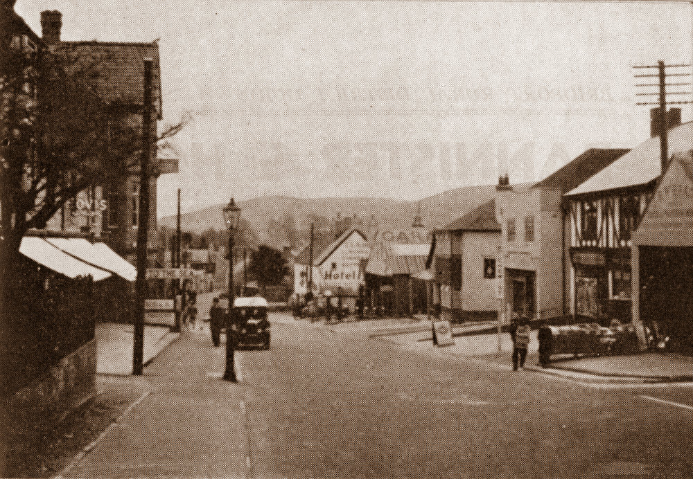 |
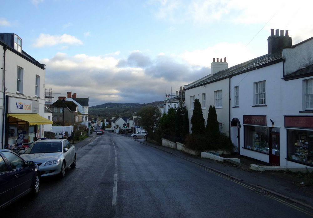
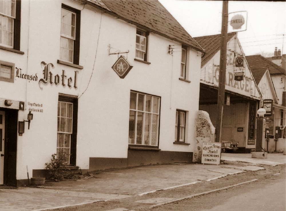
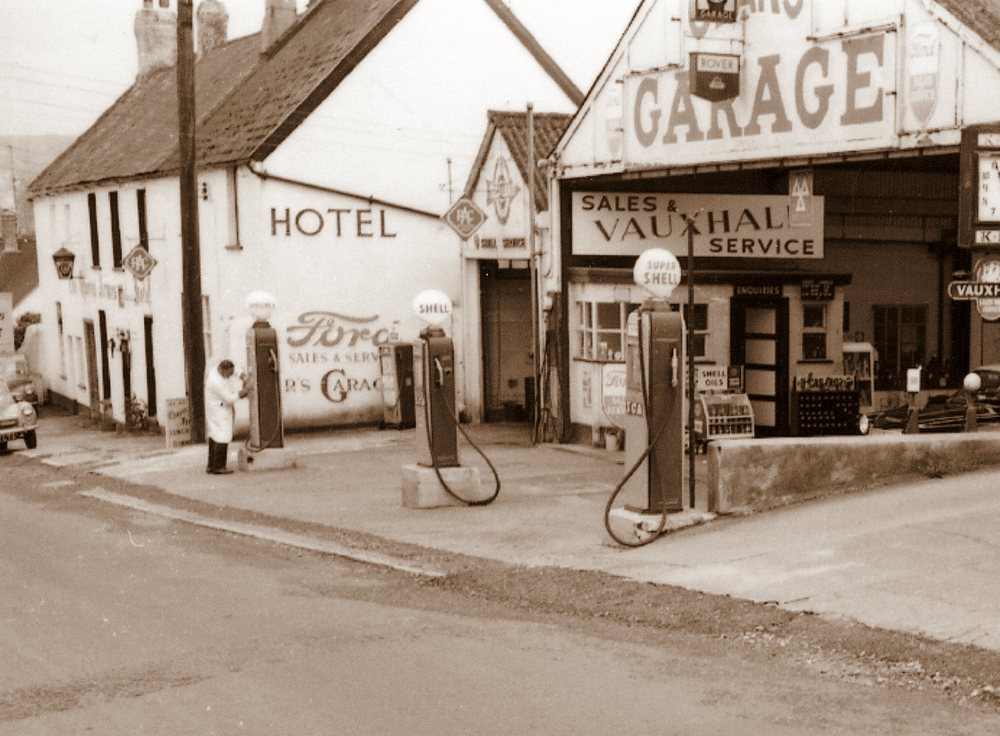
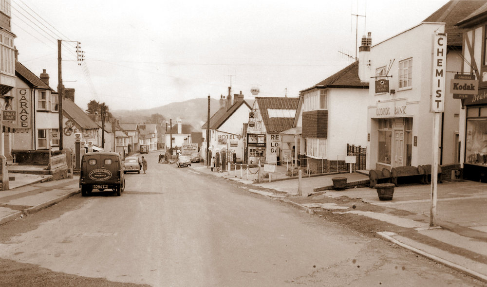
| The Street in 1953, showing Gear Garage on the right. The building on the corner of Lower sea Lane was Bragg`s General Store, where the Pharmacy is today. |
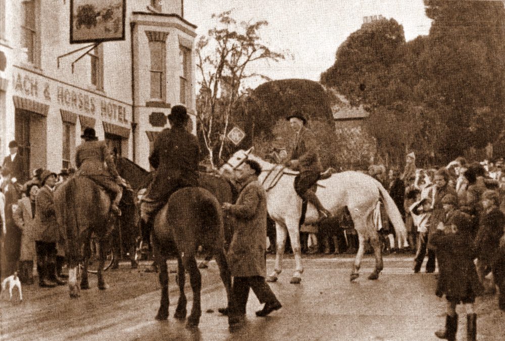 |
A Meet outside the Coach and Horses in 1953 |
|
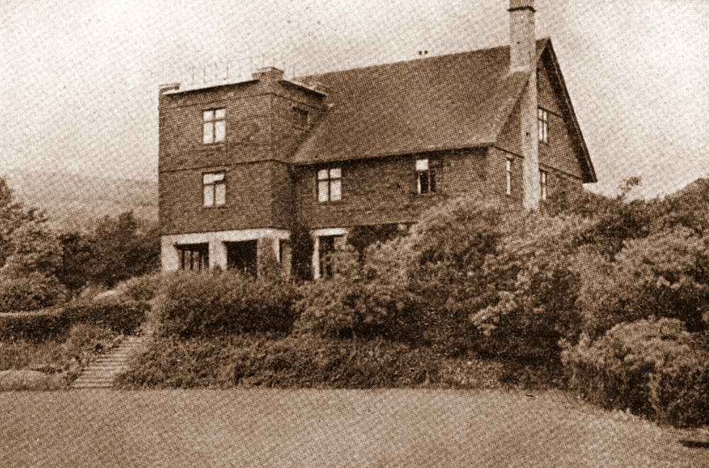
Hammonds Mead Hotel |
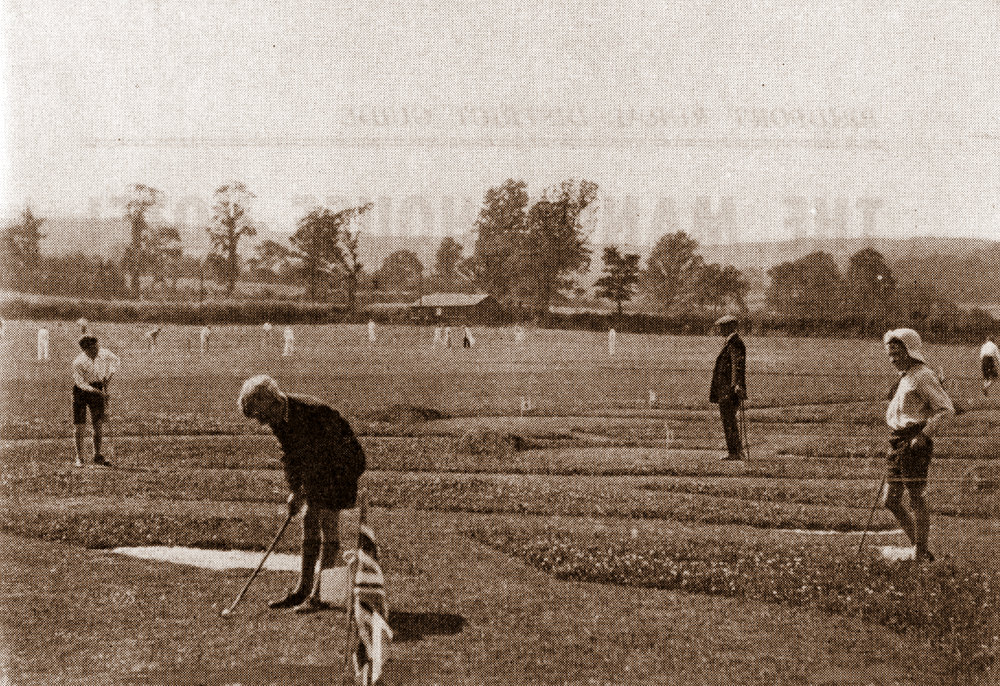 |
Playing Fields |
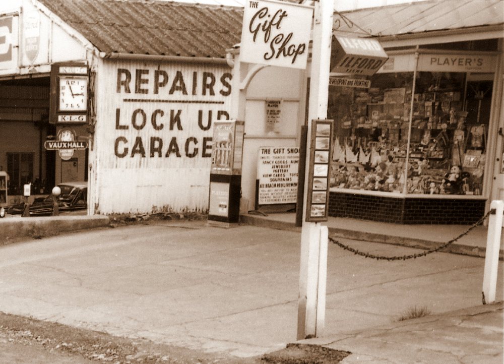
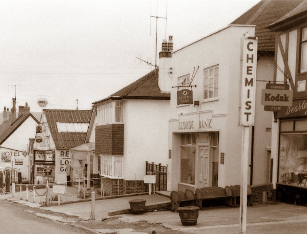
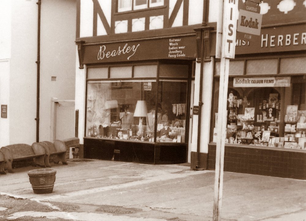
| Herbert Pinn continued photographing the local area and his son Roger kindly produced prints of a series he had done the 1950`s of Charmouth. They are of especial interest as they close ups of the parade of shops and Gears Garage, all of which have changed dramatically over the subsequent years. |
 |
| |
 |
| |
 |
| |
 |
| |
 |
| |
 |
|
|
| |
|
We do hope you have enjoyed our look back at Charmouth as it would have been nearly a century ago through the lens of Claud Hider. The postcards they originally appeared on are extremely rare and it has taken us many years to fully understand how comprehensive a view they show of the village. This entire talk and its images are readily available on the freshford.com/charmouth website if you wish follow it up later. |
|
| Click on Towns and Villages below to see views taken by Claud Hider c.1925. Numbers of images in brackets. |
.jpg)

.jpg)

.jpg)
-001.jpg)
.jpg)
.jpg)
.jpg)
.jpg)