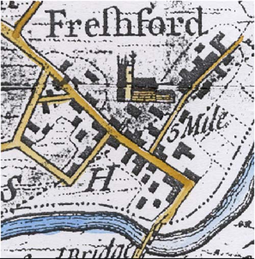
Part of the map produced by Thorpe which covers the area of countryside 5 miles from the centre of Bath. It shows the village in 1742.